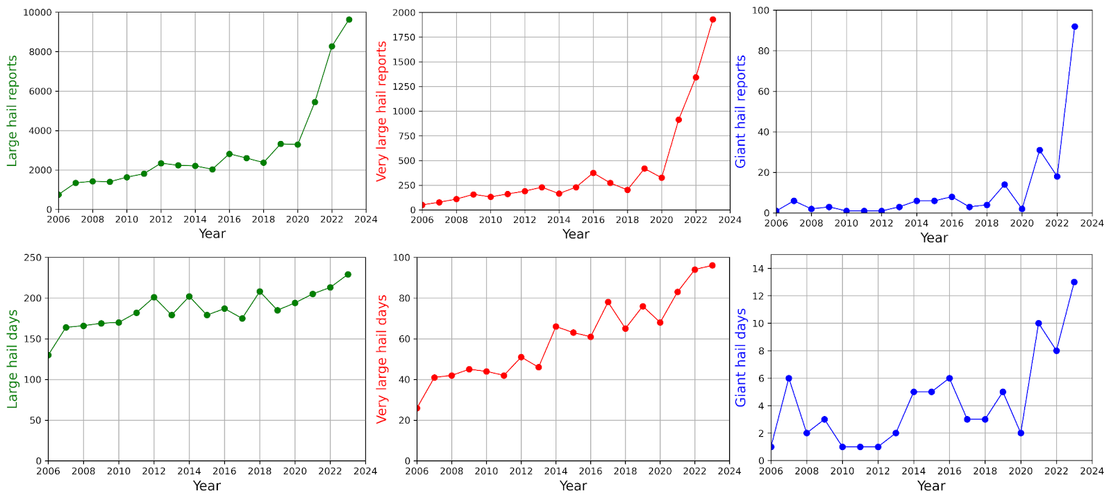
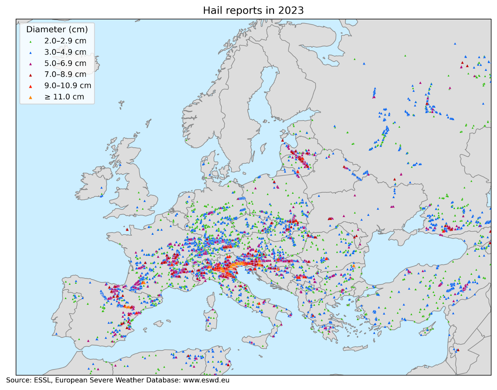
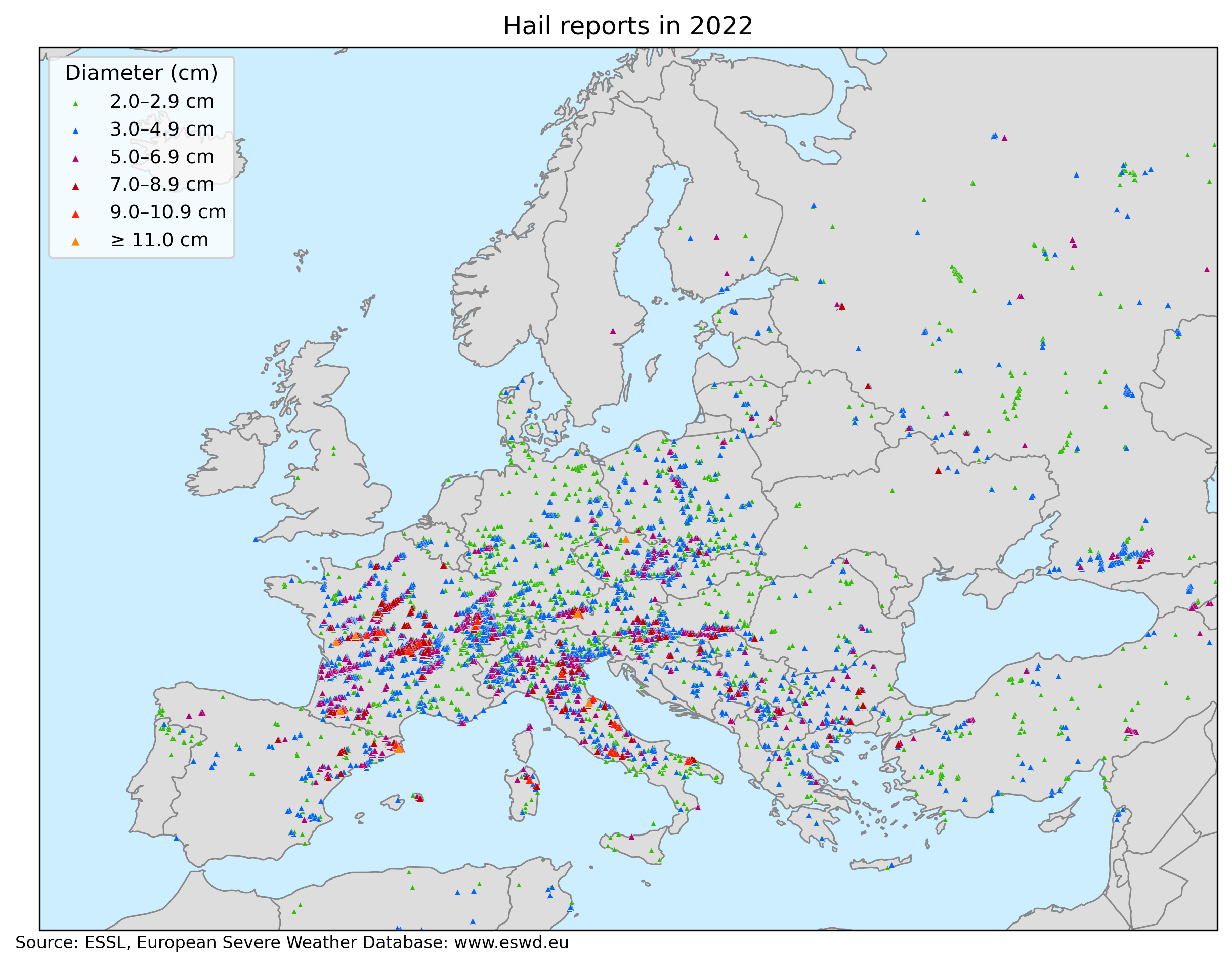
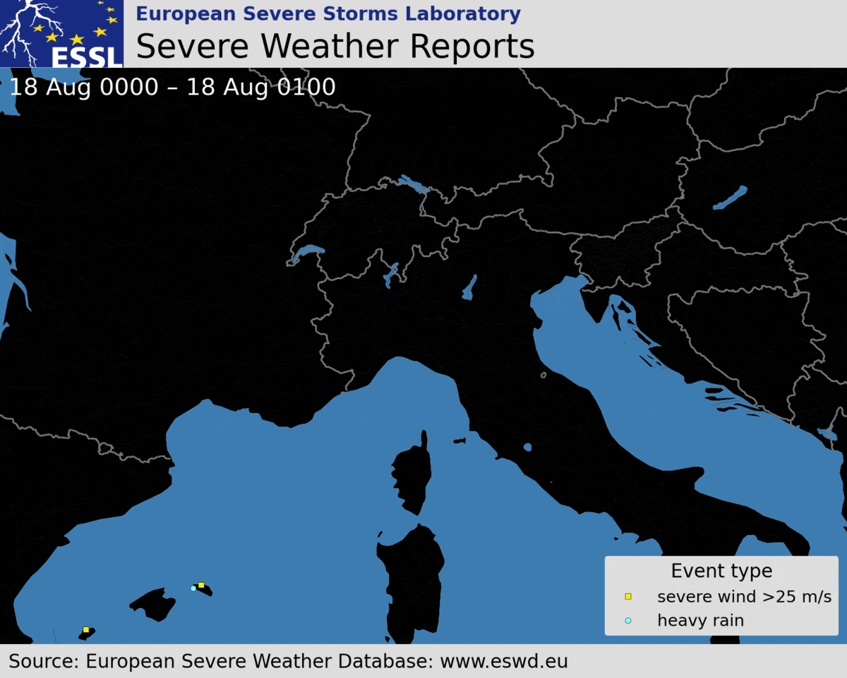
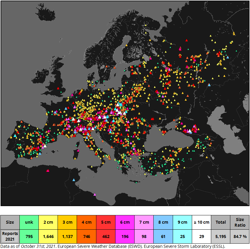
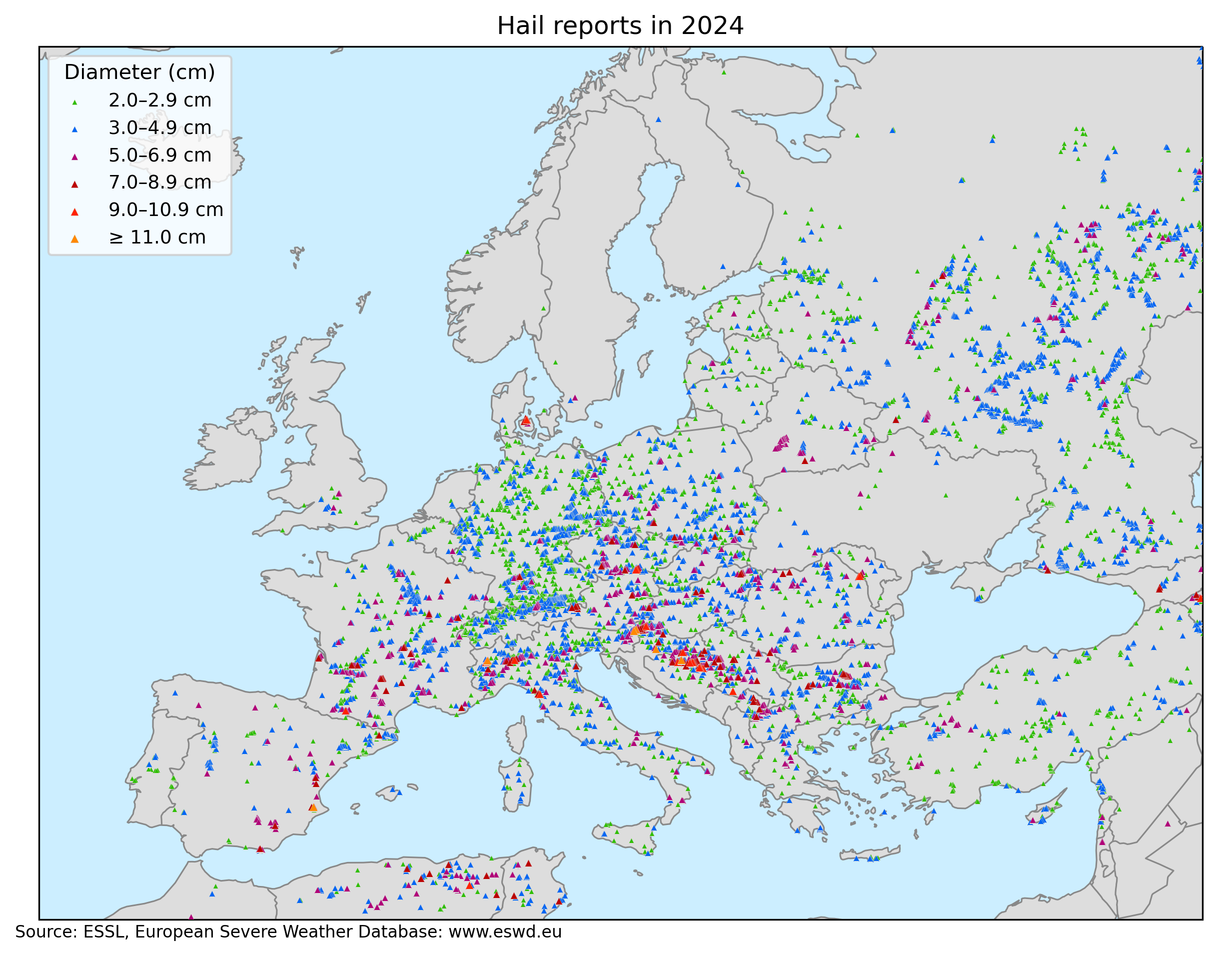
Compared to 2023, 2024 hasn’t featured record-breaking hailstorms or situations that matched the ferocity of 19 and 24 July 2023 or 26 August 2023. However, it was still a very active year, resulting in the most hail reports ever reported into the ESWD: 10 092, as well as days with large (≥ 2cm) and very large (≥ 5cm) hail days: 243 and 101 respectively. In terms of the sheer number of the most damaging hail events, 2024 pales in comparison with 2023 with a decrease in very large hail reports from 1946 to 1086 and giant hail (≥ 10 cm) reports from 97 to 19. These numbers represent the European Severe Weather Database state as of 04 January 2025.
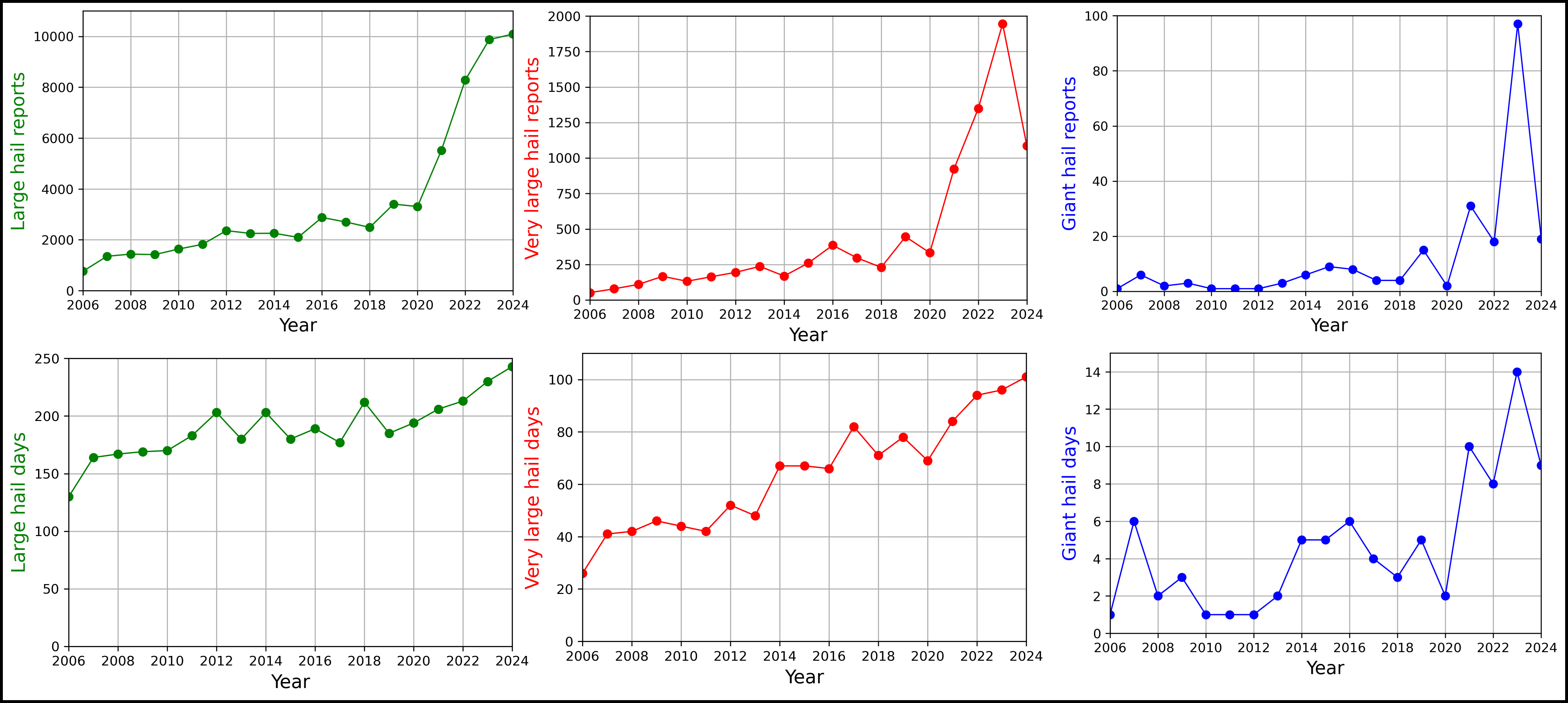
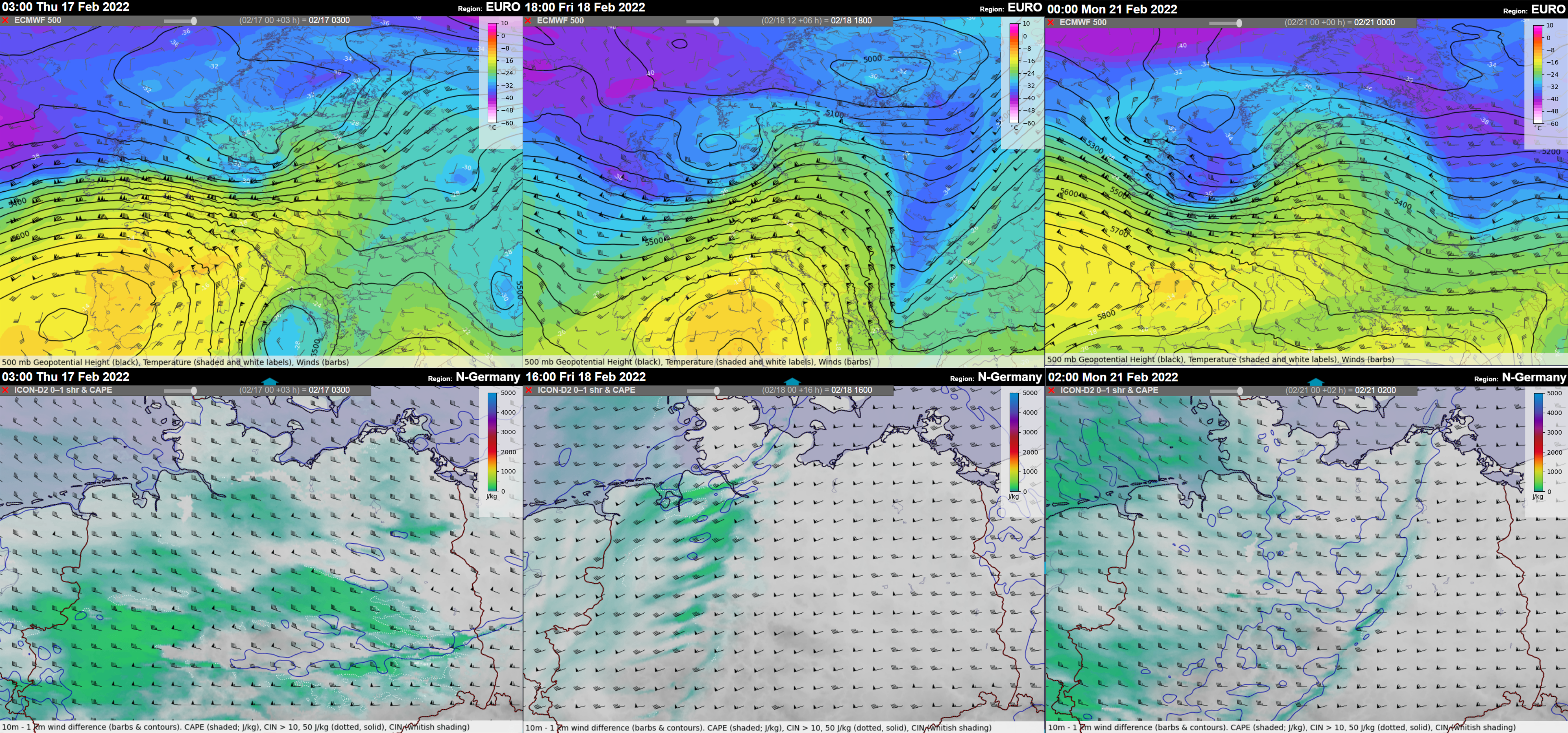
Different regions of Europe were affected by hailstorms this year. In June, southeastern Europe was especially active with multiple devastating and long-tracked hailstorms. This month was also by far the most active concerning large hail. The activity shifted further west and north towards July and August and the number of severe hailstorms dropped since mid-July with large parts of Europe experiencing drought.
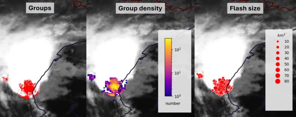
ESSL would like to express deep gratitude to all the voluntary observer persons and networks, who have greatly helped with the severe weather data collection across Europe. Now let’s have a look at the individual major hail cases last year. The list is non-exhaustive. And before we move on,
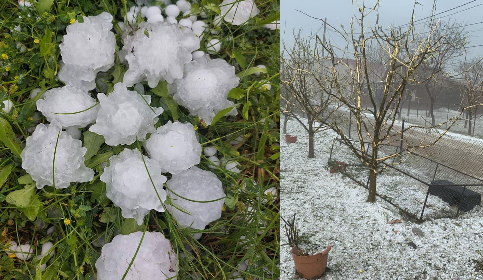
28 March: A curious event with hail up to 6.5 cm in diameter across the southern UK in a marginal CAPE environment.
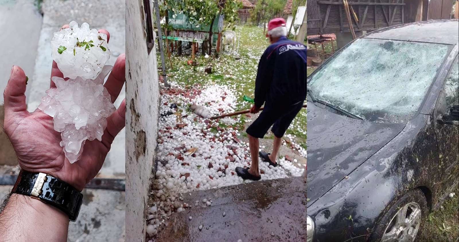
3 June: A hailstorm cut a 137 km path across northern Bosnia, extreme eastern Croatia and western Serbia. Hail reached up to 7 cm in diameter with most damage reported as the storm transitioned to a bow echo with wind-driven hail damaging facades of houses, breaking windows, and destroying crops between Croatia and Serbia.
4 June: Numerous damaging hailstorms occurred in Romania, Bulgaria, Moldova, and Ukraine. Two events stood out from the rest. The first involved densely falling wind-driven hail in Săsarm, Romania, reaching up to 5 cm in diameter. The facades, windows, and roofs of the houses were seriously damaged. Vegetation also suffered with some of the trees partially debarked by falling hail. Further east, a hailstorm crossed from Romania to Moldova, producing the first giant hail report of the year in the village of Răducăneni with hail reaching 10 cm in diameter and causing significant damage.
9 June: On this day, hailstorms were reported in a belt from southeastern France through Switzerland, southern Germany, and Austria into southern Slovakia and Hungary. The most severe hailstorms were reported from Austria. The largest hail reached 8 cm in the village of Erpfendorf and the hailstorm caused serious damage to cars and vegetation in the Tirol region. Several hailstorms developed over eastern Austria with hail up to 7 cm in diameter. One of the hailstorms produced two tornadoes and also seriously damaged an aircraft that flew through the hailstorm, making this event more well-known in the meteorological community.

12 June: Serbia, Bulgaria, and Russia were affected by severe hail. Over Bulgaria, a hailstorm tracked 170 km across the country, producing hail up to 8.5 cm in diameter, and damaging cars, roofs, house facades, and vegetation. The worst damage was reported from the village of Sheremetya. In Serbia, the largest hail reached 7.5 cm in diameter; in Russia, the largest hailstone was 7 cm across.
13 June: This day was one of the most severe hail days of 2024 across Europe. In total, 240 large hail reports were collected. Significant hailstorms formed in a belt from Bosnia through Serbia into southern Romania and Bulgaria. Dozens of reports were also collected from southern Russia. Two long-lived hailstorms tracked across Bulgaria and from eastern Serbia to Romania with hail swaths over 200 km long. Serious hail damage was reported from all three countries and in many places, hail was accompanied by severe wind gusts. In Bulgaria, the largest hail reached 8.5 cm across, and hundreds of houses were damaged in the village of Shipka. Hail reached 7 cm in Serbia and Romania, where extreme wind-driven hail damage to crops was reported east of Bucharest.

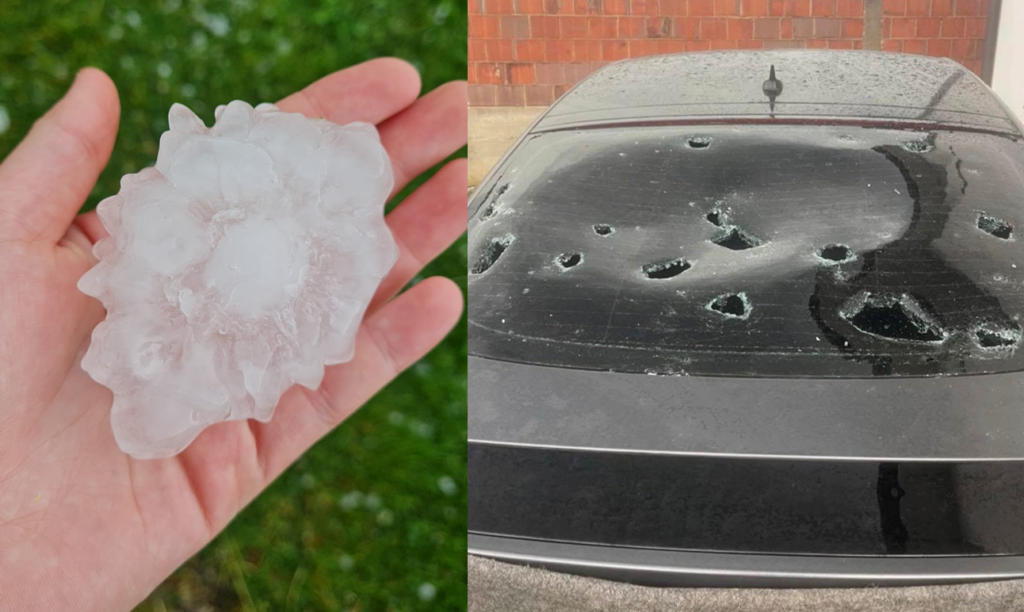
21 June: Another big day with 242 reports of large hail submitted to the ESWD, mostly from Czechia, Italy, and Germany. In Czechia, multiple supercells developed, each producing hail exceeding 5 cm. The largest hail, reaching 9 cm across, fell in Hluboké Mašůvky, a small village on the border with Austria. In Italy, a supercell produced hail up to 8 cm in diameter.
22 June: Report-wise, the spatial scale of the event was similar to the day before (220 reports of large hail), but the intensity and impacts were much more pronounced. The day started with a mid-day wind-driven hail event in Poland, especially affecting Harta and Dynów. Hail reached 7 cm in diameter, severely damaging roofs, facades, windows, cars, and crops. In the afternoon, multiple supercells formed over Bosnia, each producing hail exceeding 5 cm in diameter. Three storms produced giant, 10+ cm, hail. The largest hail fell in the town of Prnjavor, reaching 11 cm across. Extensive damage to roofs and cars was reported. Hailstorms also affected western Serbia, especially the town of Osečina. Here, densely falling wind-driven up to 8 cm in diameter caused extreme damage to crops, vehicles, and roofs. The storm also killed animals and caused an unknown number of injuries. Towards the evening, storms formed also over Hungary, with hail reaching 8 cm in diameter.
23 June: Storms continued to produce large hail across southeastern Europe. The largest hail fell in the town of Sjenica, Serbia, reaching 10 cm in diameter and damaging cars. Very large hail was also reported in Bosnia and Kosovo. In Kosovo, the largest hail was 8.5 cm across.
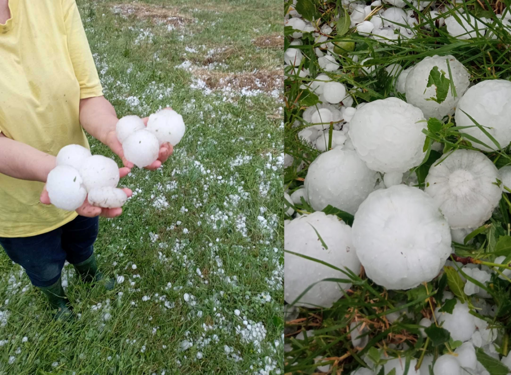
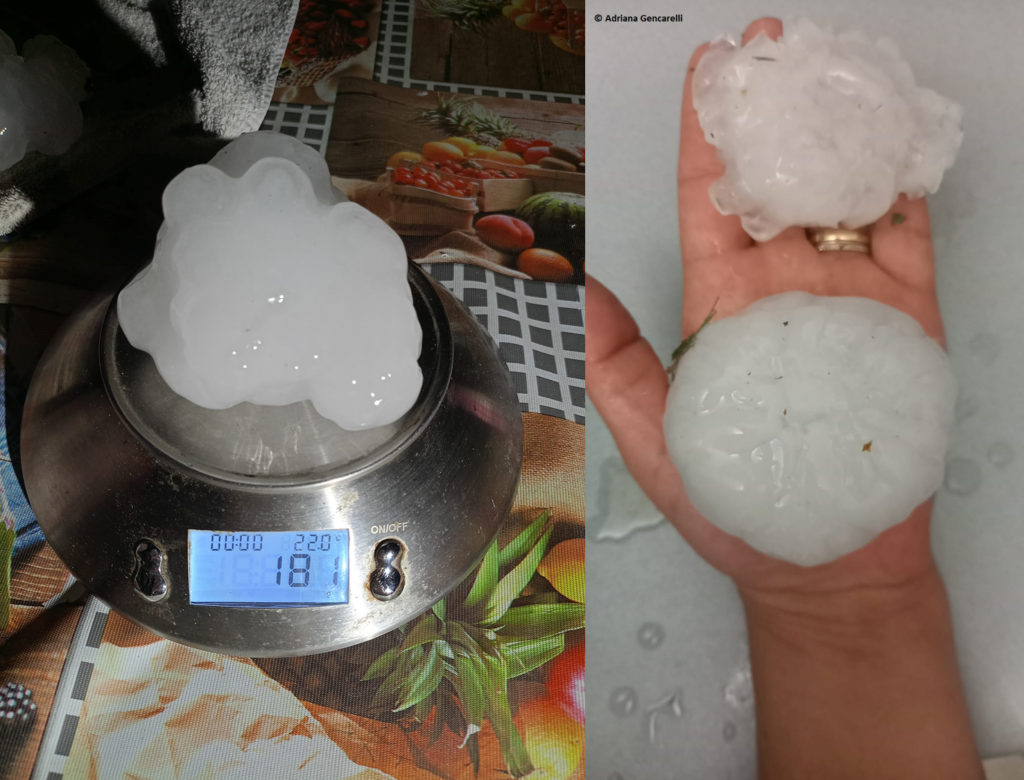
29 June: A brief, intense supercell produced hail up to 12 cm in diameter in Piemonte, Italy, damaging cars, roofs, and solar panels. 2 people were injured.
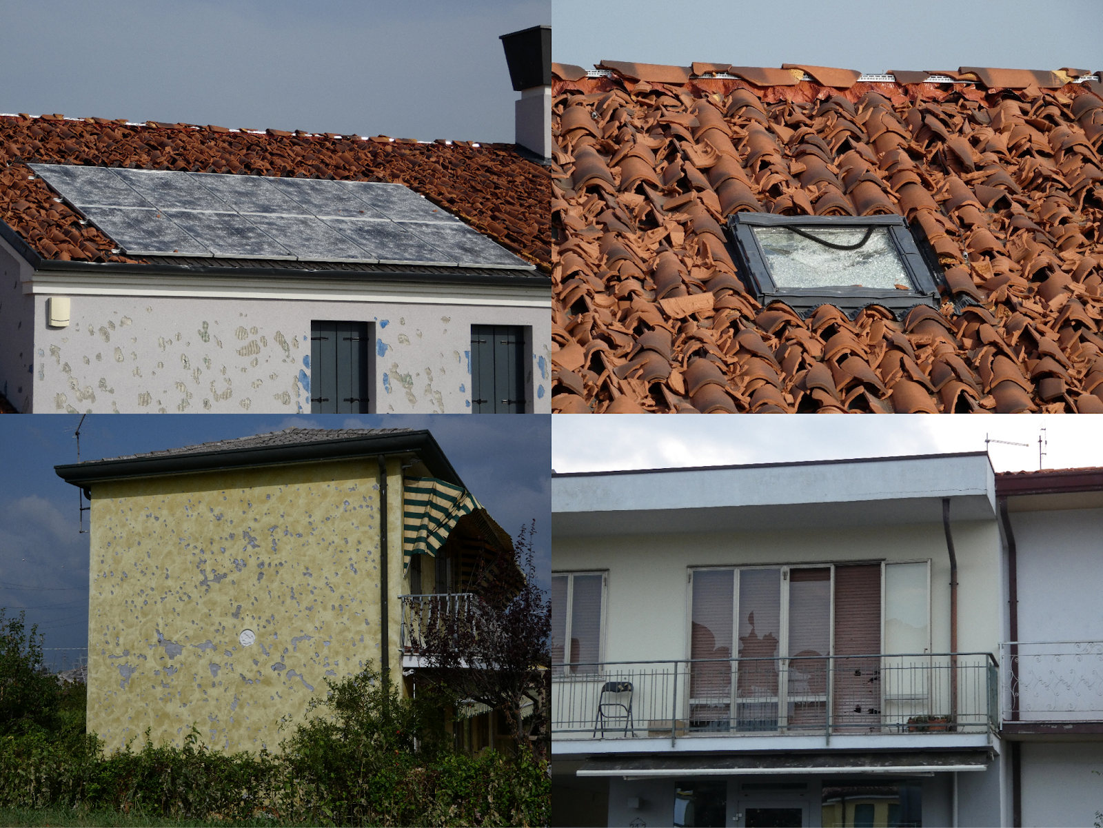
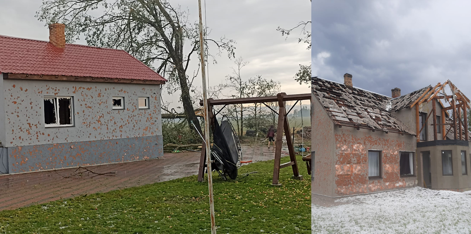
30 June: Severe hailstorms were reported in Austria, Czechia, and Poland. The most severe event occurred in Austria, specifically in the municipality of Waldkirchen an der Thaya region with hail reaching 7 cm in diameter. 80% of the buildings in the affected villages sustained damage to roofs, facades, windows, or solar panels, and the region was declared a disaster area. Very large hail up to 6 cm also fell in southern Czechia and up to 6.5 cm in central Poland.
1 July: Severe weather occurred in a belt from northwestern Italy through Slovenia, Croatia, and northern Bosnia into Serbia. The day’s main event started with supercells forming over Slovenia and producing very large hail up to 5.5 cm in diameter. Storms strengthened as they moved over Croatia with one of them producing an eccentric hailstone with an estimate of 11 cm size of its longest axis in the village of Budaševo. One of the supercells tracked for 260 km, lasting 5.5 hours. The most damaging phase of the hailstorms came later on when the hail combined with the severe wind gusts on the border of Croatia, Bosnia, and Serbia. A particularly destructive wind-driven hail event was reported from Bošnjaci with significant damage to at least 1500 buildings. Roofs, windows, and facades were heavily damaged and animals were killed. In Serbia, the hail reached 7 cm in diameter and 1 person was injured.

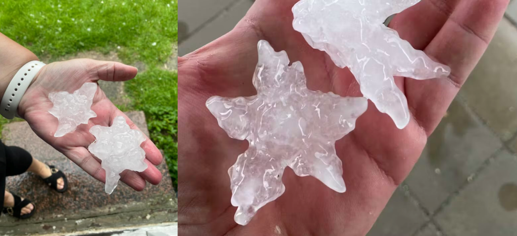
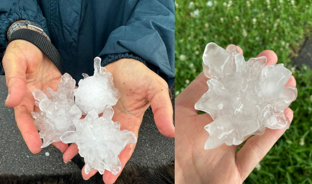
6 July: A supercell produced a swath of very large hail across Denmark. Hail had very eccentric shapes with pronounced lobes, leading to very large dimensions across the longest axis, up to an estimate of 10.5 cm. Hail damaged cars and roofs, and was by far the largest hail reported to ESWD from this country.
11 July: 328 large hail reports were submitted for this day, most of them from France. Poland, Czechia, Germany. and central Russia were also affected. In France, multiple supercells formed, producing hail locally exceeding 5 cm in diameter. Three hail swaths were more than 100 km long. The largest hailstone fell in Mazères-de-Neste and was estimated at 9 cm across. Severe hail activity continued from the early afternoon to late night, damaging roofs, cars, and crops. In Czechia and Poland, supercells produced hail up to 7 cm in diameter.
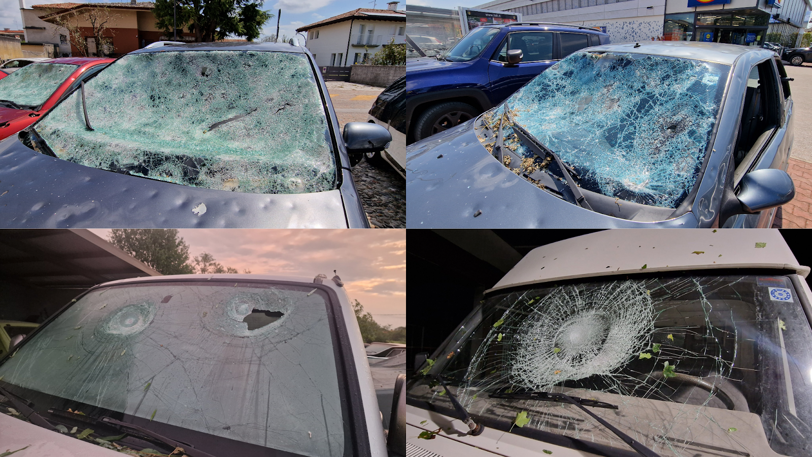
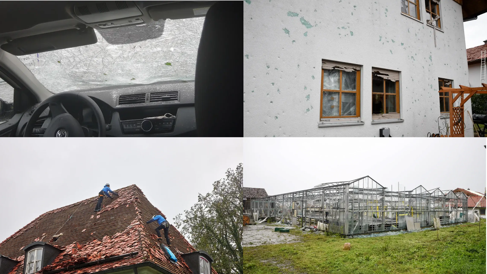
12 July: The biggest large hail day of 2024. 753 reports were submitted to the ESWD. Hail fell in a belt from France through northern Italy, Switzerland, and Germany into Slovenia, Austria Czechia, and Poland. In France, an early morning hailstorm caused damage with hail reaching 5 cm in diameter. In Italy, two supercells brought large hail. The most prominent one tracked through parts of Milan and produced hail up to 9 cm in diameter, injuring 4 people. In Germany, several storms produced long swaths of hail up to 7 cm in diameter. While the majority of hail tracks involved hail < 5 cm, 30,000 ha of farmland were damaged in the country. One of the hailstorms produced a hail swath 300 km long. In Austria, hail up to 6.5 cm in diameter damaged roofs, windows, facades of houses, and photovoltaic panels. In Slovenia, hail up to 6 cm was reported.
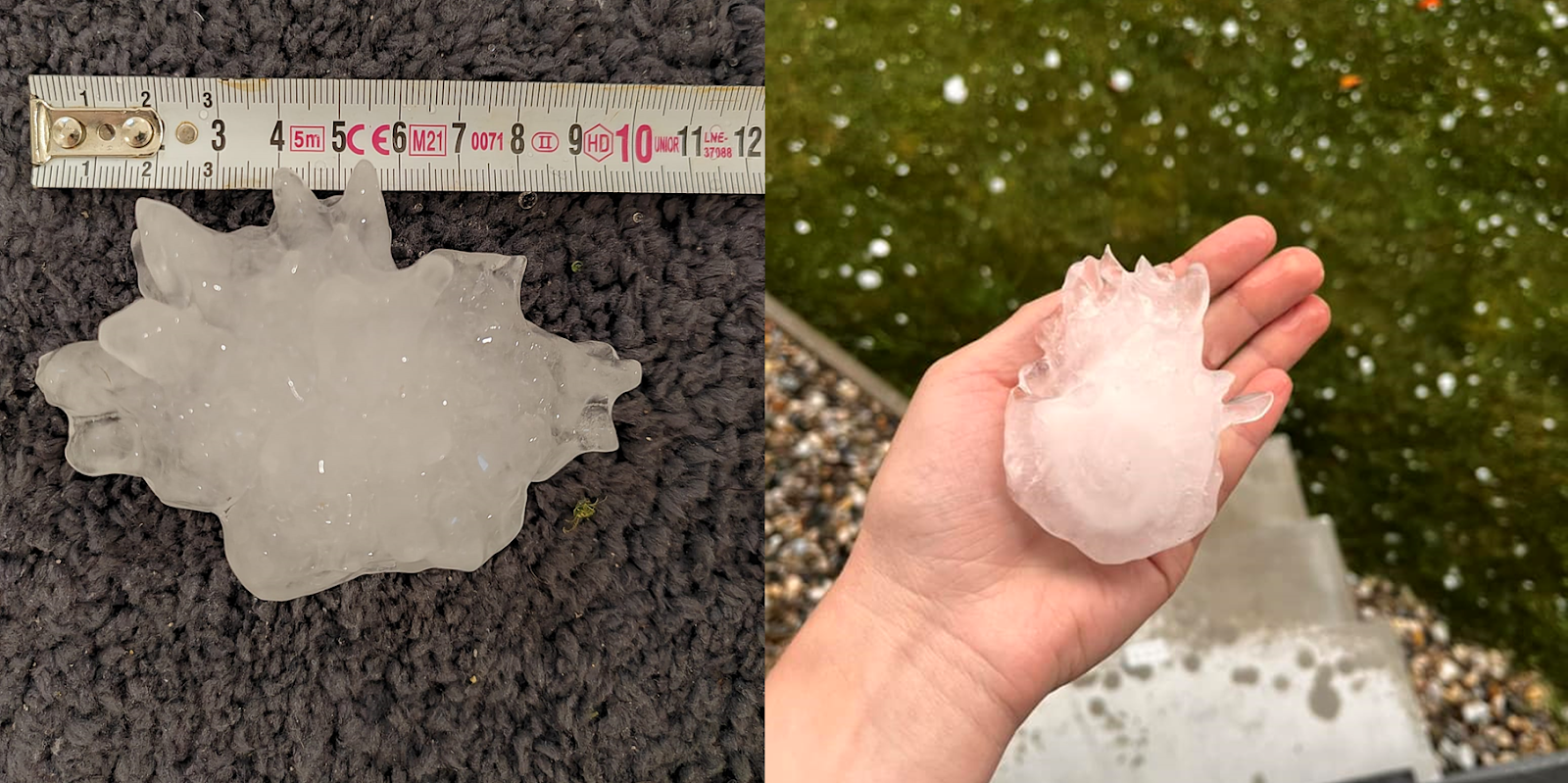
13 July: 313 large hail reports were submitted mostly from Slovenia, Hungary, Poland, and Belarus. The most severe hailstorms occurred in Slovenia, where two supercells formed in the afternoon and moved towards Hungary. Giant hail was reported in and around Slovenska Bistrica, and the largest hailstone was estimated at 12 cm across. Roofs, cars, greenhouses, and solar panels were damaged. In Hungary, the hail reached 5 cm, and in Croatia, 7 cm in diameter. In Poland, an intense overnight elevated supercell produced a long swath of wind-driven hail up to 4 cm in diameter.
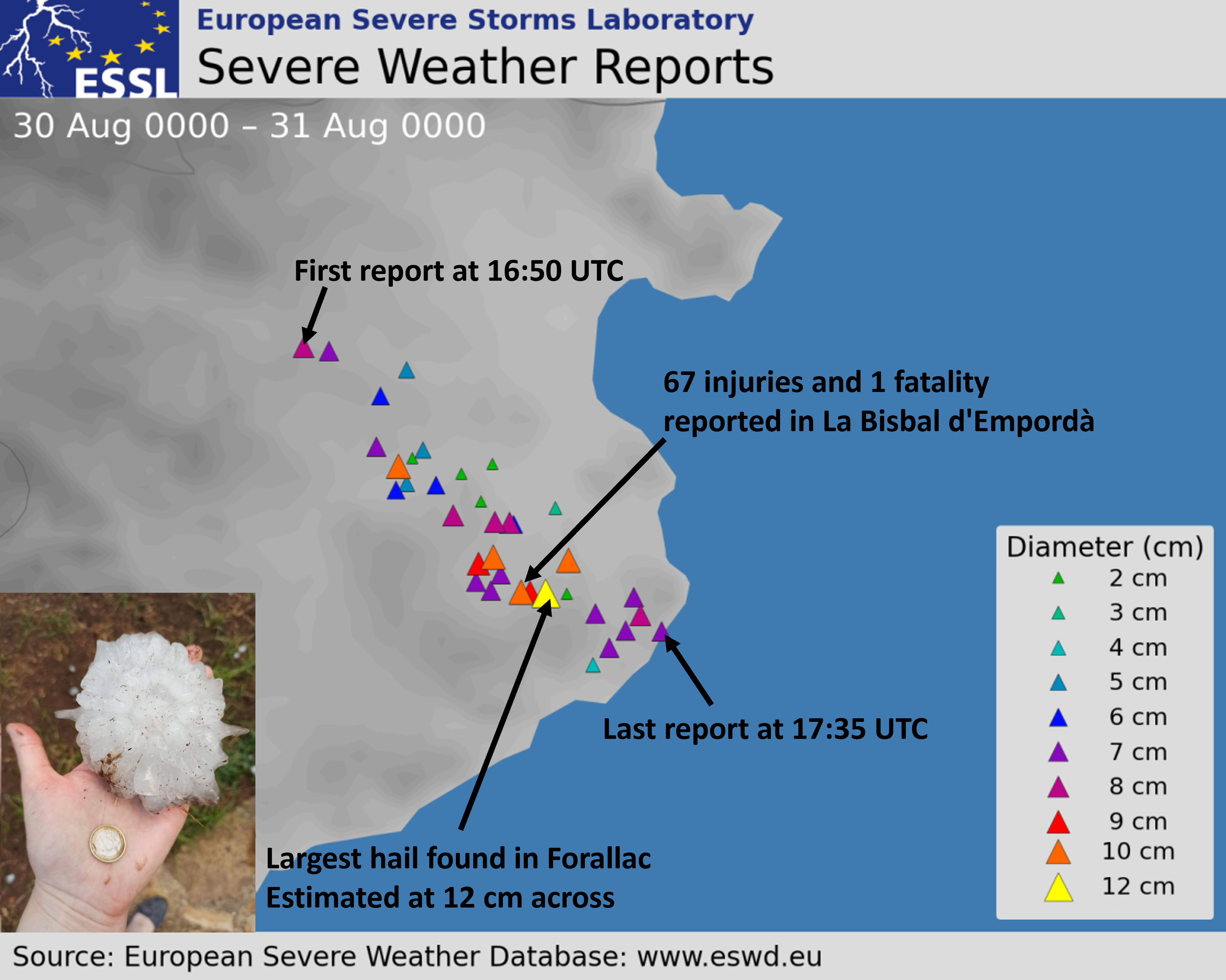
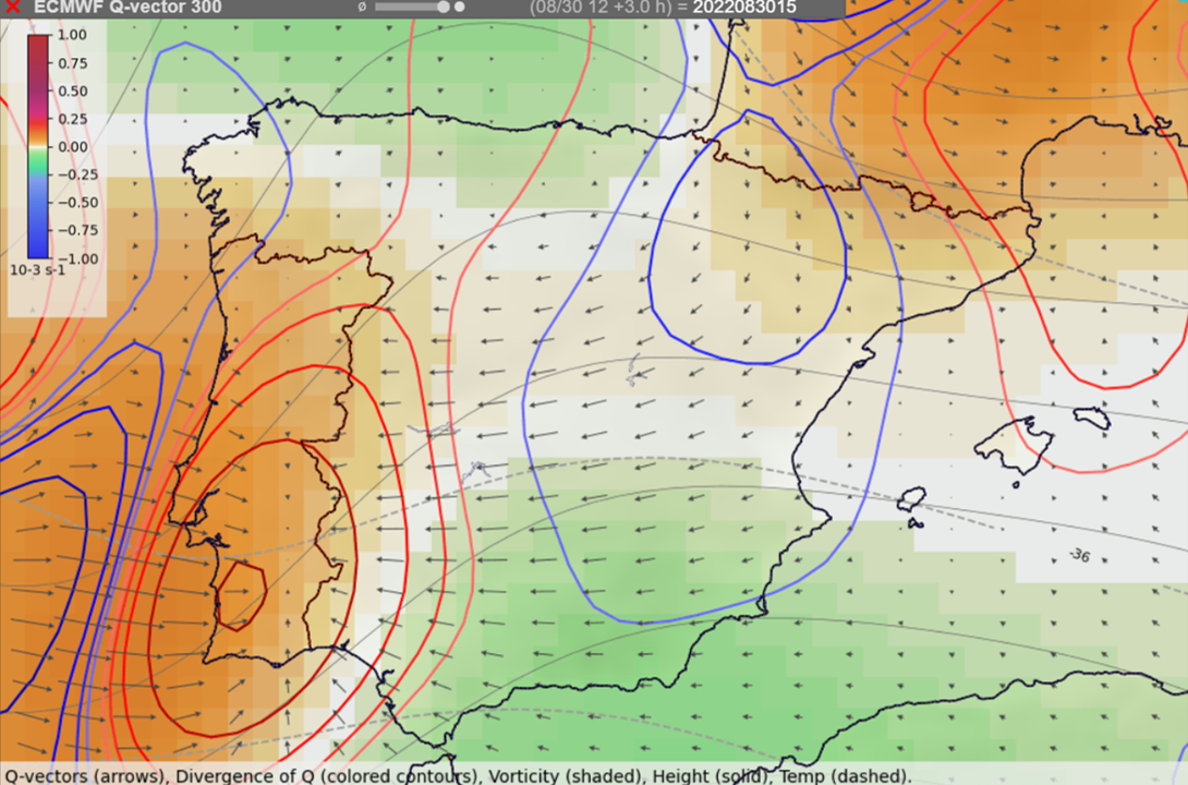
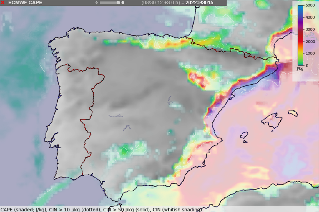
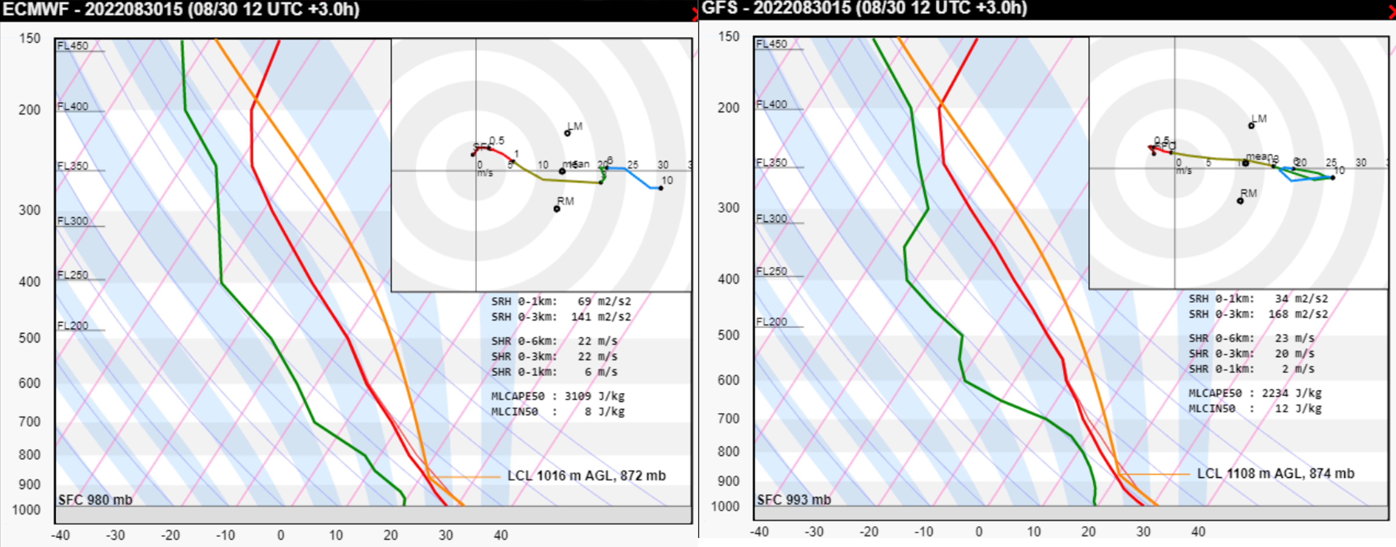
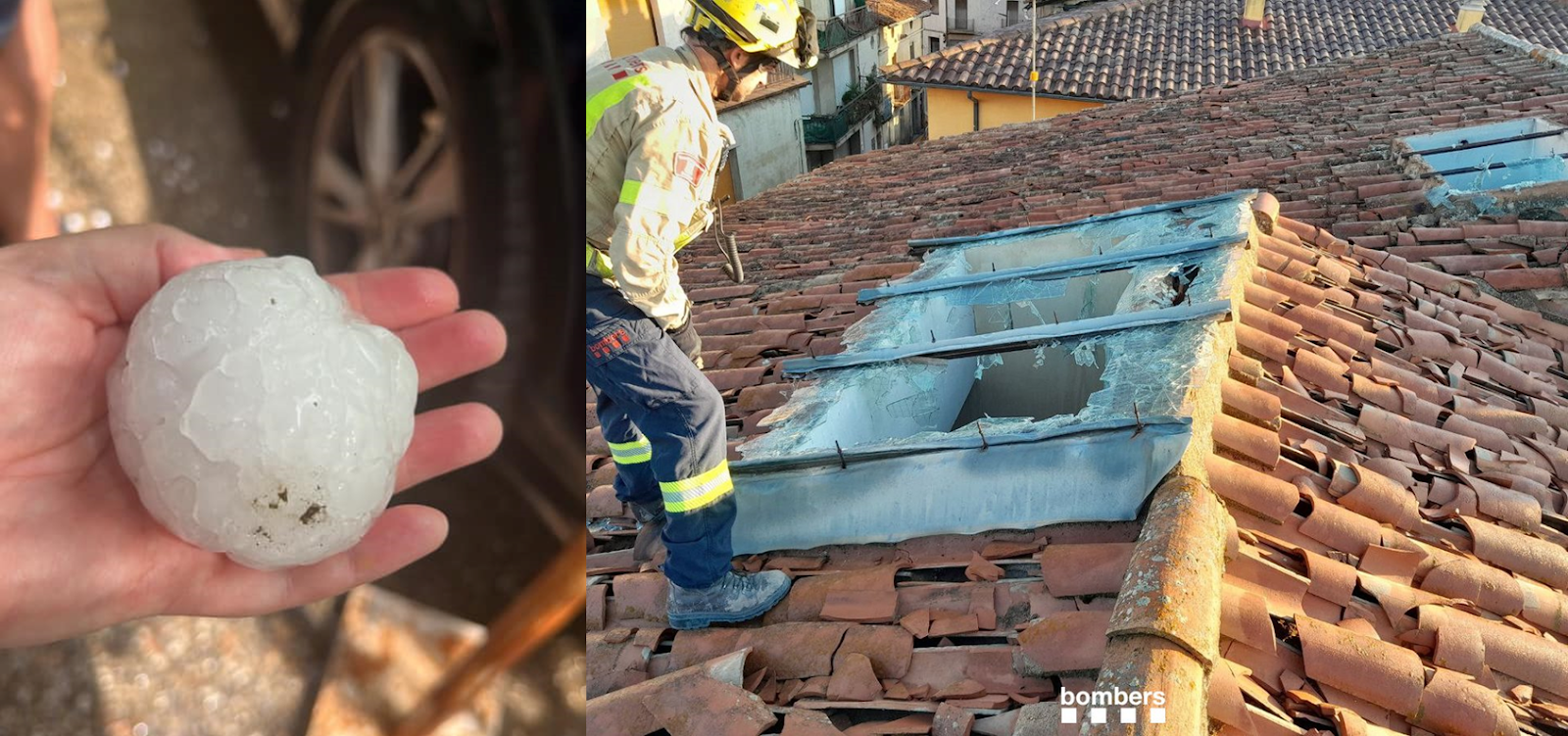
2 August: Very large hail was reported from Andorra, Italy, France, and Spain. In Italy, an intense storm developed right over Torino, producing hail up to 7 cm in diameter and causing widespread disruption to traffic and damage to cars, roofs, and windows. 1 person was injured by hail. In Spain, two supercells produced hail up to 8 cm in diameter. The biggest impact was recorded in Sant Pere de Torell, Catalonia, where hail badly damaged at least 1000 roofs and 300 cars. In France, hail reached up to 6 cm in diameter.
3 September: A supercell developed in the Valencia region, Spain, and produced hail up to 11 cm in diameter in the village of Agullent.
8 September: A supercell developed in Tuscany, Italy, and produced hail up to 9 cm in diameter in Camaiore municipality. Damage to roofs and cars was reported and hail injured one person.
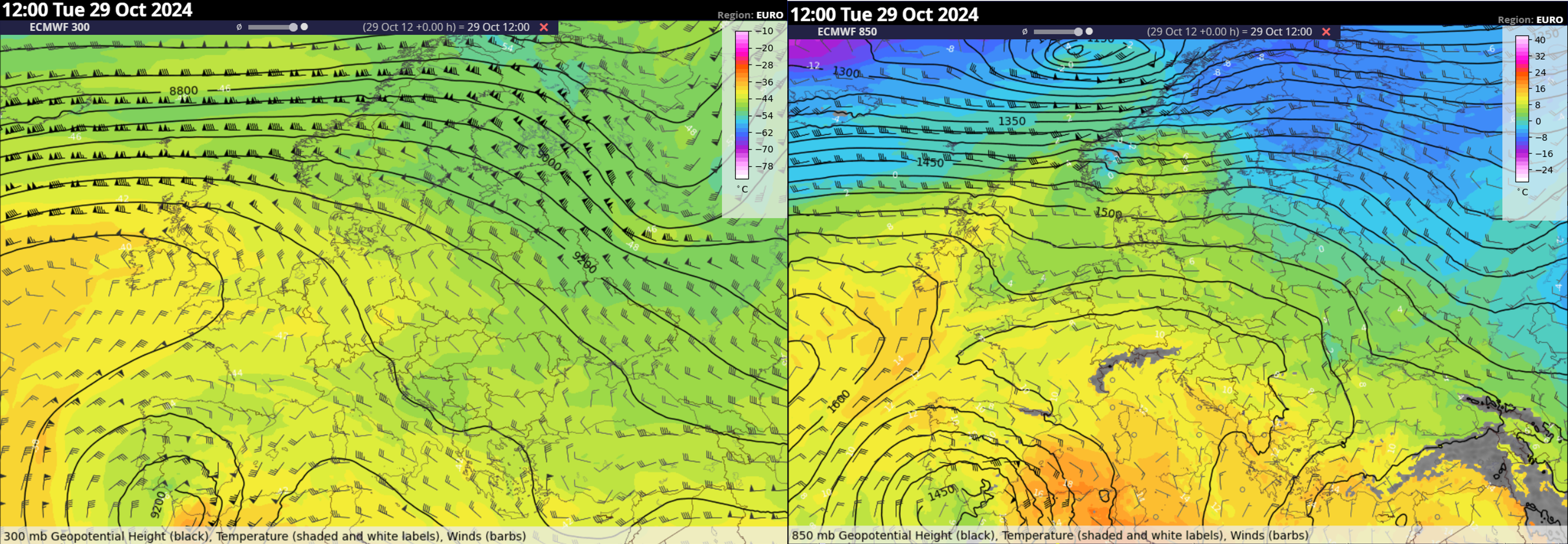
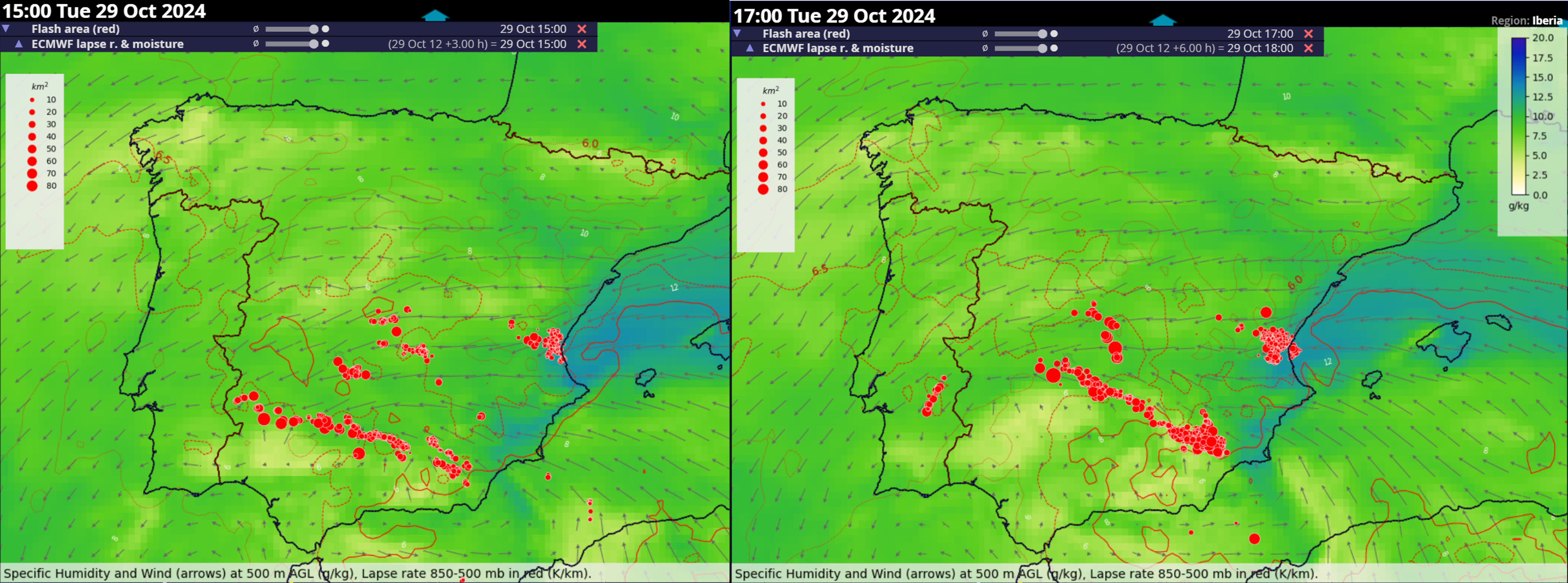
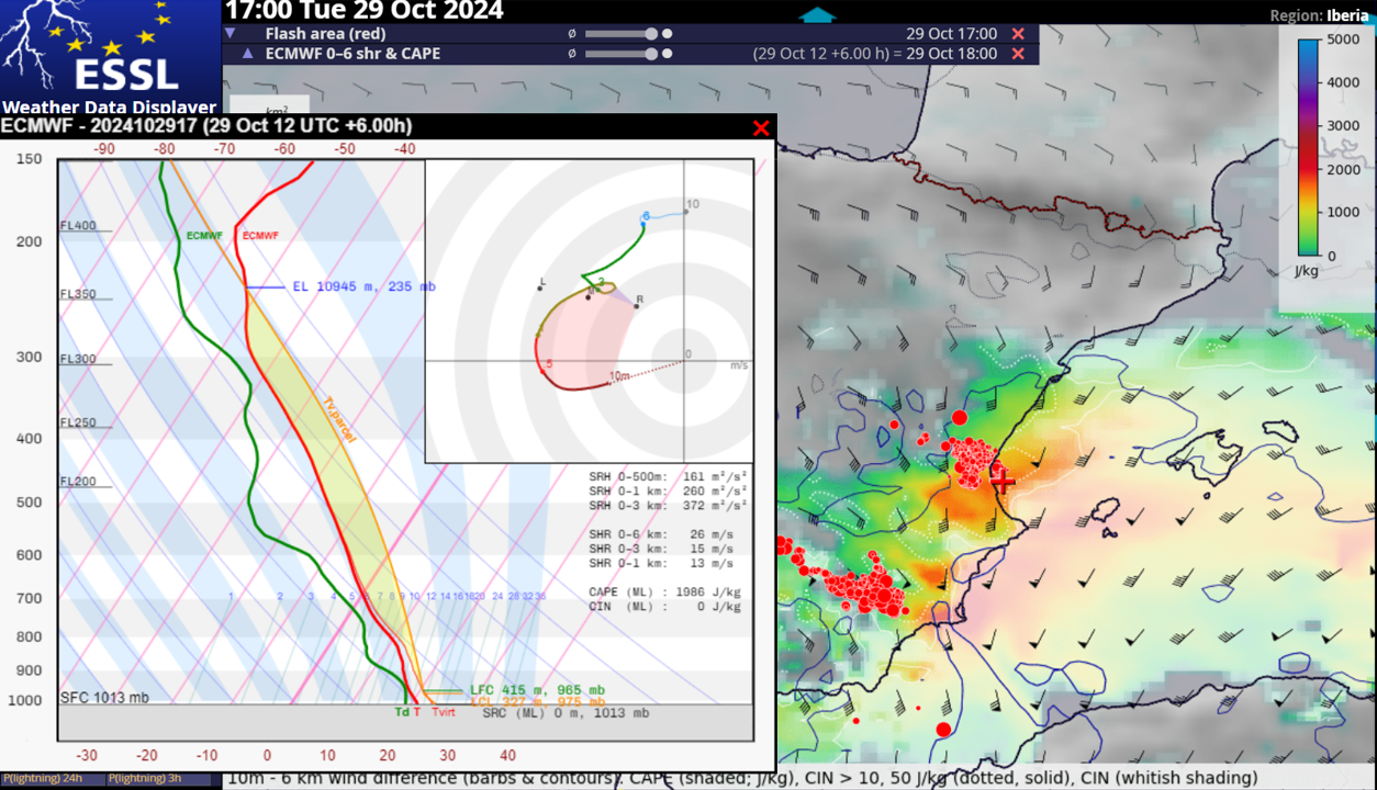
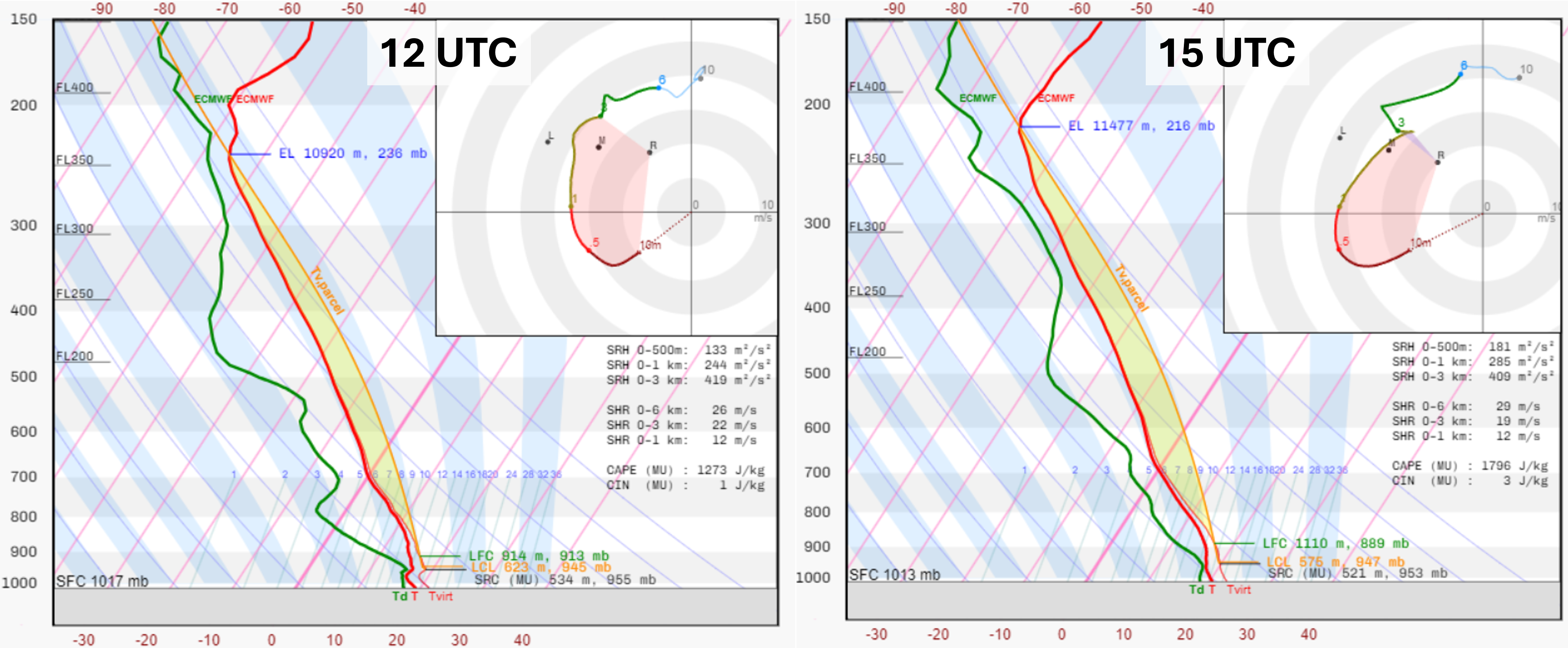
28 October: 11 300 ha of crops were damaged by a late evening hailstorm in Andalusia region. Hail up to 7 cm in diameter damaged many cars in the town of Santa María del Águila.