This short blog post provides an overview of severe weather associated with the recent windstorms and discusses why the windstorm of 16 – 17 February ended up as a prolific tornado producer.
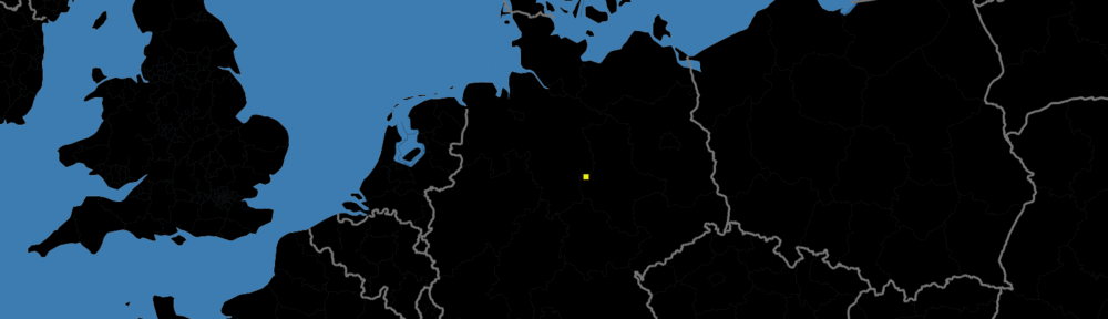
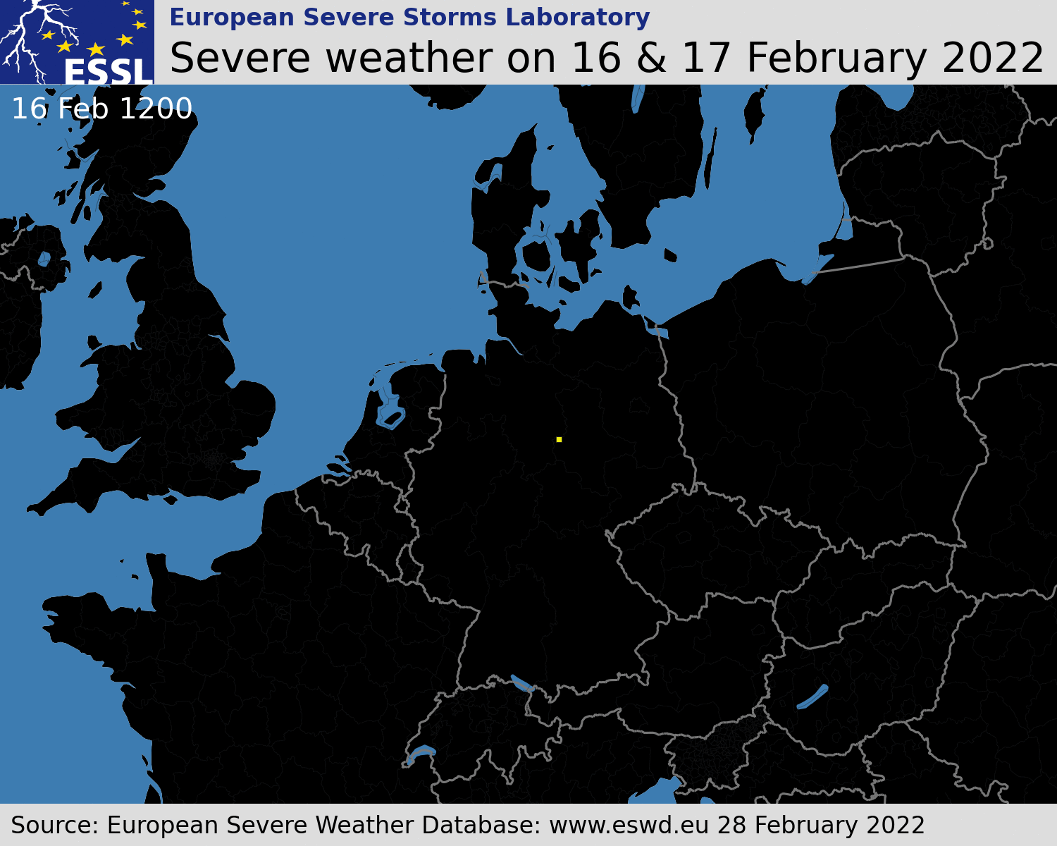
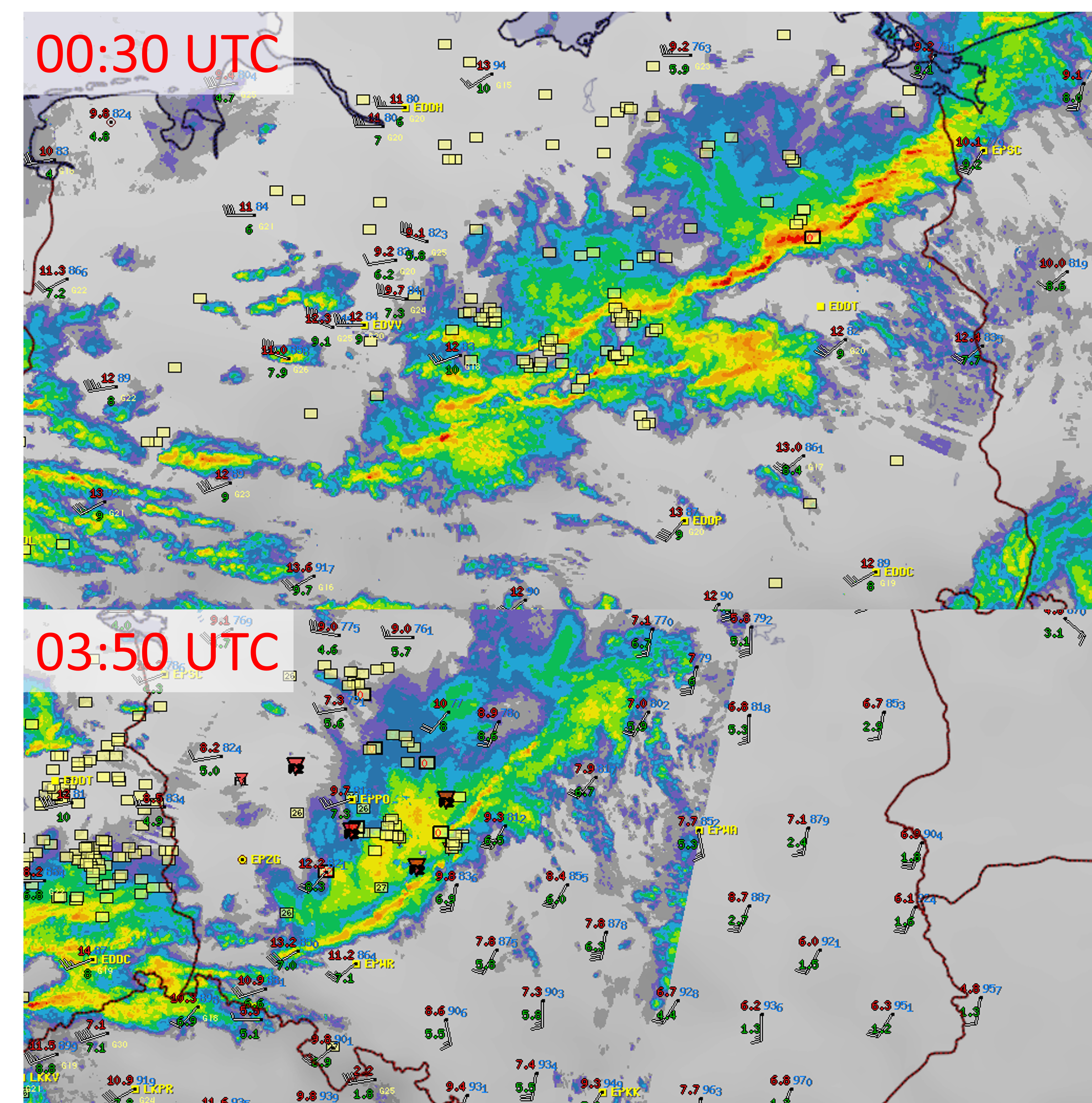
Multiple severe windstorms affected Europe in the period of 16 – 21 February. 2814 reports of severe wind gusts were submitted to the ESWD in this period, the majority of them in the belt from the British Isles through northwestern France, BENELUX, Germany into Czechia, northern Austria, and Poland. The evolution of severe weather reports for the windstorm of 16 and 17 February is shown below
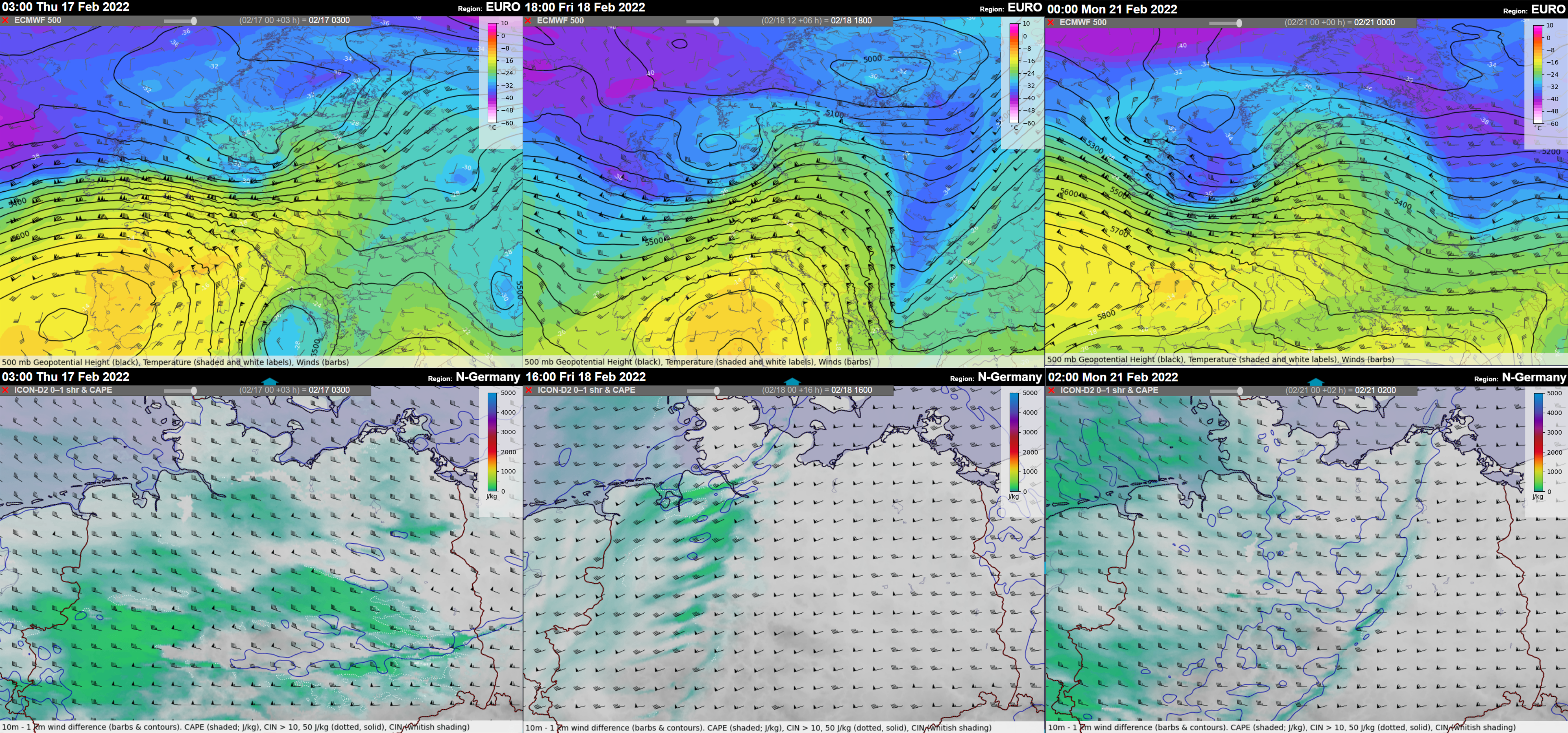
Each of the windstorms also involved a strongly-forced convective line that formed along the cold fronts ahead of the fast-moving short-wave troughs. In many areas, the passage of the convective line was accompanied by an increase in wind gusts severity. The environment featured marginal CAPE with a low Equilibrium level (suggesting low-topped storms) and strong vertical wind shear in the lower troposphere with 20 – 30 m/s of 0-1 km bulk shear. Very strong flow just above the ground explains the severity of wind gusts observed along the track of the storms.
Due to the strong low-level shear, enhanced tornado threat accompanied the passage of all the windstorms. Between the night and morning hours of 17 February, a tornado outbreak occurred in a swath from northeastern Germany to south-central Poland, Malopolskie region. By 28 February, 22 tornadoes causing 2 fatalities and 5 injuries were reported in the ESWD, while further site surveys are ongoing by Skywarn Polska, and it is likely that the number of tornadoes will grow. 12 out of 22 tornadoes were strong and rated as IF2.
While the 17 February convective windstorm ended as a prolific tornado producer, the other two situations did not result in a single tornado despite a very strongly sheared environment. Overall, three windstorms occurred in this period: the 16 – 17 February windstorm (Dudley), the 18 February windstorm (Eunice), and the 20 – 21 February windstorm (Franklin). The 16 – 17 February and the 20 – 21 February windstorms featured well-organized convective systems with persistent bowing segments and inflow notches. The 18 February convective line was broken with no accompanying bowing segments.
The first difference among the three situations was in the orientation of the convective line, the direction of the mean wind (green arrow), and the direction of the movement of convective elements, such as bow-echoes or inflow-notches (red arrow). In all three situations, the convective elements within the line moved to the right of the mean wind. The largest angle between the mean wind and the orientation of the convective line was noted for the 17 February windstorm over Poland, suggesting the strongest lift on the leading edge of the convective line (perpendicular being the most “favorable” configuration). The individual convective elements also deviated most from the mean wind in this case.
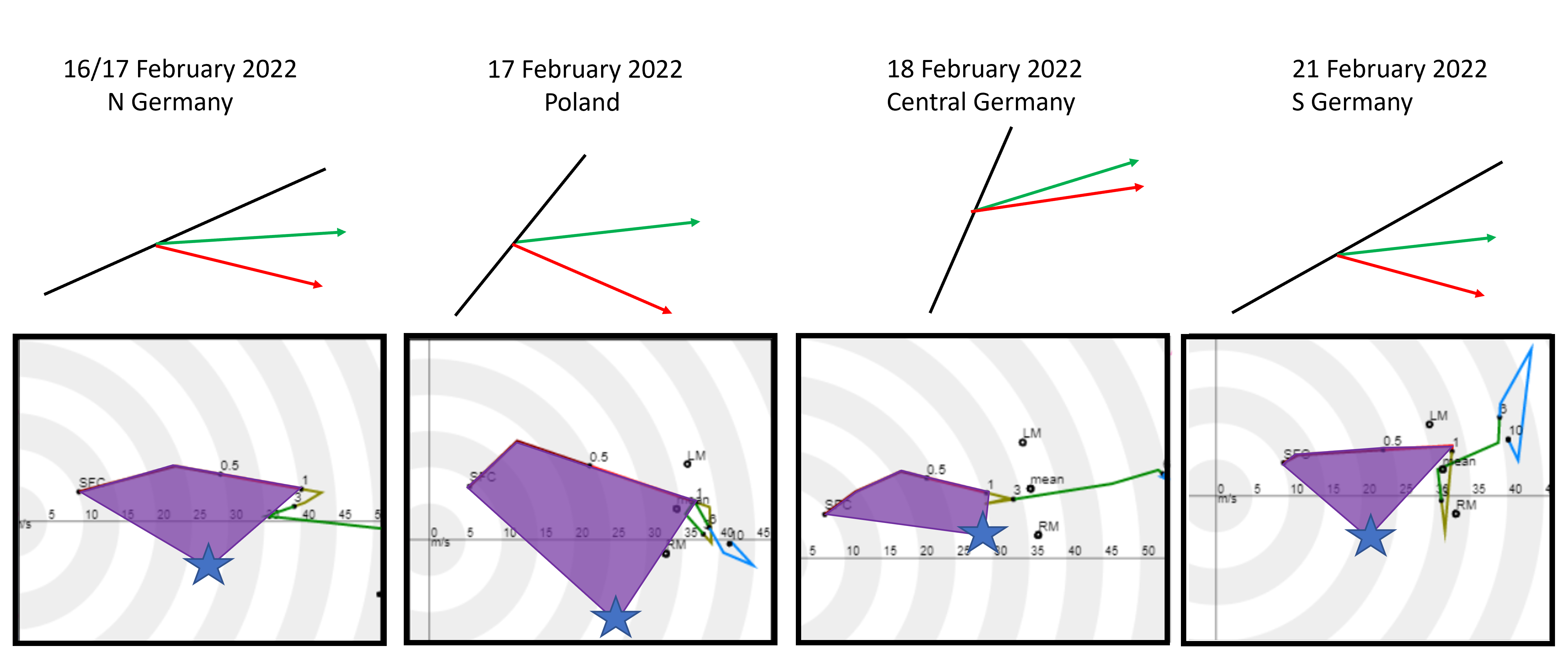
Hodographs based on the ICON-DE allow us to reconstruct the storm-relative helicity available to the convective elements in different situations. Considering the observed motion of the convective elements (marked in the hodograph by blue stars), the wind profile on 17 February over Poland had by far the most SRH. The inflow into the storm would be very strong (> 20 m/s) and contain almost purely streamwise vorticity (meaning aligned with the flow, making it “helical”). Strong inflow combined with large amounts of streamwise vorticity helped to create a favorable environment for the development of strong rotation in parts of the advancing convective system.
The reason for a higher amount of helicity was a stronger southerly component of the flow compared to the other situations. This is evident both from the hodographs and the surface station measurements. As the convective line crossed Central Europe between 16 and 17 February, 10 m wind over northern Germany had a smaller southerly component than over central Poland.
The amount of helicity in the near-surface inflow seems to be the main difference between the tornado-producing convective windstorm over Poland on 17 February and the other windstorms. 17 February also had the most abundant low-level moisture content (and the highest CAPE values) as well as the line broken into many different convective elements (bow-echoes and inflow notches). Compared to the Kyrill tornado outbreak on 18 January 2007, cold pools were weaker on 17 February 2022.
