On Wednesday 8 July 2015 late afternoon a violent tornado struck the Veneto region of northern Italy. One large villa (built in the 18th century) was completely destroyed, several houses suffered severe damage with a few walls collapsed, even more houses lost their complete roof, while many houses suffered significant or at least minor roof damage.
On 11, 12 and 13 July Alois M. Holzer from ESSL investigated this case together with Massimo Enrico Ferrario from the Meteorological Service of ARPA Veneto (preliminary report after the event), Rainer Kaltenberger from ZAMG and Alberto Gobbi from the association Meteonetwork.
The final report needs to be compiled, but a few key figures can already be given (updated on 14 July 2015 :
11.5 km – length of the tornado damage track
700 m – typical width
1000 m – maximum width of tornado damage track
F4 – maximum intensity on the Fujita Scale
A link to the ESWD database with an entry of this event can be found here.
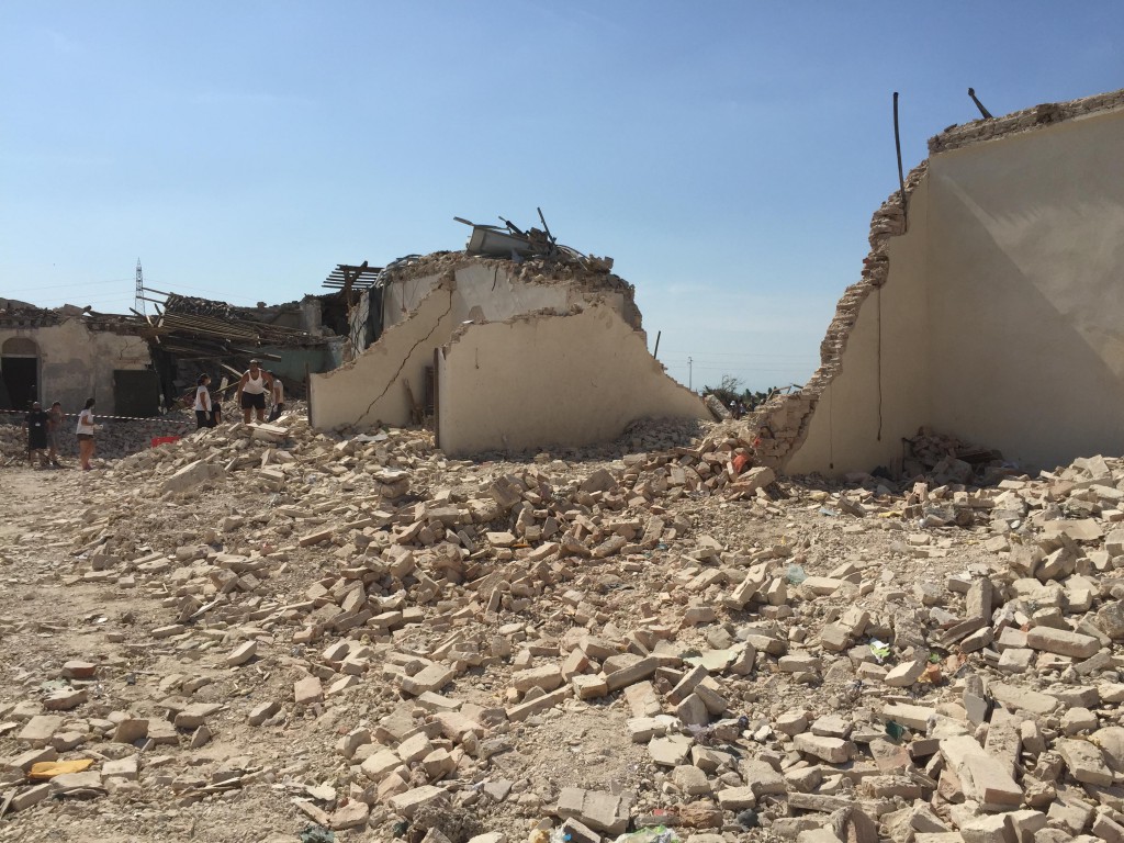
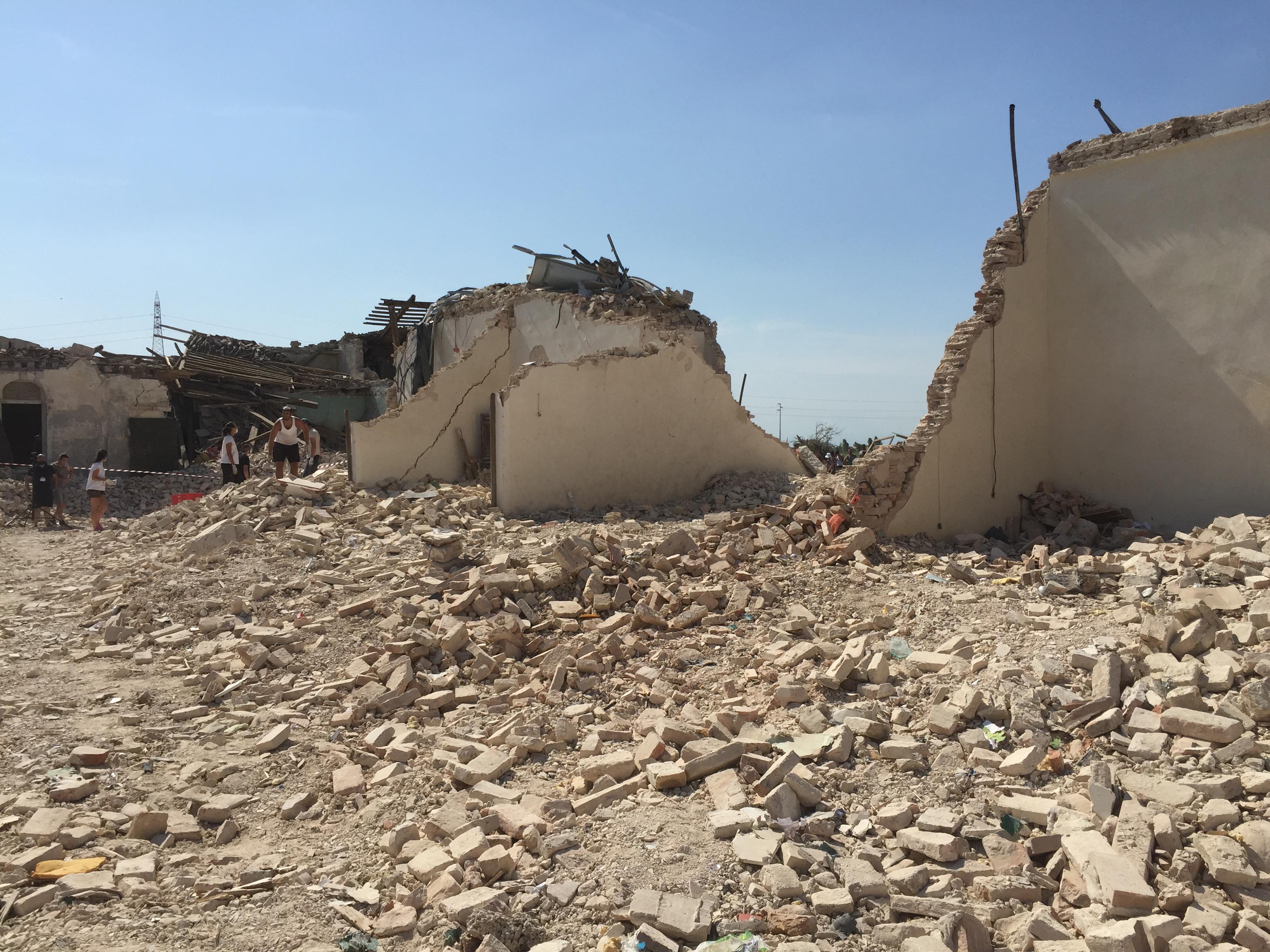
F4 damage to large villa in Mira (VE): brick structure with walls largely blown down. Damage assessment showed aged (and therefore considerably weakened) mortar between the bricks, leading to F4 (instead of F5) rating for this data point. Photo (c) ESSL, Alois M. Holzer

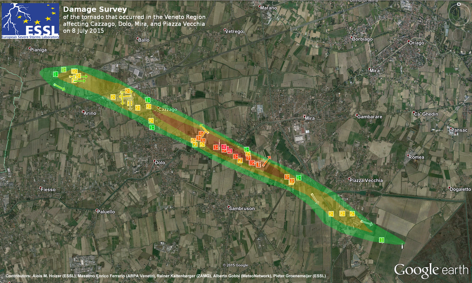
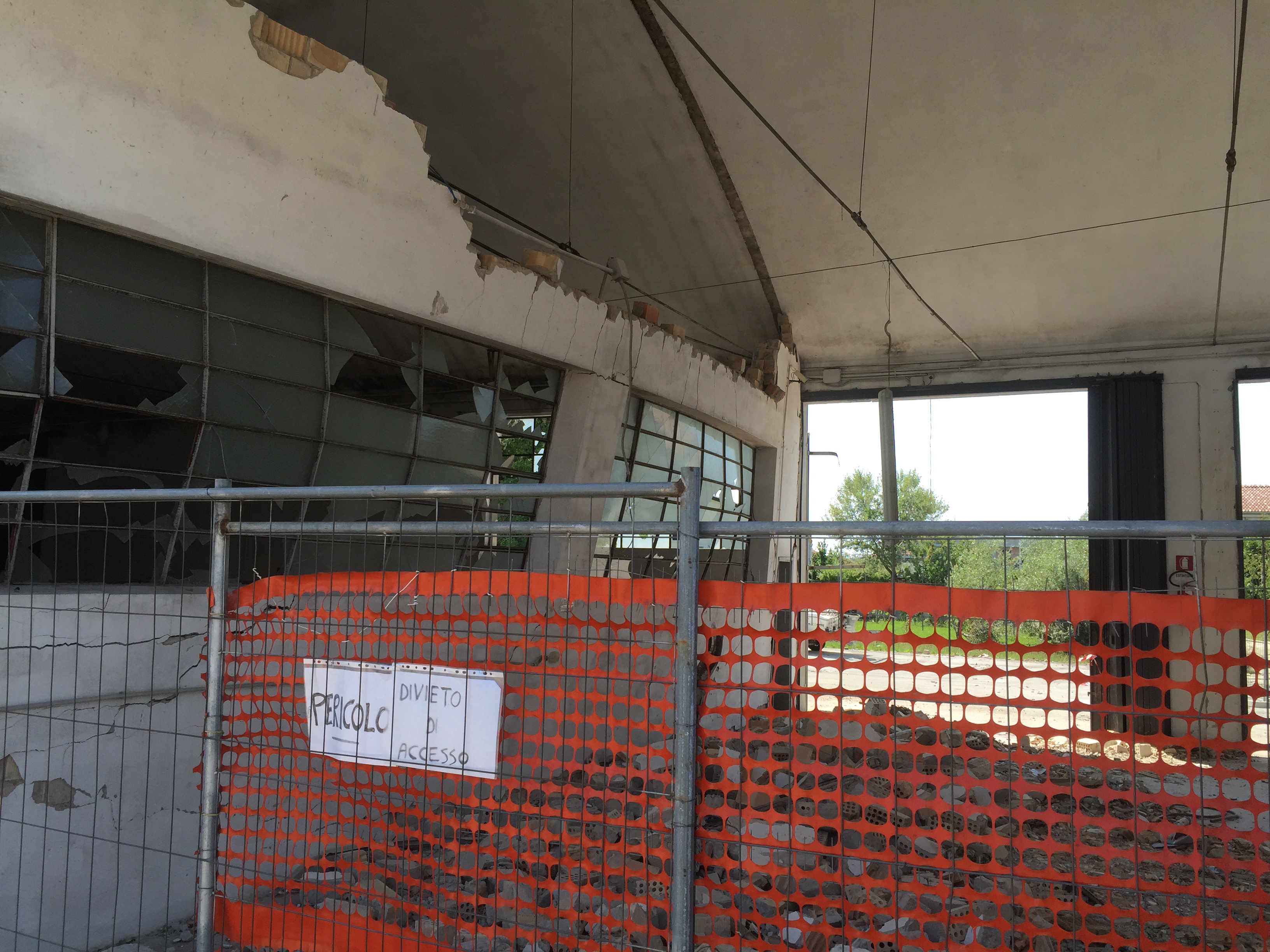 Photo (c) Alois M. Holzer