
24 June 2022 is the first anniversary of the devastating tornado that impacted southeastern Czechia in 2021. Together with the Czech Hydrometeorological Institute and partners from other weather services and universities we have worked over the past months to process data from ground and aerial surveys that we carried out in the days after the tornado.
A 30-page report has now been published that summarizes the findings and contains information about the tornado, a detailed look at individual segments of the tornado path, and a discussion of challenges associated with the survey.
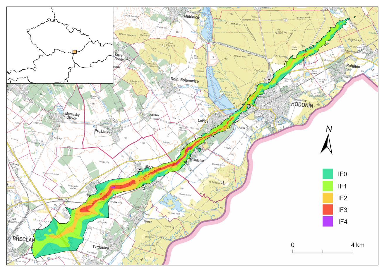
Key facts about the tornado and its damage path
Tornado formation: ~17:14 UTC, 1 km east of Břeclav
Tornado decay: 17:53 UTC, 1 km south of Ratíškovice
Maximum intensity: IF4
Path length: 27.1 km
Maximum continuous path of IF2- or stronger winds: 15.3 km
Maximum path width: ~ 2800 m, east of Břeclav*
Maximum width of IF2- or stronger winds: 590 m, in Hrušky
Minimum path width: ~ 250 m, in Hodonín
The area impacted by the tornado: 21.9 km²
The area impacted by IF2- or stronger winds: 6.1 km²
*It can not be ruled out that part of the beginning of the damage swath was caused by straight-line winds in a rear flank downdraft surge.
