
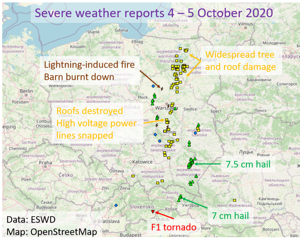
Severe weather outbreaks in autumn are quite typical over the Mediterranean but rarer over continental parts of Europe. On 4 and 5 October, an unusual synoptic-scale situation led to an outbreak of severe thunderstorms over eastern Slovakia and Poland.
During these two days, a total of 36 large hail reports (with 5 reports of hail exceeding 5 cm in diameter), 71 reports of severe wind gusts (with several instances of F1 damage), 4 reports of damaging lightning and an F1 tornado report were entered into the European Severe Weather Database (eswd.eu). The map below gives an overview of the impacts. While severe convective wind gusts are not uncommon with deep low pressure systems over this part of Europe, hail reaching 7 cm or more in diameter is exceptional for this time of year.
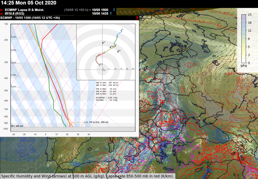
The outbreak was caused by severe thunderstorms developing in a very warm and moist airmass that had been advected northward from the southern Mediterranean Sea (Fig 2). Mixing ratios of 10 – 12 g/kg allowed 500 – 1500 J/kg of MLCAPE to build over the area. Combined with strong vertical wind shear (exceeding 20 m/s in the 0-3 km layer), thunderstorms quickly turned severe as they organized into supercells and bow-echoes.
More information concerning the F1 tornado over southern Slovakia can be found here. ESSL would like to thank Skywarn Polska and the Slovak Hydro-Meteorological Institute for providing severe weather reports!