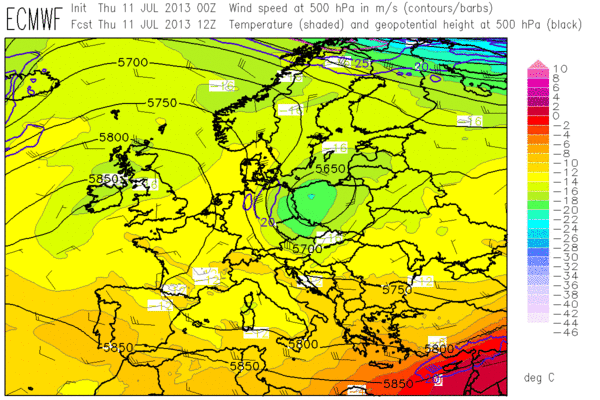
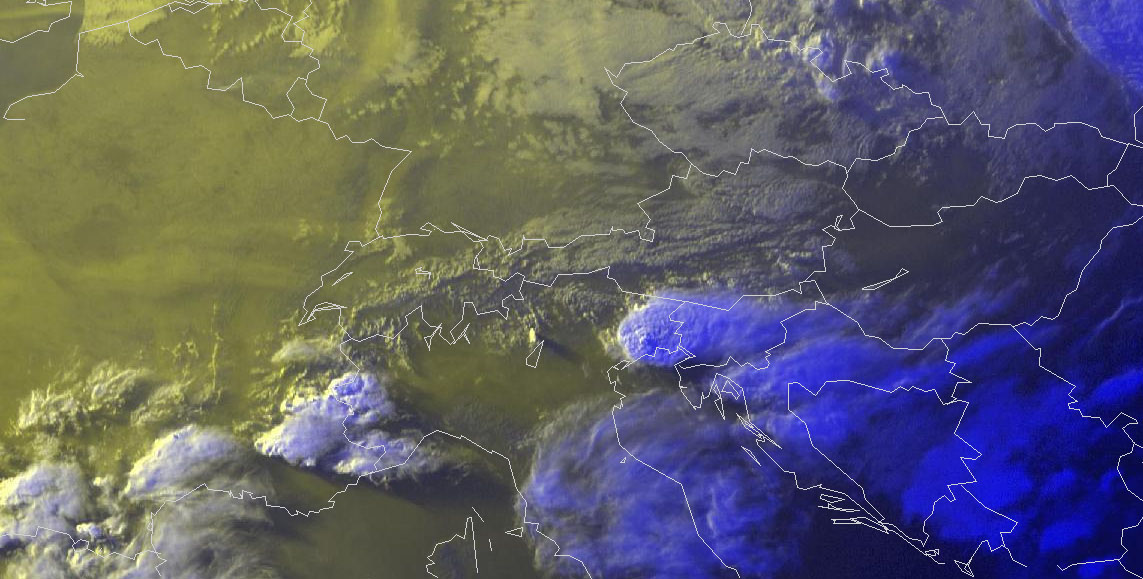
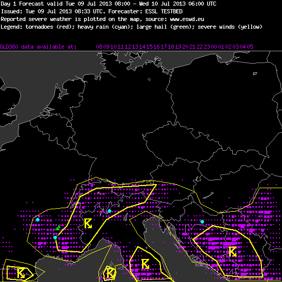
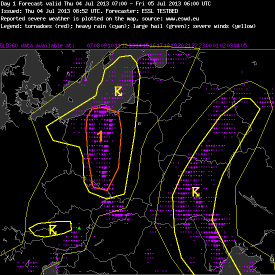
Yesterday (Thu 11 July 2013) some severe weather occurred with the thunderstorm activity along and ahead of the cold front of the low pressure system centred over Poland, which was already featured in yesterday’s post. First large hail reports arrived from E Slovakia and the W Ukraine in the early afternoon. Additional hailstorms formed a little later over Western portions of Slovenia and Croatia, where the city of Rijeka also suffered some flooding. In Italy, hail, flooding and severe wind gusts were reported from Florence (2 people injured by falling trees) and Perugia with pulse storms in the afternoon, and especially along the Northern Adriatic coast with a giant evening supercell that formed the climax of yesterday’s activities. All in all, this was quite a lot of severe weather for a rather moderate-looking day, and all but the Florence and Perugia events occurred within the domain of yesterday’s day 1 forecast (Fig. 1).
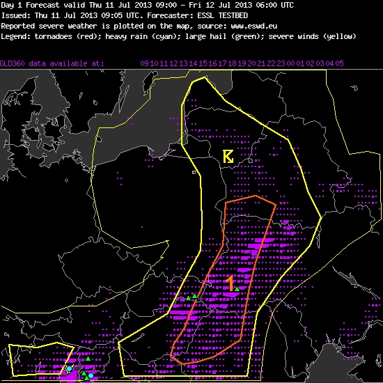
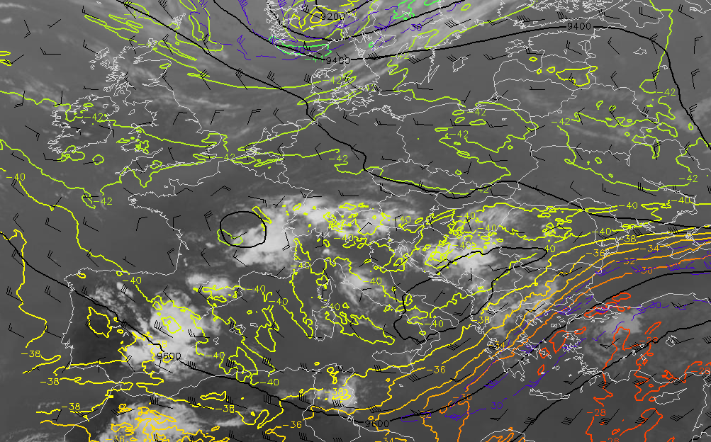
Fig. 1: Verification of the day 1 forecast issued on Thu 11 July 2013.
—–
Day 1 Forecast
Valid: Thu 11 Jul 2013 09:00 to Fri 12 Jul 2013 06:00 UTC
Issued: Thu 11 Jul 2013 09:05
Forecaster: ESSL TESTBED
A level 1 was issued for south of Belarus, west of Ukraine and northwest of Romania for heavy rain, hail and strong winds.
Most severe thunderstorms is expected to form along or ahead of a cold front moving eastwards. Moderate CAPE (up to 2000-2500 J/kg) is predicted ahead of the cold front, and the rear edge of this area overlaps with increasing 0-6km wind shear (~15m/s). We expect some multicells or even a few supercells, and later the formation of a convective line is possible as well. There is a chance of large hail and severe wind gusts.
Further South (NW Romania), vertical wind shear is weaker, but instability is equally high. Strong pulse storms can form especially over the mountains with a risk of localized heavy rain and marginally large hail.
—–
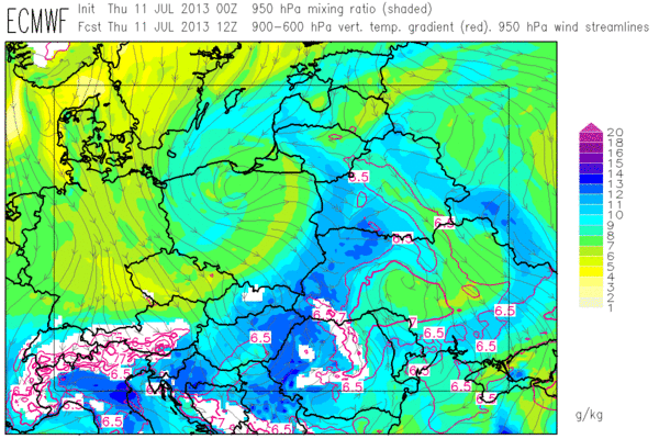
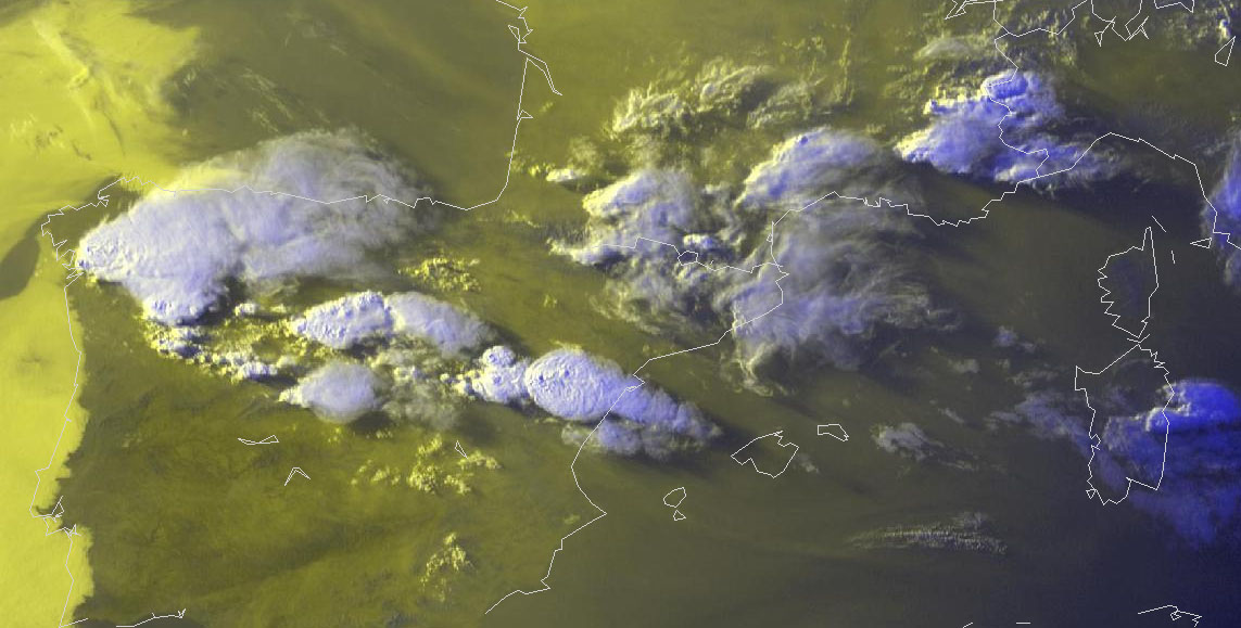
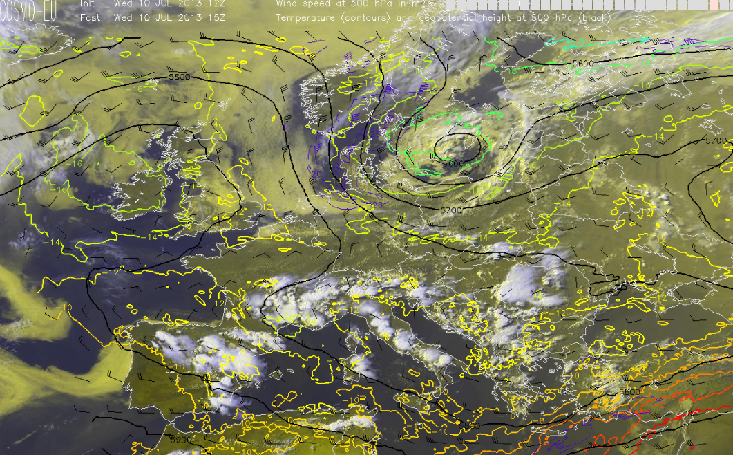
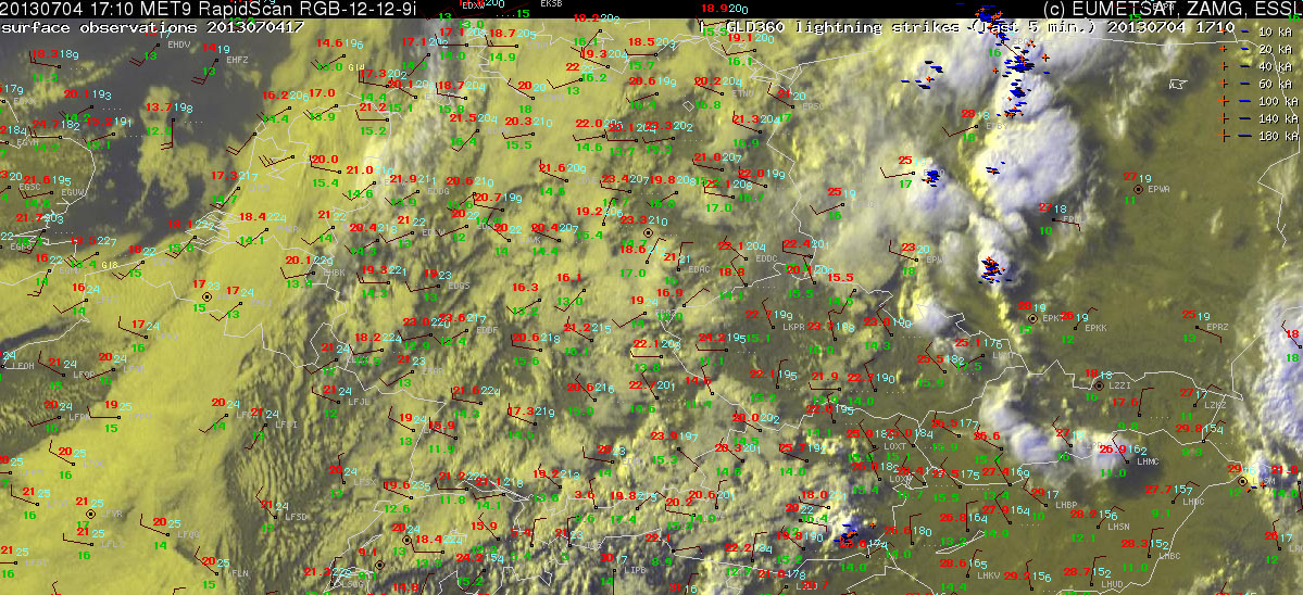
Today’s verification of this forecast showed a partial success with the big Eastern 50% lightning area and the Ukrainian hail report, two closely missed Slovakian hail reports and unfortunately a complete miss of the Slovenian, Croatian and Italian events. It turned out that three small misinterpreted details had a big effect and led to this forecast errors, as it is tried to reproduce below. Fig. 2 shows the situation at 08 UTC, approximately the time when the day 1 group was ready to issue their forecast.
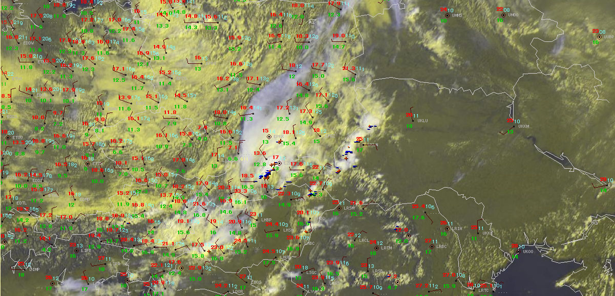
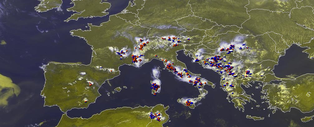
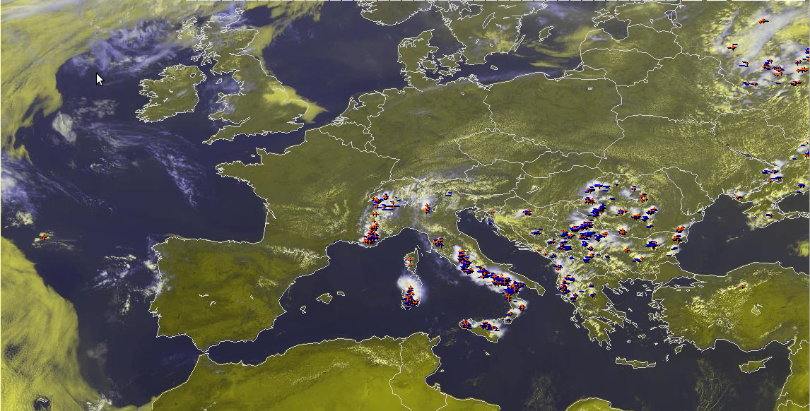
Fig. 2: Nowcast display at 0800 UTC Thu 11 July 2013: Meteosat E-View satellite image, SYNOP reports and lightning detections within the last 15 minutes.
Bust #1: Over E Hungary and the W Ukraine, a band of cumulus clouds with limited lightning activity was visible. The station measurements as well as our commonsense suggested that this band would already indicate a wind shift line that outran the following cold front. Since there was still a window with clear skies visible behind this line, we also expected storms further West over Hungary, but the then Westerly low-level wind and a beginning decrease of low-level moisture should reduce both vertical wind shear and CAPE. Hence we expected significantly enhanced chances of severe weather only in the moist Southerly flow further ahead, and the Western border of the level 1 area was aligned with the present position of this cumulus band. However, later observations soon revealed that this first outflow boundary decayed and most of the low-level convergence returned to the front line further West, where strong and well-organized storms formed around noon and the Slovakian hail reports were placed just outside our level 1 area.
Bust #2: Slovenia was excluded from the 50% thunder area. The latest satellite data (see Fig. 2 again) already showed plenty of cloudiness and rather cooler and drier Northeasterly winds, as the tail of the “backdoor” cold front moved around the Alps. In fact, however, some hours of insolation followed again and the nose of this wind regime became stationary over the Western parts of the country, where the strong convergence triggered the first hailstorms. Remnants of these storms also brought fairly much lightning over the rest of Slovenia.
Bust #3: Northern Italy was included into the 50% thunder area, but no second level 1 area was issued. We expected some thunderstorm activity overnight with the arrival of this “backdoor” cold front, but were not confident about still a presence of surface-based instability then. Hence the storms’ severity should be suppressed despite 15 m/s deep-layer shear. However, all the calamities came together in this area: Steady Southerly wind raised the dew points and enhanced vertical wind shear, and the thunderstorm activity already exploded in the evening instead of slowly gearing up during the night.
Even though we had good reasoning for our forecast (or at least thought so), things turned out different. The saying that you can learn more from one poor forecast than from a hundred successful ones was proven right again. Cases like this one only emphasize the importance of a continuous monitoring of the situation, in order to quickly react to any unexpected developments.
Looking back, the first misinterpretation could already have been corrected one hour later with the newly arrived 09 UTC observations. The second and third misinterpretation were recognizable shortly after noon, when the clearing skies and the strength and persistence of the convergence zone over Western Slovenia became visible, as well as the moist Southerly inflow over Northeastern Italy with a rise of the dew points up to 22°C.
These events only added to a longer list of days with an underforecasting of severe weather in this second Testbed week. In many cases, these severe storms formed downwind of mountain barriers (Spanish plateau, Appennin, Alps), where low-level sea breezes and upvalley winds in their wake were opposed to the mid-level flow. This favourably influences all the ingredients for severe storms: low-level moisture (originating from the sea surface or moist lowlands) gets advected under steep lapse rates (originating from the mountains), the nose of this onshore/upvaelly winds provides a triggering convergence zone, and the vertical wind shear gets enhanced by roughly 5 m/s.
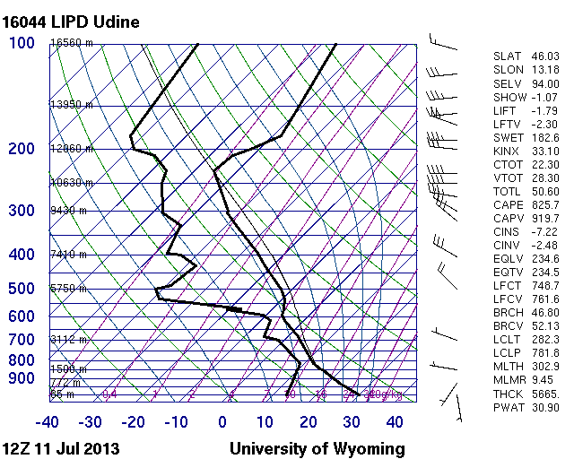
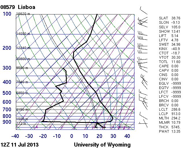
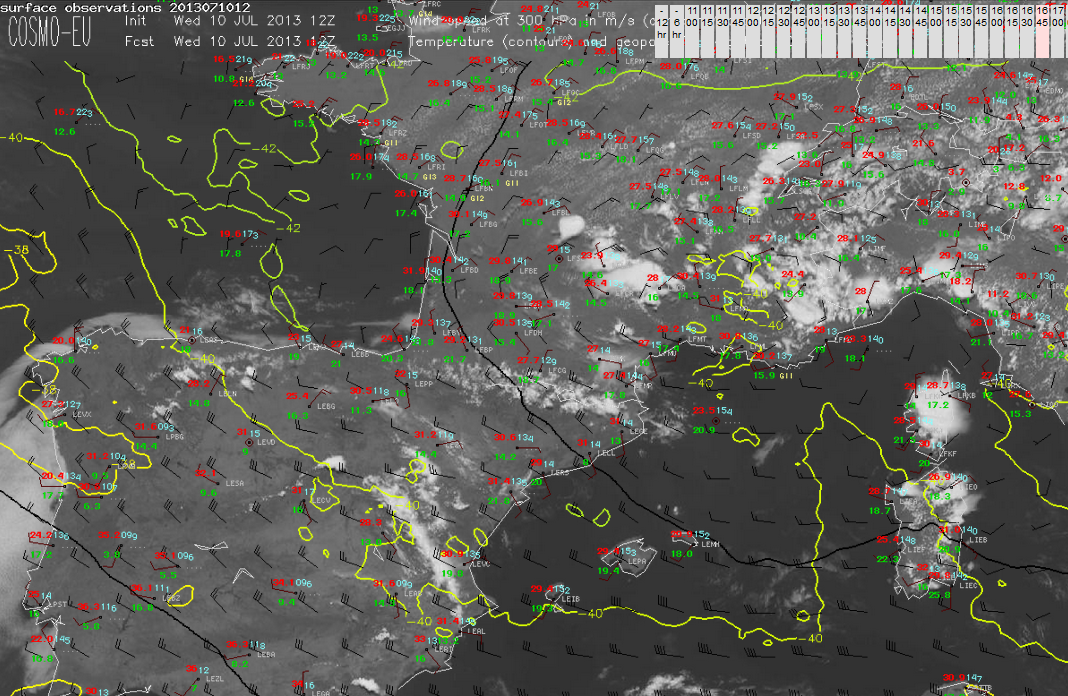
Fig. 3: 12 UTC Thu 11 July 2013 sounding from Udine (IT).
The first and foremost take home message from this second Testbed week is that these mesoscale modifications can frequently turn a “marginally non-severe” setup (e.g. shown by yesterday’s 12 UTC Udine sounding in Fig. 3) into a “marginally severe” setup and can account for a number of severe weather events in an otherwise inconspicuous situation.
Turning less serious (which is hopefully allowed by the end of the week), the second take home message is that Northern Italy is always moister than expected. The third take home message is that the atmosphere has a great sensitivity towards what we do, say and feel at the Testbed – in the first two weeks the weather always turned interesting as soon as people started to complain how boring it is. So, dear participants of the third Testbed week, please start to complain as soon and as often as possible if you want to do us (and yourself) any good! Other than that: feel very welcome in Wiener Neustadt!