
Since forecasting beyond the end of the first Testbed week is not so exciting any more, both teams worked on a parallel day 1 forecast today, resulting in a “mini ensemble” whose results can be seen in Fig. 1 and Fig. 2 below.
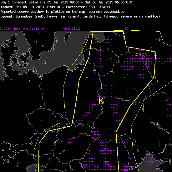
Fig. 1: Day 1 forecast for Fri 5 July 2013, issued by team 1.
—–
Day 1 Forecast
Valid: Fri 05 Jul 2013 09:00 to Sat 06 Jul 2013 06:00 UTC
Issued: Fri 05 Jul 2013 08:49
Forecaster: ESSL TESTBED
High Pressure ridge over SW Europe, Polar front over north of Scandinavia. Old low pressure systems over the east of the continent keep dissipating, no major pressure gradients are present in the region, so the upper level flow is very weak. During the night a short wave trough is moving over the north Baltics. Besides that, pressure levels slowly increase over the continent.
Today, the CAPE index values are moderate, wind shear 0-6 km is low in whole area, wind shear 0-3 km has 10m/s just in the central south Hungary, low level moisture is a bit higher over Carpatian and Poland-Ukraine border region. A convergence zone over central poland is weakening while moving slowly eastwards.
Quite numerous thunderstorms are expected to develop throughout large parts of eastern and southeastern Europe, which are unlikely to produce severe weather in the next 24h.
—–
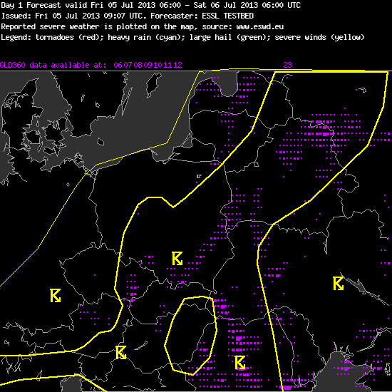
Fig. 2: Day 1 forecast for Fri 5 July 2013, issued by team 2.
—–
Day 1 Forecast
Valid: Fri 05 Jul 2013 06:00 to Sat 06 Jul 2013 06:00 UTC
Issued: Fri 05 Jul 2013 09:07
Forecaster: ESSL TESTBED
No threat levels have been issued.
…other comments…
A very isolated excessive precipitation event might occur especially with the local convergence zones or with the upslope flow along the mountain chains.
The best conditions speaking of upper level forcing will exist over W Hungary and SW Slovakia later on today with enhanced PV approaching the area. A detrimental factor is the lack of steep mid level lapse rates across the whole thunderstorm risk area, which attm precludes the issuance of lvl 1.
—–
Weak pressure gradients across most of Europe and the lack of any dynamics do not support organized thunderstorms any more, and not much will change in the next few days. Some devil’s advocats have already dared to say that the perspective for the second Testbed week is gloomy.
Nonetheless, rather widespread thunderstorms are forming daily over the Eastern half of Europe, where the low levels are still very warm and regionally moist, but the upper levels have cooled down under the influence of a weak and extensive upper-level low (see Fig. 3 for today’s 00 UTC ECMWF 500 hPa analysis).
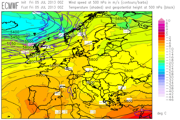
Fig. 3: 00 UTC Fri 5 July 2013 ECMWF analysis of the 500 hPa geopotential (black contour lines), temperature (colour shades) and wind (barbs).
In general, hardly any change is expected compared to yesterday, when thunderstorm activity was concentrated along two parallel convergence lines / thermal ridges, one over Belarus and the Western Ukraine and the other across Poland. Additionally, orographic convection formed over the High Tatras, the Eastern Alps and the Dinaric mountains. The convective initiation along the convergence line over Poland was particularly nice to watch (Fig. 4).
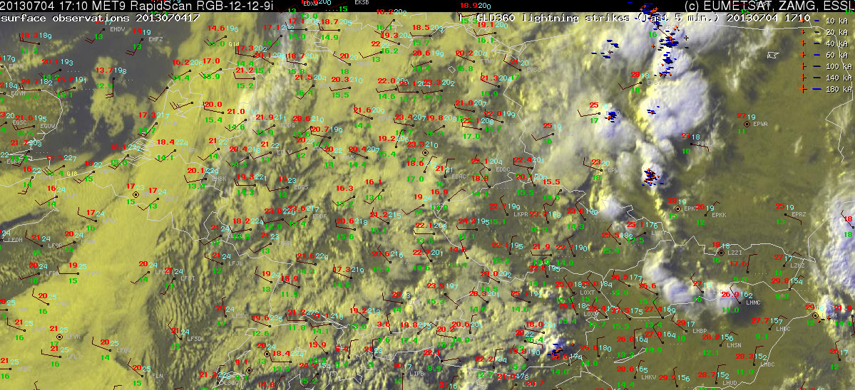
Fig. 4: Nowcast display at 1410 UTC Thu 4 July 2013: Meteosat E-View satellite image, latest SYNOP reports (17 UTC) and lightning detections within the last 5 minutes.
The verification of yesterday’s day 1 forecast (Fig. 5) showed that – apart from a doubtful hail report from Austria – no severe weather occurred. Hence neither the level 1 area issued for Poland nor the various watch areas in the afternoon nowcasts for the Ukrainian, Polish and Slovakian storms worked out. However, it was emphasized in each of the accompanying texts that the threat was considered quite borderline. The lightning areas (yellow lines) matched the detected lightning (magenta dots) pretty well, apart from the rather unexpected storms over Slovakia that moved from the High Tatras some distance into the forelands.
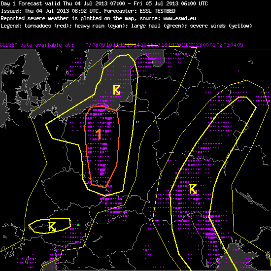
Fig. 5: Verification of the day 1 forecast for Thu 4 July 2013.
Last nowcasting activities and evaluation of various tested products are currently underway. We wish the participants of the first Testbed week a safe journey home and the participants of the second week a safe journey to Wiener Neustadt, looking forward to seeing you on Monday morning!
