
By the time of writing, 21 severe weather reports have arrived for yesterday’s (Mon 8 July 2013) pulse storm activity over the mountain areas across the Southern half of Europe. Our Bosnian Testbed participant Milica deserves special credits for retrieving and entering a few of them into ESWD on-site when we prepared today’s opening verification session.
The most striking reports were at least three wind events in Serbia which uprooted trees and damaged house roofs, pointing to maximum wind speeds in the lower F1 range (i.e., between 120 and 150 km/h). Later today, another report arrived from France with a measured wind gust of 38 m/s (135 km/h) at Croix de Chamrousse yesterday. While we were still discussing whether evaporative cooling and/or precipitation load could indeed cause such extreme wind gusts in the absence of almost any vertical wind shear (see the 12 UTC Payerne proximity sounding in Fig. 1a), a closer look at the station’s graphs which were included in the primary source of the ESWD report revealed that it is rather doubtful: the extreme gust did neither plausibly fit to the mean wind (only 4 m/s) nor to the temperature, which remained constant during the alleged wind gust and only dropped some time later, when the station was indeed hit by a thunderstorm. A more thorough review of this event is on the way, but a data error seems more likely than a true measurement.
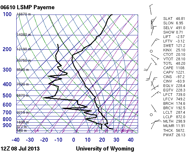
Fig. 1a.
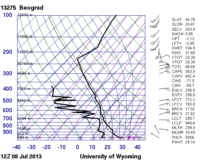
Fig. 1b.
However, the Serbian wind events were impressive enough, given that the Belgrade proximity sounding looked equally inconspicuous (Fig. 1b). Additionally, reports of marginally severe hail events arrived from Serbia, the Swiss and French Alps and the Italian West coast, and reports of excessive rainfall from Serbia, Bosnia-Hercegovina and Croatia (Fig. 2).

Fig. 2: ESWD reports (yellow: severe wind, green: large hail, blue: excessive rain) between 06 UTC Mon 8 July and 06 UTC Tue 9 July 2013.
Altogether, the number of severe weather events was higher than we expected on such a seemingly quiescent day. It was a gentle reminder that even though heavy rain is the dominant and obvious risk with storms on such days, at least localized events of marginally large hail and severe downbursts should not be left unconsidered. Maybe a level 1 is appropriate for regions with a more robust instability release even in the absence of noteworthy vertical wind shear.
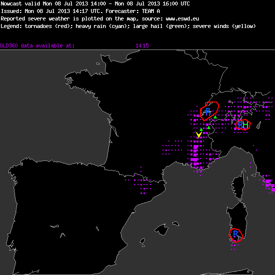
Fig. 4: Verification of the nowcast issued at 14 UTC Mon 8 July 2013, valid for the 14 to 16 UTC period.
It is needles to say that forecasting, and even more nowcasting, of such storms is particularly difficult. Fig. 3 shows yesterday’s 14 UTC nowcast (valid for 14 to 16 UTC) for the Munich domain, which did not verify positively at all. Three different areas were covered with rain watches, where either young and healthy-looking storms were already present or new daughter cells seemed about to initiate. The storm over the Italian Alps was the only one for which an additional hail threat was mentioned, since it seemed to be close enough to ingest the best low-level moisture over the Po Valley, allowing the strongest instability release. However, within the following two hours hail was reported from the French and Swiss Alps instead, while the “shadowed” storms started to decay rather soon. Fig. 4 tries to illustrate how difficult it is to do nowcasting for such a mosaic of “popcorn storms”: which of the dozens of unorganized storms will be the next big thing?
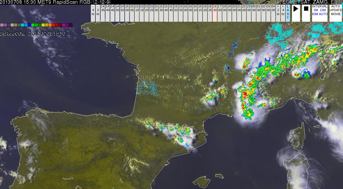
Fig. 4: Nowcast display at 1530 UTC 8 July 2013: Meteosat E-view satellite image and EuRadCom radar composite.
A more thorough weather discussion will follow in a separate post by this week’s newly acquired guest writer. 😉
