Verification and presentations of participants

During this week each participant has to present weather briefing of its own group for day1 and day2 forecasts. Yesterday this taks fell to Stefan and Dennis while today to Tomislav and Andreas. Briefings were very interesting and mostly focused on southern and south-eastern part of Europe where most of severe weather is expected to occur.

w16

Tomislav and Andreas during weather briefing day1 and day2 forecast presentations

w17

Stefan and Dennis during weather briefing day1 and day2 forecast presentations

Except weather briefing, also Wednesday’s forecasts and nowcasts were evaluated. It seems that most of the severe weather phenomena was reported in the belt from N Italy through Bosnia and Herzegovina. Serbia and parts of Romania. In Bulgaria and S Serbia convection did not initiate. Significant severe damage was associated with isolated supercells mentioned in previous blog entry. How our participants managed to predict this situation?

v1 v2 v4 v5

In the afternoon, one of our last ESSL Tesbed’s expert lectures was conducted by John Hart from Storm Prediction Center (USA). John gave a very interesting talk about forecasting supercell tornadoes and received quite a lot of questions after his presentation.

w9

John Hart


Share

Severe weather over Balkans

As our participants predicted on Tuesday, severe weather is ongoing over Bosnia and Herzegovina, Serbia and Romania. In the environment of DLS exceeding 35m/s and CAPE ~ 1500 J/kg two right-moving isolated supercells move SE-ward and are capabale in producing all kinds of severe weather phenomena.

sondowanie

25.06.2014 15 UTC Meteosat IR image with cloud top temperature (note cold ring feature over eastern cell) and roaming sounding product measuring environment of moving supercell.

Participants work on nowcasts in two groups, the first is supported by Georg Pistotnik, while the second by Helge Tuschy.

w14 w15


Share

First verification and interesting setup for Wednesday

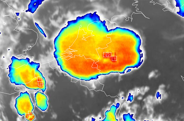
In the morning, first verification of our week 4 participants revealed severe weather reports from N Italy and parts of Austria. Lightnings derived from GLD360 network overlapped quite well with >50% probability for lightning threat (thick yellow line). v2

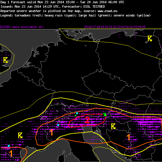
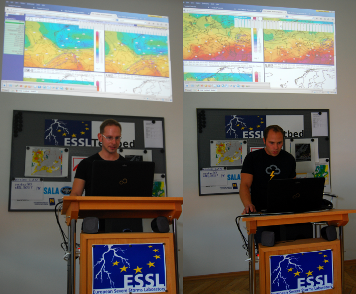
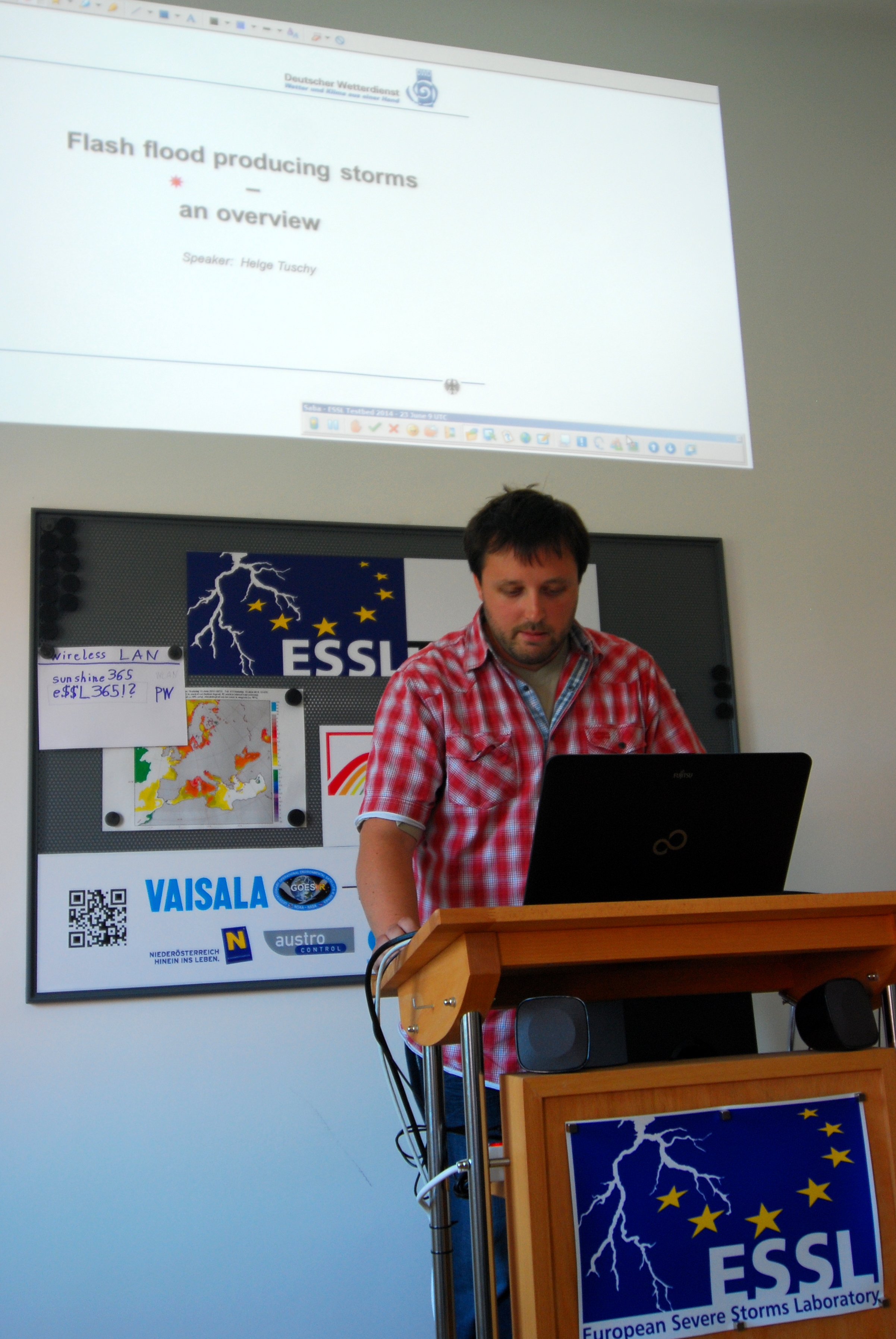
In the afternoon, our expert John Hart from SPC gave very interesting presentation on the topic “Overview: Severe Weather Forecasting”. Basing on his 25 years of experience in forecasting severe weather, it was a great opportunity to listen his talk. We had numerous questions from our participants and long discussion.

JohnH

John Hart having discussion with Helge Tuschy and Alois Holzer

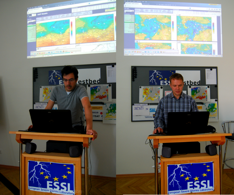
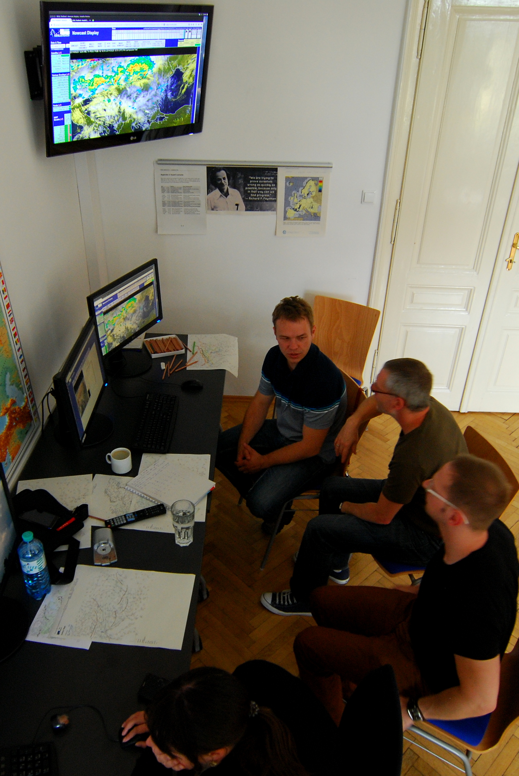
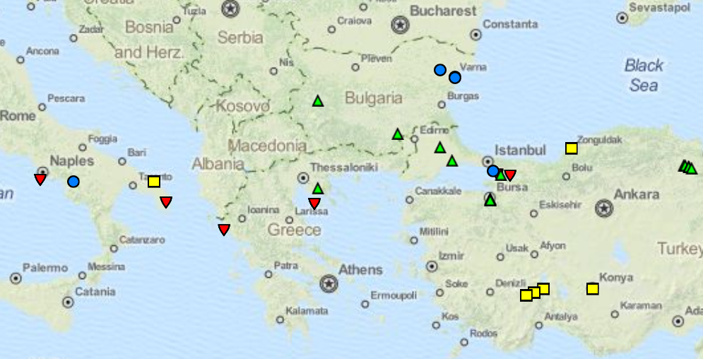
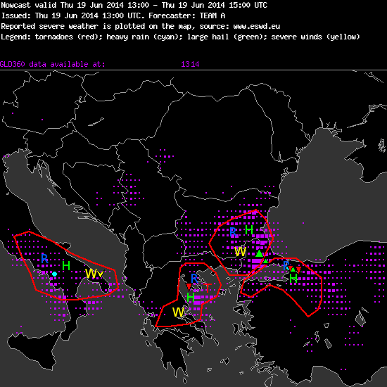
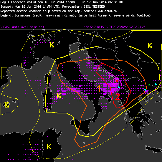
Later on, participants began to analyze weather setup for Wednesday and finded out that severe weather outbreak is possible tomorrow in central Italy and Balkan Penninsula. Mateusz Barczyk and Piotr Zurawski from Poland presented results of their teams day1 and day2 forecasts.

o2

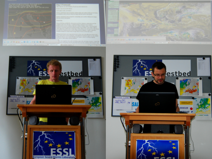
Piotr Zurawski presenting day2 forecast (left), and Mateusz Barczyk presenting day1 forecast (right).

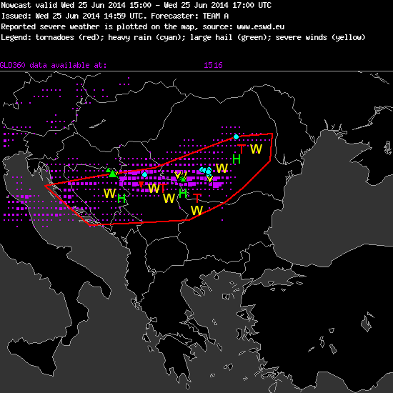
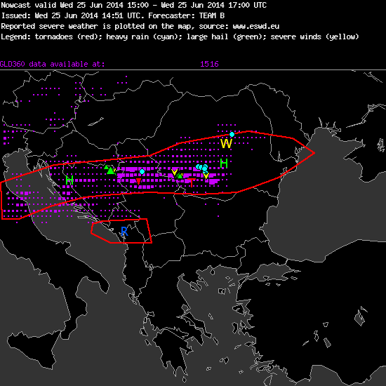
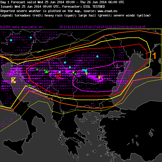
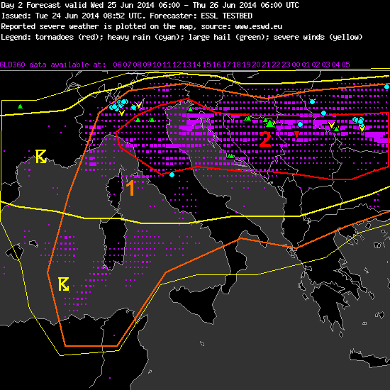
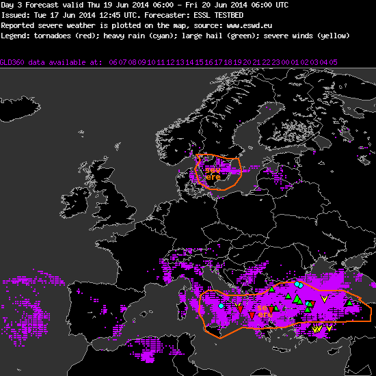
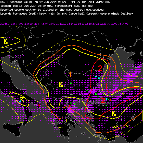
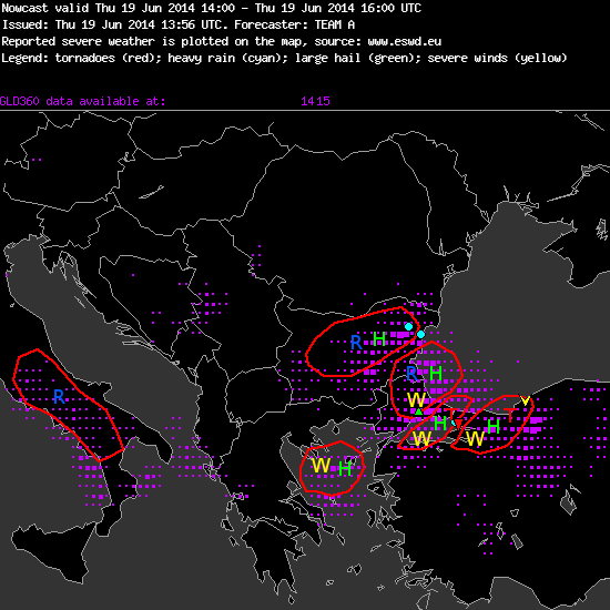
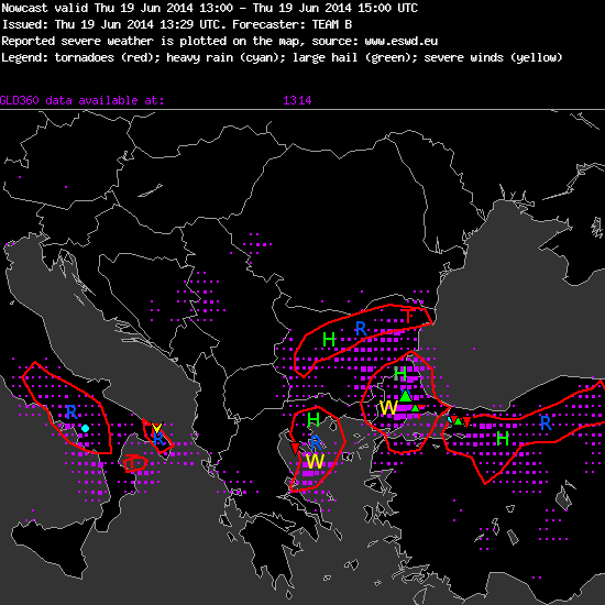
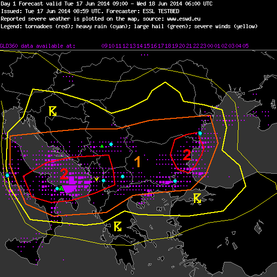
… and this is how their forecast for tomorrow look like:

o1

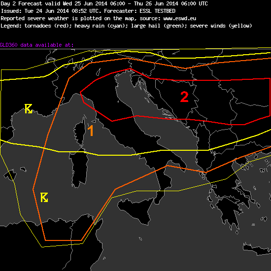
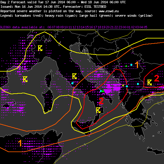
A level 1 and level 2 was issued for northern Italy and northern Balcans for heavy precipitations and to lesser extent for large hail and severe wind gusts.

A level 1 and level 2 was issued for central Italy and southern Balcans for large hail and severe wind gusts.

SYNOPSIS:

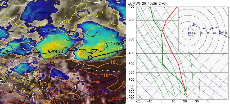
Strong SW flow at 500 hPa. Hot and dry air from Sahara is advected over the southern part of our domain. Frontal boundary stretches from western Mediterranean across northern Italy into northern Balkan states. Rich low-level moisture is present near this frontal boundary and enables mod CAPE (500 to 1500 J/kg) over a wide area. Deep-layer shear will be very strong (25 to 40 m/s) in the belt from Tunisia across much of Italy and the Balkans. Large scale lift is available ahead of a short wave trough which moves in from the west.

Widespread storms are expected to form in the noon and afternoon hours over level 2 area and to move eastward. Overnight the arriving trough can also initiate scattered storms over central Mediterrean region, where a strong capping inversion is still in place during daytime.

Storms can organize very well, including supercells and large clusters. Large hail and severe wind gusts are the dominant risk over the southern half of level 1 and 2 area, where more discrete stroms are expected. Due to high low level shear (up to 15 m/s) also a few tornados may occur, especially in the Balkans area.

The highest coverage of storm is predicted further North, where heavy precipitation is the primary risk.

_______________________

Our readers: any comments? 🙂


Share

Last week!

Today we started new week with new participants from Lithuania, Poland, Germany, Austria, Croatia, USA and Netherlands. This week ESSL team is supported by Pieter Groenemeijer, Alois Holzer, Thilo Kuhne, Mateusz Taszarek, Georg Pistotnik, Helge Tuschy and Magdalena Pichler. John Hart from Storm Prediction Center (USA) is our expert guest.

part

Monday’s presentation about flash flooding threat was conducted by ESTOFEX forecaster Helge Tuschy. Helge shown that different convective setups can be responsible for excessive precipitation and forecasters should be able to apply various approaches in their forecasting.

Helge

Share

Tornado day

We started our day from the verification of very interesting yesterday’s severe weather events over Sofia domain (Turkey, Balkan and Italian Peninsula). In total 6 tornadoes, numerous heavy rain and large hail cases have been reported so far. Most serious event associated with excessive precipitation occurred over eastern parts of Bulgaria where 11 people were killed by flash flooding.

reports

19.06.2014 ESWD reports (state for 20.06.2014 0800UTC)

Our participants focused on this domain in yesterday’s nowcasting, previous day1 and day2 forecasts as well as in long term forecasting few days ago. Let’s take a quick look at verification of the most precise forecasts and nowcasts:

Day 3 forecast: 1


Day 2 forecast:
1c

A level 2 was issued for eastern Romania and eastern Bulgaria for extreme rainfall and to a lesser extent for severe wind gusts and hail.

A level 2 was issued for western and northern Turkey for large hail, severe wind gusts, tornadoes and to a lesser extent for heavy rainfall.

A level 1 was issued across a large section of the Balkan peninsula for heavy rainfall and large hail.

Day 1 forecast:
1b

A level 2 was issued for the Northern Aegean Sea, Northeast Greece, Southern Bulgaria and extreme Northern Turkey for heavy rain, frequent CG lightning, and the possibility of large hail and strong wind gusts. A waterspout cannot be ruled out, especially over the North Aegean Sea.

A level 1 was issued for the most of the Balkans and Southern Italy. Associated hazards in this region include heavy rain and lightning. In southern Italy, low LCL heights coupled with strong deep layer shear could promote an enhanced hail threat for the area in the afternoon and early evening hours.

Nowcasts:
1d 1e 1f

This somehow proves that with the use of products available for parcitipants during the Testbed, it was possible to estimate severe weather threat even on the day3 forecast. Day 1 and 2 forecasts as well as nowcasts also issued tornado threat on quite distinctive area of NW Turkey.

Congratulations to our participants for good forecasts!

Share

Verification and overshooting top detection algorithm

This week severe weather is likely to occur mainly in Italy and Balkan Peninsula. As usually, we began our day with Pieter’s verification of previous day1 and day2 forecasts. Quick look on them below:

Alois2 Alois3

In the afternoon, forecasts and nowcasts for Balkan Peninsula were presented by Meda Daniela Andrei from RNMA (Romania):
E1

It is also worth to say few thoughts about overshooting top detection algorithm which is used by participants during ESSL Testbed. When thunderstorm’s updraft reaches equilibrium level (EL), usually its spreads horizontally and creates characteristic anvil. However, if the updraft is sufficiently strong it penetrates the EL and forms a convex feature so called overshooting top (OT). Since the satellite is able to measure cloud tops temperature, it can detect the OT by evaluating the temperature difference between the anvil and the penetrating updraft. Why is it useful in operational nowcasting? In general, it denotes places where the thunderstorm’s updraft core is located. Examples of OT detections during Testbed’s nowcast are shown below (squares with temperature difference values):

ex3

09.06.2014 1925 UTC Meteosat IR-108BT image + overshooting top detection algorithm. Detections denote quite well places with intense updrafts.

ex2

16.09.2014 1300 UTC (top) and 1430 UTC (bottom) Meteosat IR-108BT image + overshooting top detection algorithm. Detection of 14 C denotes a strong updraft of a developing thunderstorm. In the next 90 minutes thunderstorm became intense.

Share

Stormchasing presentation

As in previous post we mentioned about lvl 3 issued by TEAM A, we received reports of excessive precipitation and weak tornado that occured near Albanian coast. However placement of this threat was very good, we think that it should deserved lvl 2. Overall, it was good forecast, congratulations to our participants! essl testbed

In the evening we had an unexpected very intersting presentation from our participant Dean Gill about stormchasing in Europe. Dean shown us videos and pictures from his stormchasing adventures. We saw supercells, hailstorms, waterspouts and numerous beautiful pictures with lightnings, it was really impressive.

prez_burze


Share

Is the level 3 for Albania too much?

Day 1 forecast of the team in the green room

Day 1 forecast of the team in the green room

The situation in the central Mediterranean Sea is quite exceptional for the season. And especially ECMWF was very aggressive in its 0-1 km shear forecast, with more than 15 m/s in a stretch along the coast of Montenegro and Albania. 0-6 km bulk shear reaches 30 m/s in some places in the 00 UTC ECMWF forecast, resulting in this map. Forecasters in the green room discussed if they should stay with level 2 or go for the 3, and finally decided to take the upper, because of the impressive overlay of all ingredients for tornadic supercells in this region overnight. We will see if nature will evolve this solution or another.


Share

The person behind this blog

Mateusz Taszarek, a PhD student from Poland, this year took the opportunity of an internship at the ESSL Testbed. And one of his tasks is to take care of this blog. So most of the posts here were written by Mateuz. Thank you for that! Alois

ESSL Testbed Blogger 2014: Mateusz Taszarek

ESSL Testbed Blogger 2014: Mateusz Taszarek (looking into the camera and discussing with Thilo Kühne)

Share

Week no. 3

This week participants from Germany, USA, Austria, Switzerland, Poland, Netherlands, Romania, Estonia are taking part in ESSL Testbed.

B2

The expert lecture of the day about frontogenesis was presented by Prof. David Schultz from the University of Manchester. This week, also the ESWD quality control manager of ESSL, Thilo Kühne, joins the Testbed as well as Dr. Kathrin Riemann-Campe, ESSL Deputy Director.

B1


Share