
Our joint Thursday dinner and the subsequent whiskey tasting in a Scottish pub prevent a longer post today, but at least an outline of an eagerly awaited change and some satellite snapshot of particularly beautiful storms should be presented.
An upper-level low was moving southeastward today over Poland and provided pronounced large-scale lift for the downstream areas of E Slovakia, E Hungary, the W Ukraine and NW Romania (Fig. 1). Near the surface, it was accompanied by a cold front which took over the role of the main trigger for thunderstorm development. Along the front, converging winds resulted in a belt of enhanced low-level moisture, which at least partly overlapped with moderately steep lapse rates aloft (Fig. 2). The rear area of the resulting belt of 500 to 1200 J/kg CAPE was overspread by increasing deep-layer shear between 15 and 20 m/s (Fig. 3). Finally!
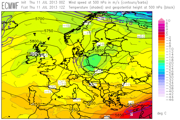
Fig. 1: ECMWF forecast of 500 hPa geopotential (black contour lines), temperature (colour shading) and wind (barbs) at 12 UTC Thu 11 July 2013.
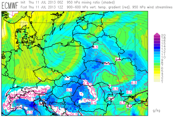
Fig. 2: ECMWF forecast of low-level moisture (colour shading) and mid-level lapse rates (red contour lines, plotted above 6.5 K/km) at 12 UTC Thu 11 July 2013.
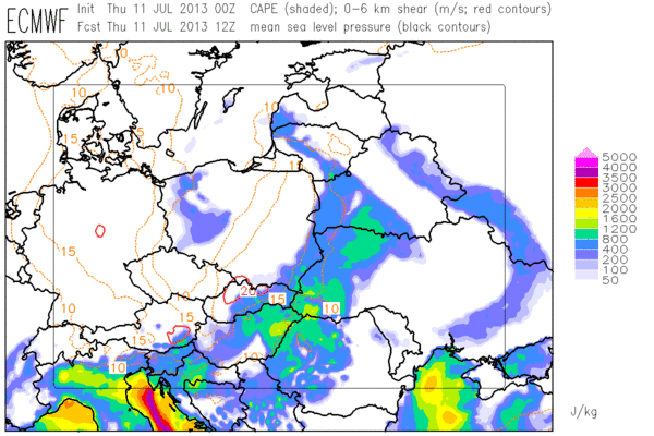
Fig. 3: ECMWF forecast of CAPE (colour shading) and 0-6 km vertical wind shear (contour lines) at 12 UTC Thu 11 July 2013.
A verification of today’s forecasts and nowcasts will be left for tomorrow, but for starters it can already be mentioned that the expected well-organized storms formed over the area of interest. In other parts of Europe, conditions still remained the same: A stationary high pressure area over the British Isles and weak geopotential gradient with daytime thunderstorms over the mountains of Spain, S France and Italy.
A few satellite images of particularly beautiful thunderstorms are presented below. Fig. 4 shows the well-organized thunderstorms over Eastern Europe at 1315 UTC. Of particular interest is the big storm over the Slovak/Hungarian border which dropped 3 cm sized hail in Trebišov (Slovakia) at that time; its flanking line extends well into the Hungarian plain.
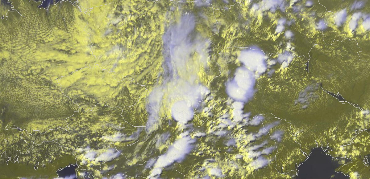
Fig. 4: Meteosat E-View satellite image at 1315 UTC Thu 11 July 2013.
As the tail of the cold front crossed the Alpine chain in the afternoon and evening, severe thunderstorms were also triggered over Slovenia, Croatia and N Italy. Fig. 5 shows a particularly strong and right-moving sunset storm, possibly a supercell, over Friuli (Italy) as it headed towards the Adriatic coast. About 20 minutes later, it dropped a hail layer onto Caorle, where holiday makers could mix their evening cocktails with natural ice.
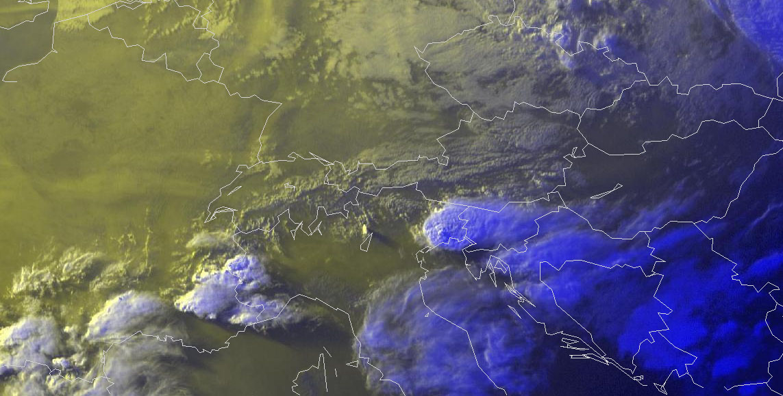
Fig. 5: Meteosat E-View satellite image at 1825 UTC Thu 11 July 2013.
Last but not least, Fig. 6 shows some of the healthy looking storms which are forming over Spain each day in an environment of locally very high CAPE and 10 to 15 m/s deep-layer shear. Today they backbuilded so strongly towards the West that they almost encountered the sea fog over the adjacent Atlantic Ocean.
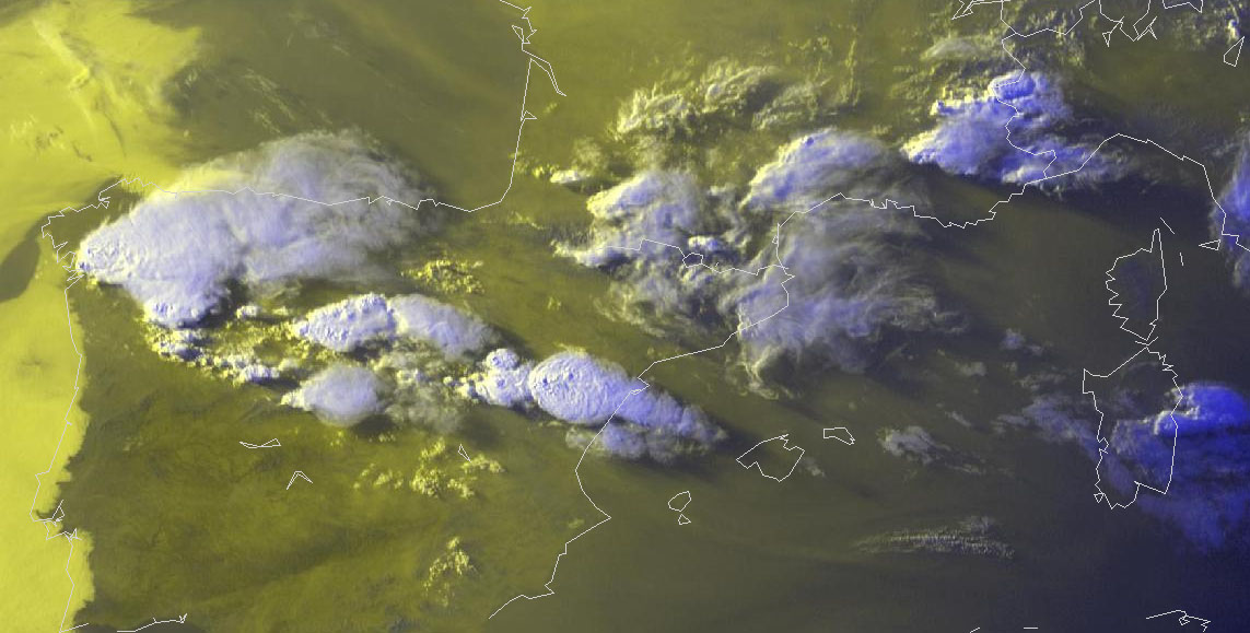
Fig. 6: Meteosat E-View satellite image at 1835 UTC Thu 11 July 2013.
The 12 UTC Lissabon sounding in Fig. 7 illustrates the special stratification along the coastal areas of the Iberian Peninsula. A thin cool and moist layer is in place over the sea surfaces, capped by the hot and dry inland air as it gets advected over the open sea. Of course these low levels are way too cool to allow any deep convection, but once they get picked up by upslope flow and get exposed to some hours (or days) of strong insolation, “loaded gun” type situations are created with explosive thunderstorm formation once the cap is broken.
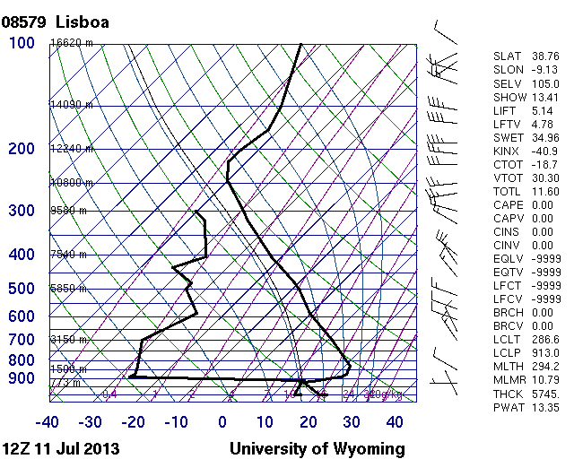
Fig. 7: 12 UTC Thu 11 July 2013 sounding from Lissabon (PT).
And what’s the weather doing on site? Last night, the Eastern European cold front also passed Wiener Neustadt and brought some non-organized thunderstorms in the vicinity. Those who stayed up long enough reported a very nice lightning show. Today it cleared up again with a few degrees lower temperatures. In the medium range, it seems like the quiet summer weather will still continue in the Alpine region.
Today after lunch we got visited by Christian Vergeiner, who is doing electrical field measurements of lightning for the Austrian Lightning Detection and Indicating System (ALDIS) and Graz University of Technology. He did not only add his input in our lightning-related discussions, but also deployed a part of his instruments on our parking lot and demonstrated their functionality by artificially triggering them with a camera flash. As an example, Fig. 8 shows the field antenna and his self-built unit which converts the electromagnetic signal into an optical signal.
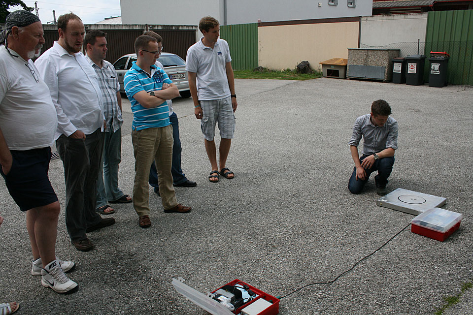
Fig. 8: A brief diversion from today’s intense nowcasting activities. (Alois’ pic)
