
As promised, we would like to bring you an overview of the major convective windstorms in Europe last year.
The first event we are going to cover is the case of 29 May 2017 in Russia. This event did not feature one of the longest-lived convective windstorms of that year in Europe, nor did it involve the highest measured wind gusts (which reached up to 30 m/s). Yet, its societal impact was the largest of all the cases. As the windstorm hit the metropolitan area of Moscow, it resulted in 18 fatalities and 168 injuries (economic loss estimated at 25 million rubles). The first reports of wind damage came in from 11:15 UTC. Between 12 and 13 UTC, the convective system reached its maturity as it passed over Moscow and it decayed shortly after 14 UTC (Fig. 1).
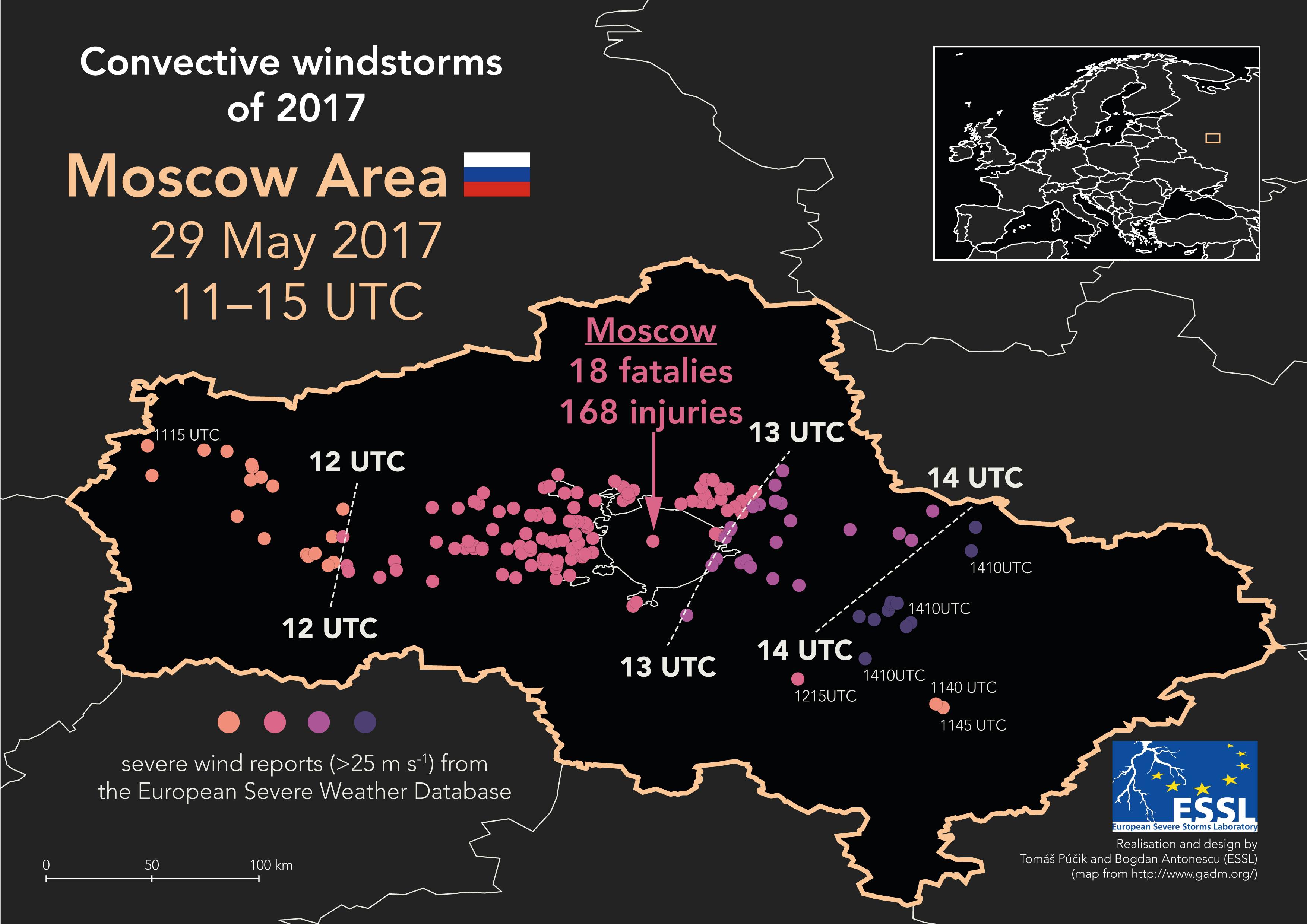
Fig 1. Chronological progression of severe wind reports in a convective windstorm of 29 May 2017 in the Moscow area.
Radar imagery shows that at 12:30, a linearly oriented convective system was moving into the Moscow area. The convective system was not particularly large, without very high reflectivity values and did not show a classic “bow-echo” structure, which would typically be associated with damaging wind gusts (Fig. 2). The apparent lack of strong updrafts was also confirmed by virtually no lightning activity in the southern part of the system (Fig. 3).
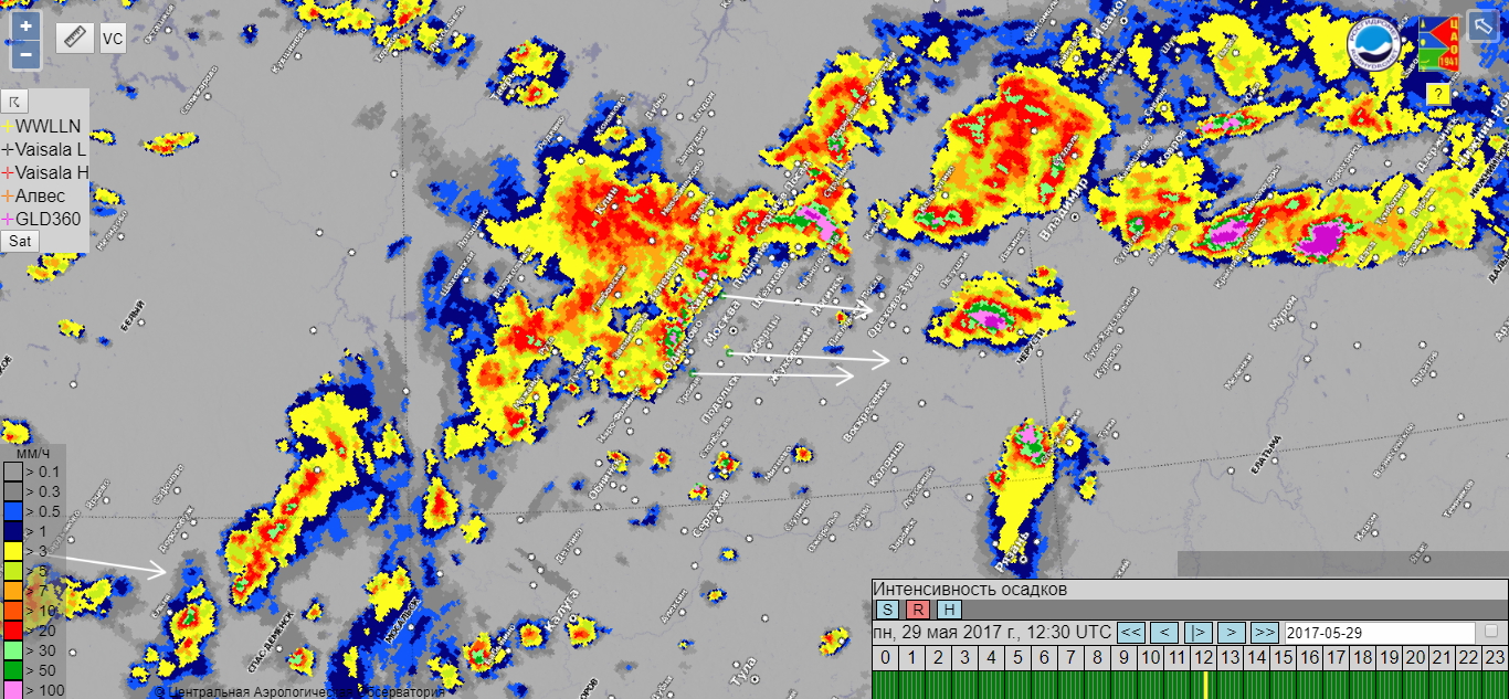
Fig 2. Precipitation intensity (mm/h) s in Moscow region for 12:30 UTC 29.05.2017 (data from Web-GIS ‘Meteorad’ of the Central aerological observatory based on Roshydromet radar network). Arrow points to the direction of the storm movement.
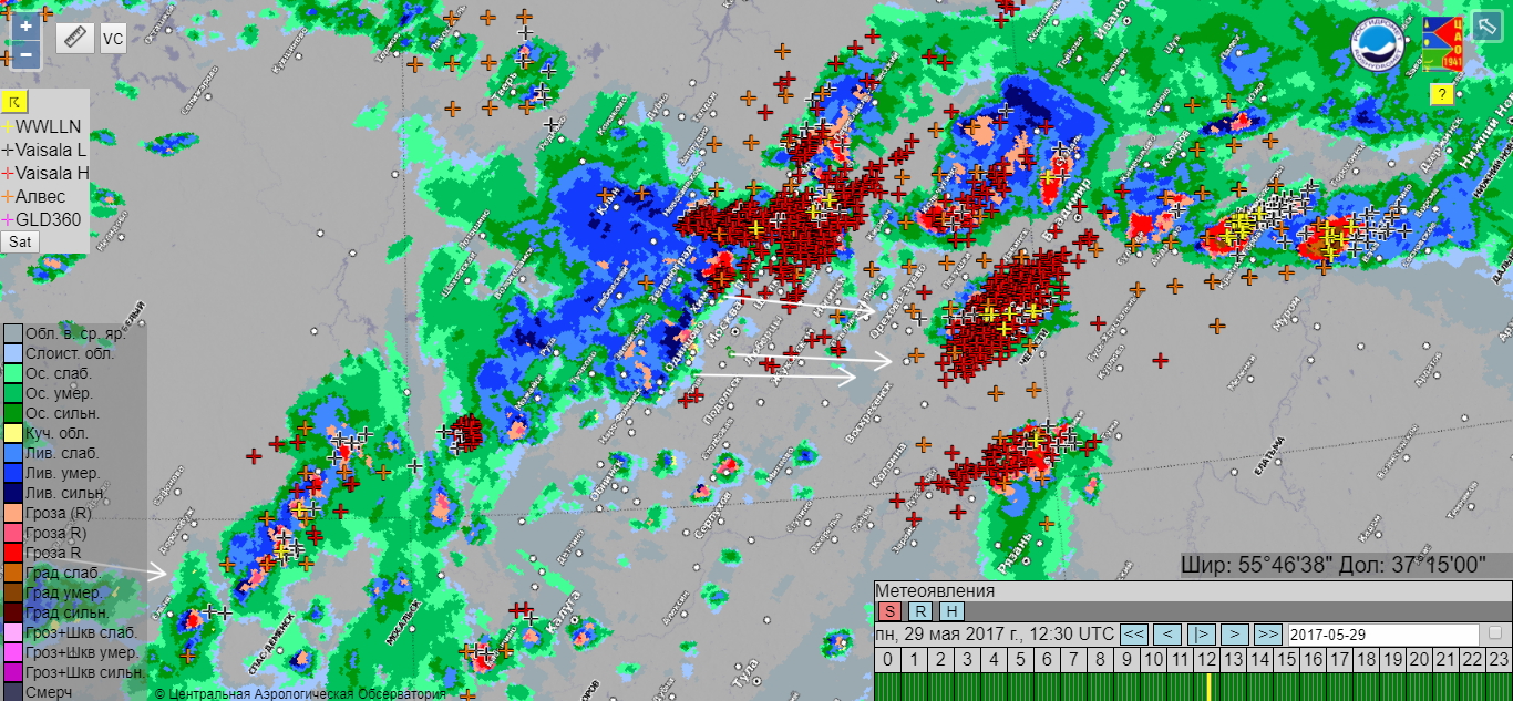
Fig. 3 Combined information on weather phenomena (based on Roshydromet radar network) and lighting detection networks (WWLN, ALVES, Vaisala LS-8000) in Moscow region for 12:30 UTC 29.05.2017 (data from Web-GIS ‘Meteorad’ of the Central aerological observatory). Arrow points to the direction of the storm movement.
The reason for this untypical behaviour were the background environmental conditions. The convective storm formed ahead of an advancing mid-tropospheric trough (Fig. 4 left). Buoyancy was rather low with CAPE values around 400 J/kg according to the Era-Interim. At the same time, vertical wind shear was moderate, with 0-6 km bulk shear values around 15 m/s (Fig. 4 right). Overall, the environment did not seem to be too favourable for an extremely severe convective event, which would be typically anticipated in high CAPE and high shear regime. However, a combination of very strong flow in the lower troposphere and a dry boundary layer (Fig. 5) created favourable conditions for powerful downdrafts transporting high momentum air down from above.
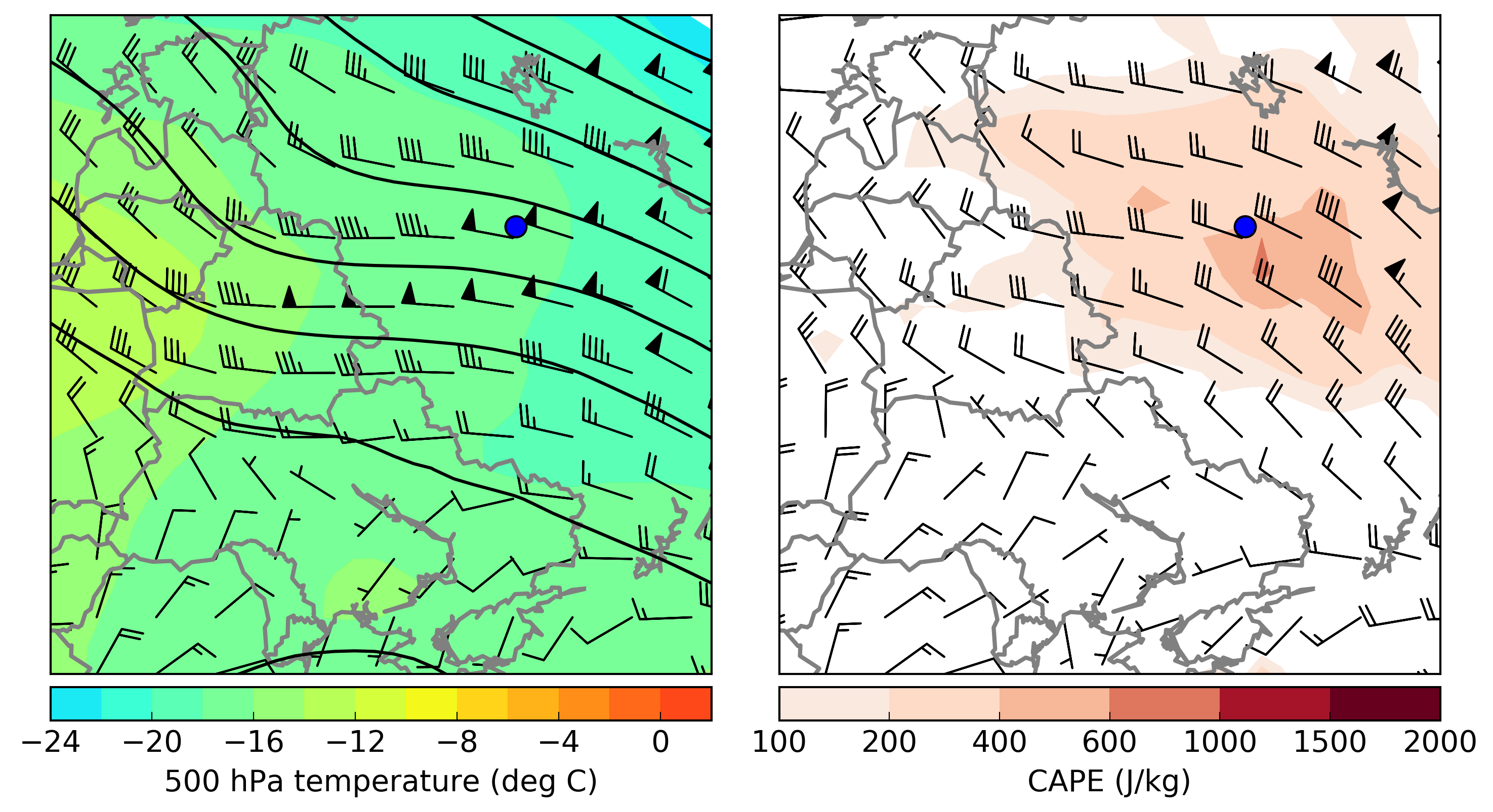
Fig. 4 (Left) 500 hPa geopotential height (black contours), temperature (colour scale) and wind barbs, (Right) CAPE (colour scale) and 0 – 6 km bulk vertical wind shear (wind barbs) for 29 May 2017 12 UTC according to ERA-Interim reanalysis. Blue dot represents location of Moscow.
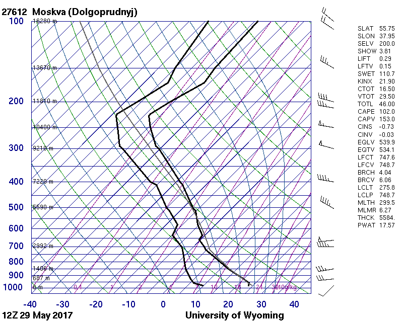
Fig. 5 Moscow Dolgoprudnyj 12 UTC sounding. Courtesy of University of Wyoming.
The convective system weakened soon after leaving the Moscow area, probably suffering from the lack of ideal environmental conditions. Nevertheless, this case illustrates that high-impact convective windstorms are possible in a wide variety of conditions.
ESSL would like to thank Alexander Chernolusky from the A. M. Obukhov Institute of Atmospheric Physics for his contribution to this case study.
