ESSL Testbed 2018 started

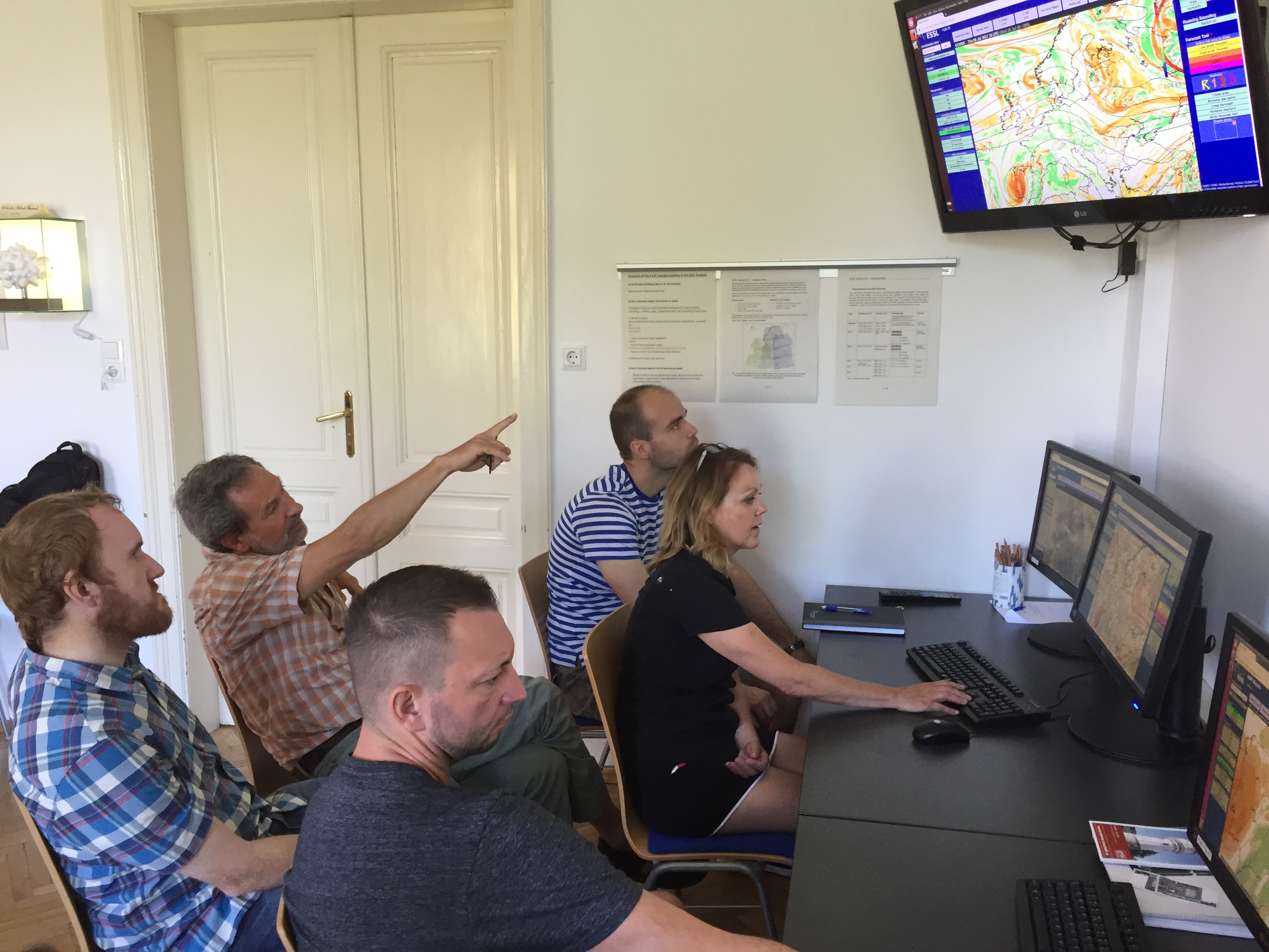
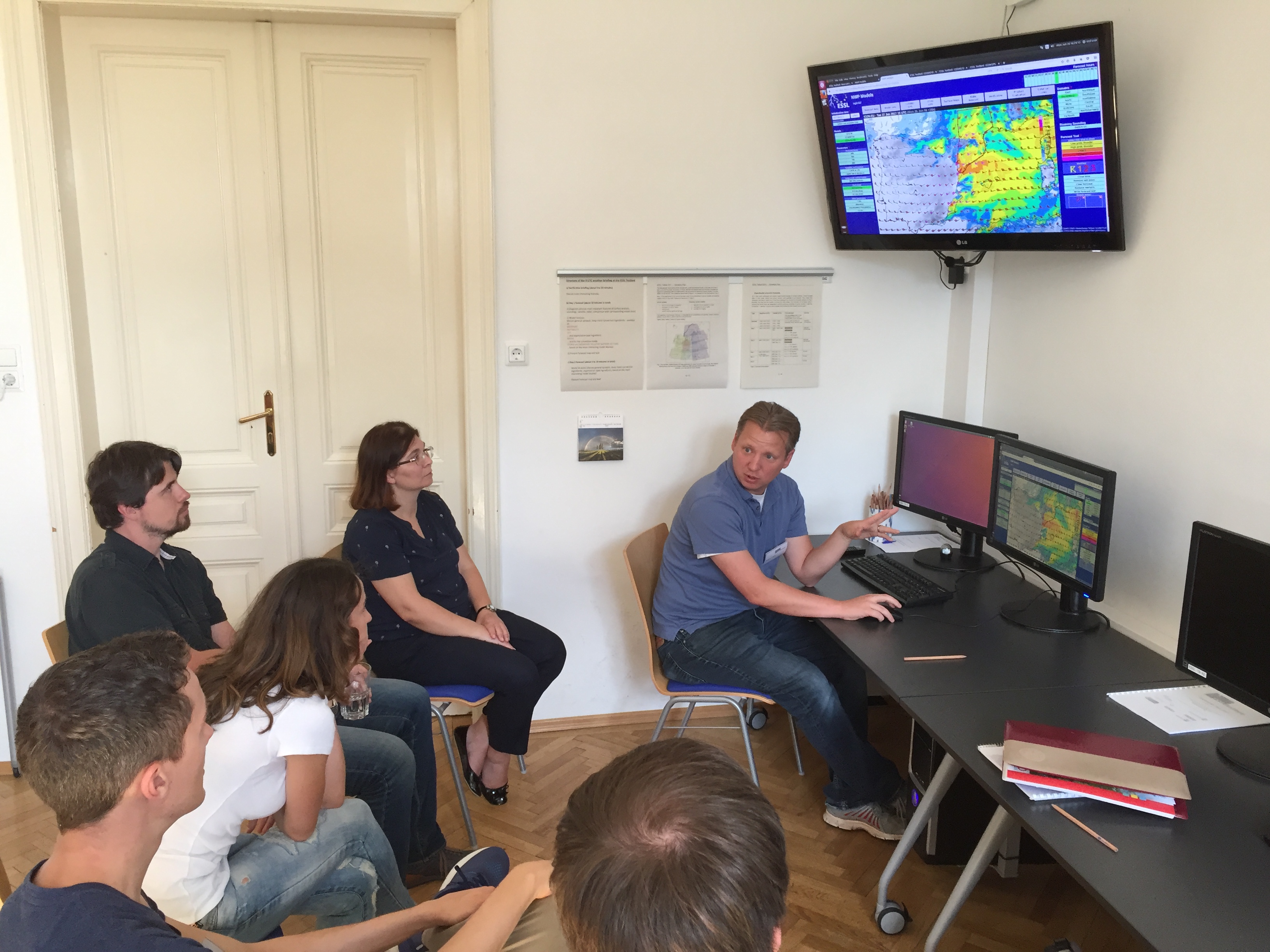
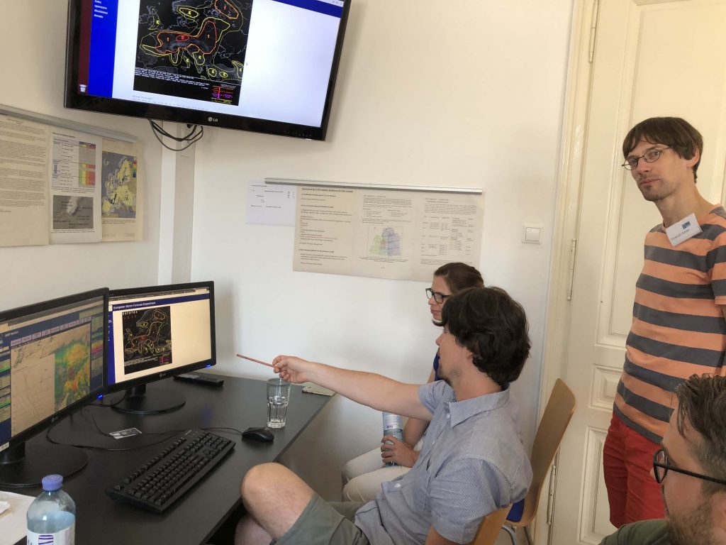
Testbed activities started today with participants being introduced to the different new products. This year new:

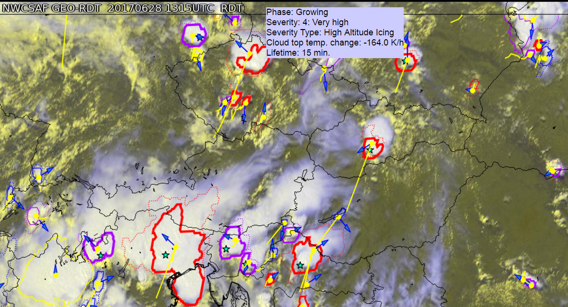
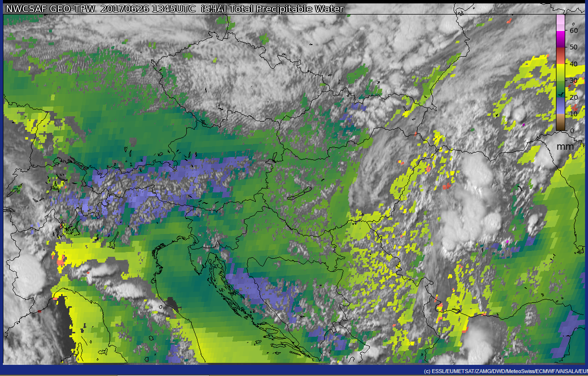
  1. Focus on two EUMETSAT NWC-SAF products: Difference fields of low-/ and mid-level precipitable water retrievals and Cloud Top Height product
  2. NowCastSAT-Aviation from DWD
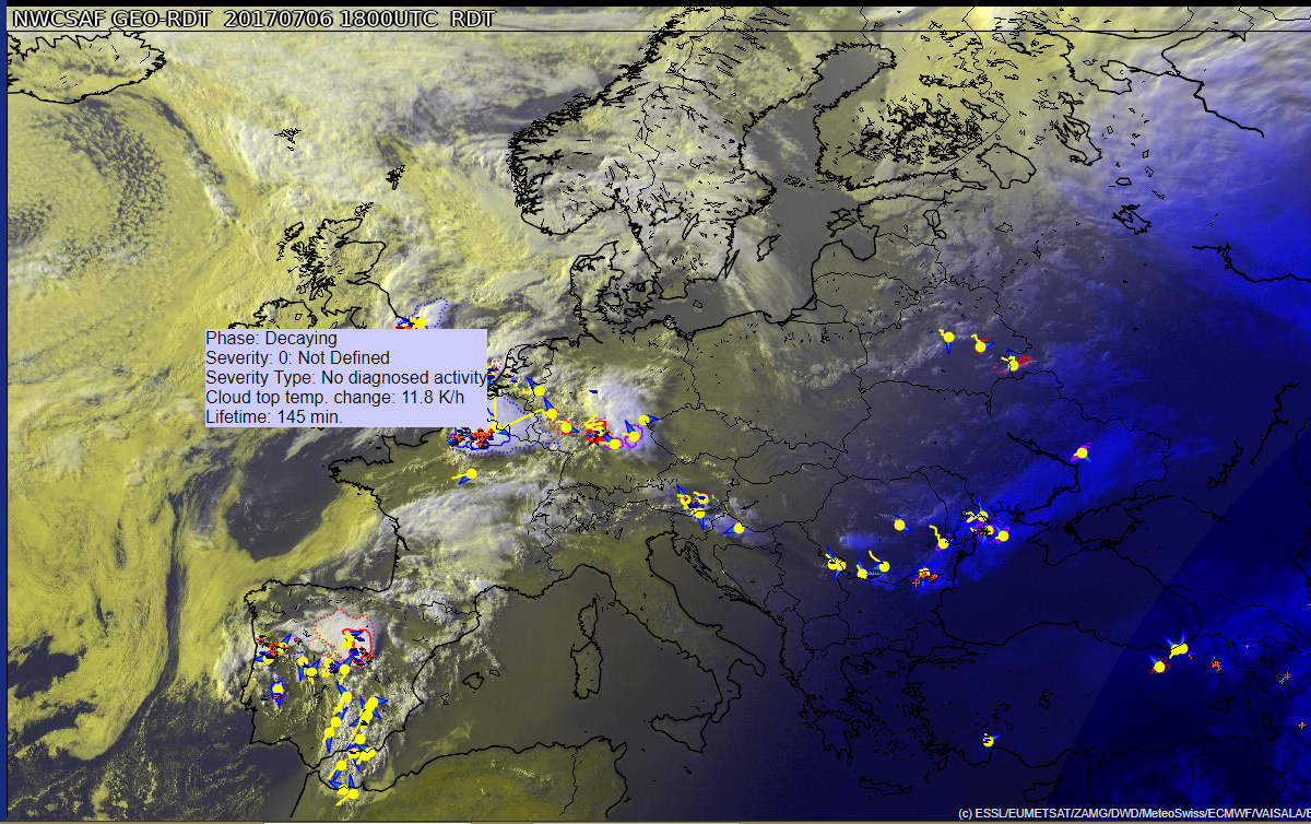
  3. NowcastMIX – Tracks from DWD
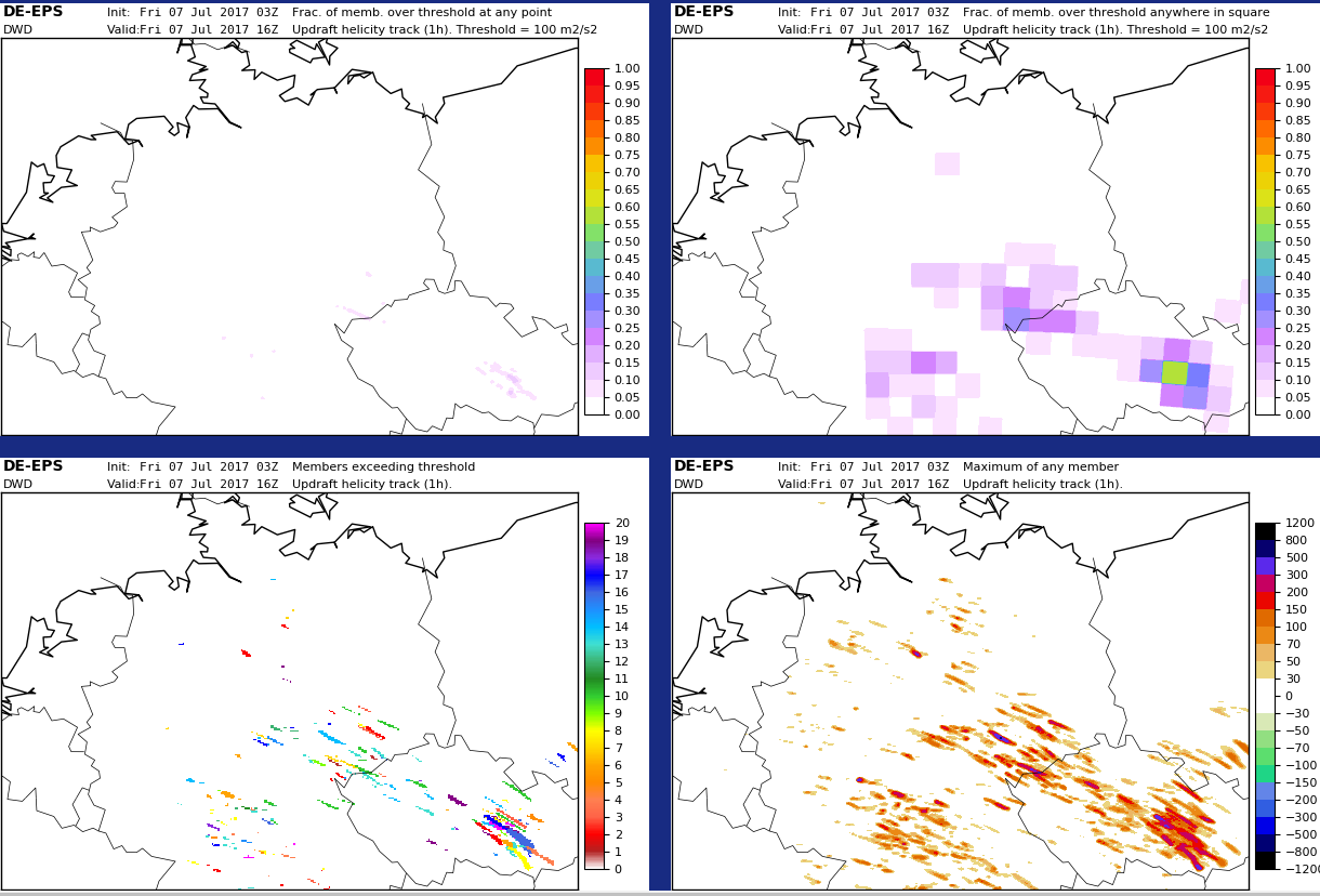
  4. New configurations of convection permitting model systems: COSMO-D2 and COSMO-D2-EPS

Persons interested in our Tue-Fri 9 UTC weather briefings are invited to follow us via BlueJeans:

https://bluejeans.com/720241930


Share

Last day of participant activities

Today the participant phase of the ESSL Testbed 2017 comes to an end. The upcoming months will be dominated by the reporting phase. And soon we will start to prepare the 2018 edition. Dates are already fixed: 11 June to 13 July 2018.

We thank all partners and participants of the ESSL Testbed 2017. Weather was quite interesting this year. And we are very much looking forward to continued and new collaborations for the coming years.

Here two product examples of this year:


Image: EUMETSAT NWCSAF RDT product overlay of yesterday 18 UTC with highlighted cell near Paris (mouse-over cell properties).


Image: DWD COSMO-DE EPS updraft helicity tracks for today 16 UTC: some regions show high signals.

Share

Spain in the focus today

A rare mid-summer cut-off low over the Iberian Peninsula makes it interesting to forecast for Spain (Southwest Domain at the ESSL Testbed) with participants discussing NWC SAF products …

… and NWP outputs in the other room for the day 2 forecast:

Also over the eastern Alps substantial shear can lead to some well-organized storms near the Testbed site. A mobile nowcast team would form during the afternoon, if storms would initiate close enough.

Share

Heavy rain predicted by ICON EPS over NE Germany

ICON EPS shows elevated probabilities for excessive rainfall over parts of eastern/northeastern Germany in a 12 hour timeframe from 06 to 18 UTC today (see image). Already yesterday’s ICON EPS highlighted this area for a heavy rain threat. The maximum of the ENS members today even show 12 h accumulations of more than 120 mm in two small areas, which is extreme:

icon eps rr12

Partly based on this the day 1 forecasting team highlighted the area for a risk of heavy rainfall, while the large level 2 area over eastern Europe is mainly for severe thunderstorms with large to very large hail, severe gusts and maybe a few tornadoes:

showforecast

Share

NWCSAF RDT

The NWCSAF product “Rapid Developing Thunderstorms – RDT” demonstrates that it indeed is good in highlighting properties of relatively young but rapidly intensifying storms (see red bordered areas in northern half of screenshot). rdt

Based on their nature it is much more difficult to tackle large mesoscale convective complexes, as can be seen in the southern half of the screenshot. There the detection of the most active area of MCSs or MCCs is challenging.


Share