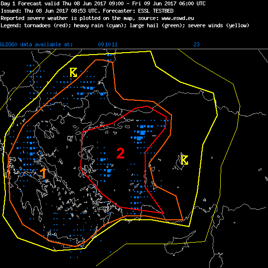
Today’s forecasting team for day 1 found a significant threat for severe weather over western Turkey in the coming hours: level 2 there.

Here is what their experimental Testbed forecast says:
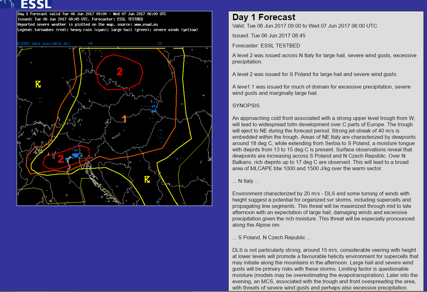
Valid: Thu 08 Jun 2017 09:00 to Fri 09 Jun 2017 06:00 UTC
Issued: Thu 08 Jun 2017 08:53
Forecaster: ESSL TESTBED
A level 2 was issued across W Turkey mainly for large hail and to lesser extend isolated tornadoes, severe wind gusts and extreme rainfall.
A level 1 was issued across Bulgaria, Greece and soroundings for large hail and extreme rainfall.
DISCUSSION
Turkey
Approaching trough from the Mediterranean push a strong southwesterly mid level jet into W-Turkey. Large scale lift/height falls expected. Broad overlap of a steep lapse rate and low level moisture as indicated by the latest observations will create a favorable environment for initiation in the afternoon hours. First storms are expected over the mountains. Strong deep layer sheer and favorably veering profiles supports supercells (deep layer sheer ~ 20 m/s or more). First stroms are capable of producing very large hail (5 cm), later on highest storm coverage poses of threat of large hail and locally excessive precipitation and severe windgusts. In the evening increasing low level sheer can be sufficient for a few tornadoes as well.
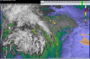
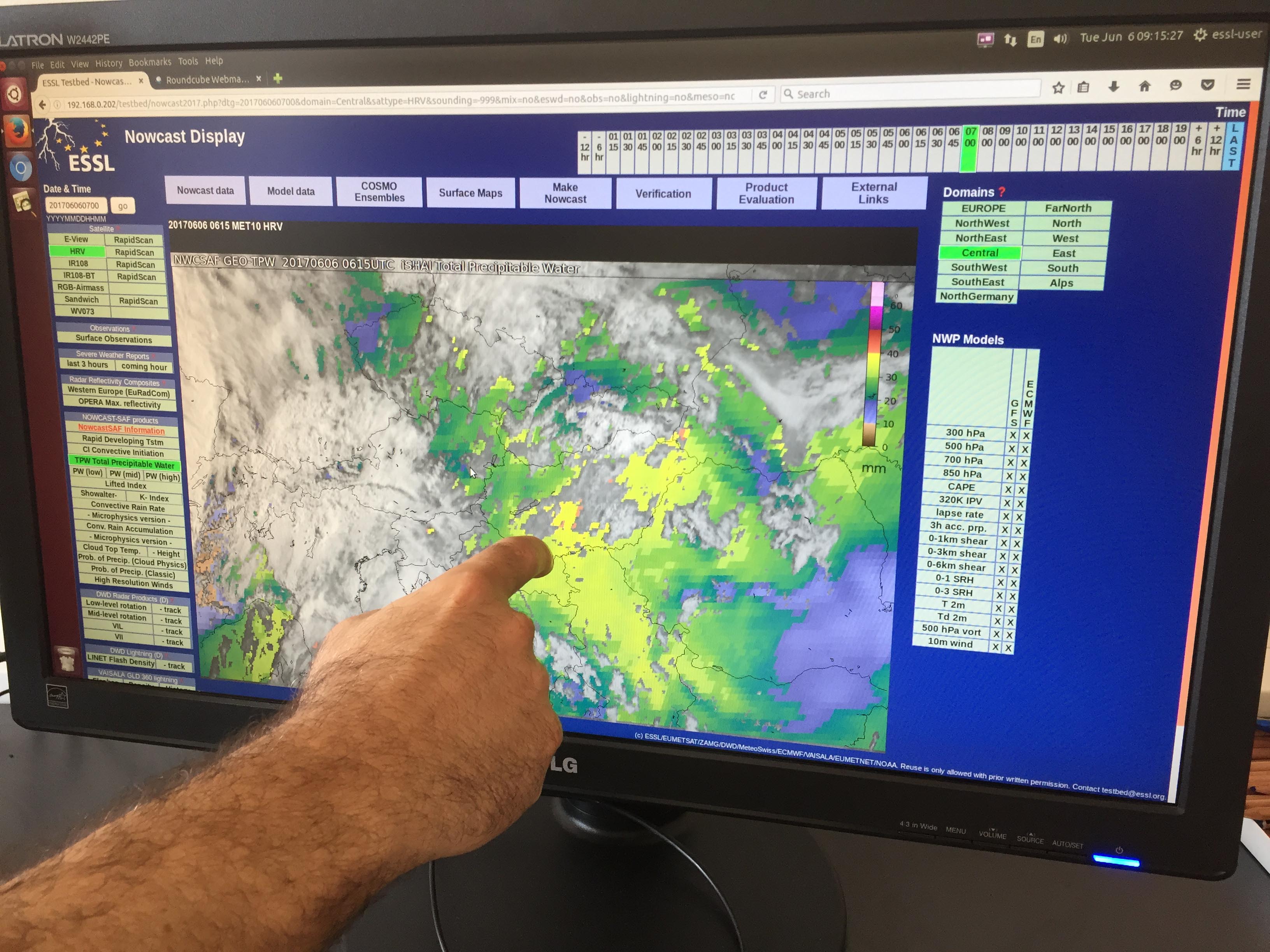
Image: Interesting EUMETSAT NWCSAF product for today. Discussion showed that there is substantial moisture available not only in the typical very thin mediterranean coastal layer, but also inland over western Turkey with ongoing advection from the south (green to yellow to orange colours in the precipitable water product).
You can also follow our updates on Facebook and Twitter – also via our Twitter newsfeed on the ESSL homepage.

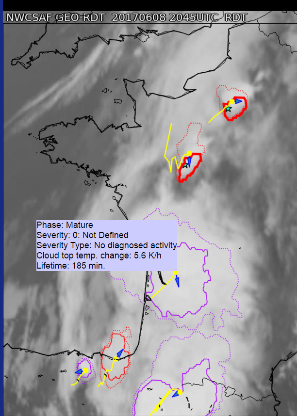 RDT product screenshot: growing cells with red borders, mature cells with magenta. Mouse-over function provides a selection of additional cell properties.