
More and more routine can be felt with the activities on the third day of the Testbed. Neither the huge amount of available data nor the equally huge Schnitzels at the nearby lunch restaurant are as intimidating any more as they were on the first day.
Since the weather pattern for the next days does not look too promising (hardly any dynamics across the continent will only allow for weakly organized thunderstorms), the nowcasting was today’s most interesting part. As already outlined in yesterday’s post, a weak cold front was entering the Munich domain from the West and provided a trigger mechanism for convection. However, the belt of forecast CAPE along the cold front was quite narrow, as the area with the steepest lapse rates which had brought us yesterday’s vivid storms was forecasted to depart to the East ahead of the best low-level moisture (Fig. 1). It was hence expected that thunderstorm activity would mostly be tied to the front line over parts of Poland, the Czech Republic, E Germany and Austria. A level 1 risk was issued for these areas in the day 1 forecast (confirming the previous day’s day 2 forecast) mainly for a heavy rain risk due to a slow and almost front-parallel storm motion, and secondarily for large hail with more isolated, prefrontal storms which could still benefit from the steeper lapse rates and less competition.
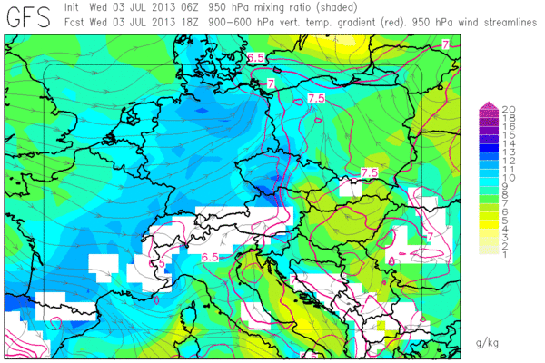
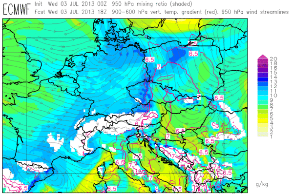
Fig. 1: GFS (top) and ECMWF forecasts of low-level moisture (colour shades) and mid-level lapse rates (red contour lines, plotted above 6.5 K/km) for 18 UTC Wed 3 Jul 2013.
This forecast implied that the behaviour of the low-level moisture and wind field had to be closely monitored throughout the day. Fig. 2 shows the situation at 1355 UTC, which was the latest data available for the 14 UTC nowcast (valid 14 to 16 UTC).
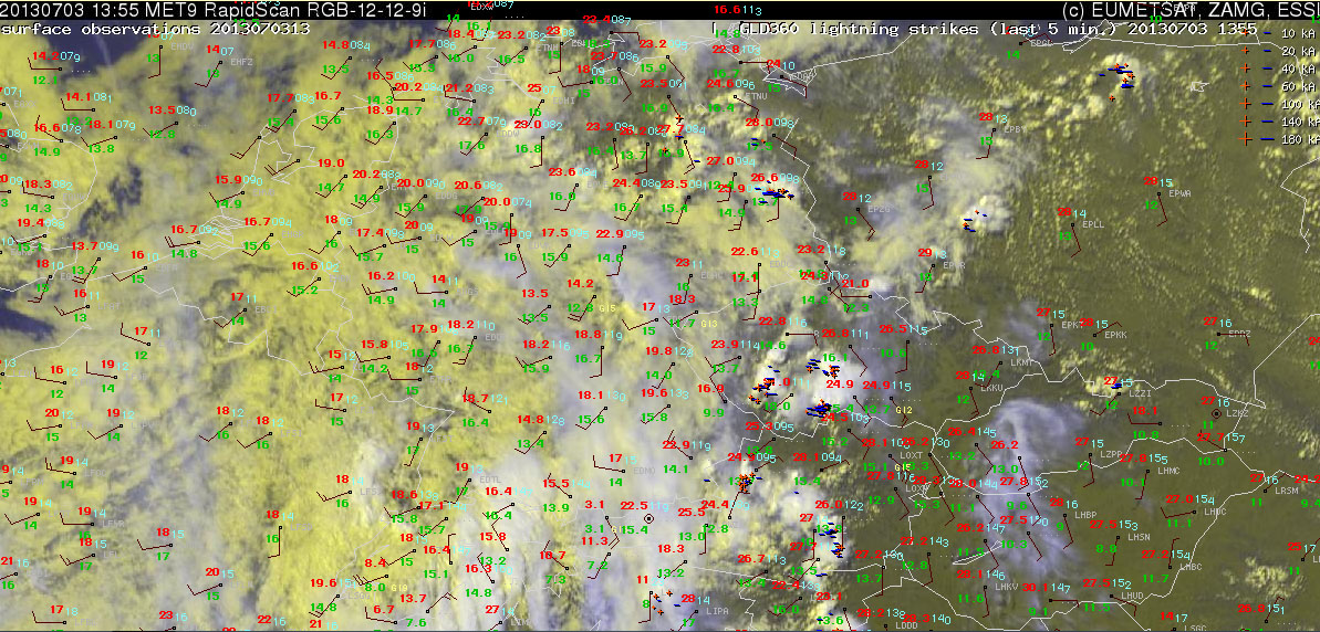
Fig. 2: Nowcast display at 1355 UTC Wed 2 July 2013: Meteosat E-View satellite image, latest SYNOP reports (13 UTC) and lightning detections within the last 5 minutes.
It was decided to cover the already existing Czech storms (plus expected further initiations) with a watch area for a heavy rain risk. A last moment hail watch was added for the forming storms over SW Poland, after the 12 UTC Wroclaw sounding had arrived just in time. This sounding showed 800 J/kg CAPE with a surface temperature of 28°C and a surface dew point of 14°C (Fig. 3), while measured dew points up to 18°C in the near surroundings suggested even higher CAPE values.
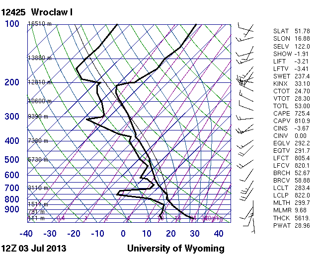
Fig. 3: 12 UTC Wed 3 July 2013 sounding from Wroclaw (PL).
Given the forecasted lack of too interesting weather, a closer look at the successive verification of day 3, day 2, day 1 forecasts and nowcasts will likely be given in tomorrow’s weather summary for today’s case. Teaser: a few severe weather reports have already arrived for the areas of interest.
