
The 4th and last Testbed week 2013 has begun, and 13 new participants from Poland, the Czech Republic, Germany, Austria, Portugal, Finland, the USA and Hongkong (!) have arrived. Furthermore, also the usual ESSL team is complemented by Kathrin (our Deputy Director) and by Thilo (our ESWD Quality Control Manager), which means that the activity in our building is more bustling than ever before.
The weather seems to join in and there are convincing signs that it may approach top form by the end of the week. Fig. 1 presents the ECMWF 500 hPa forecasts in 24-hour time steps for today till Friday (26 July 2013) this week.
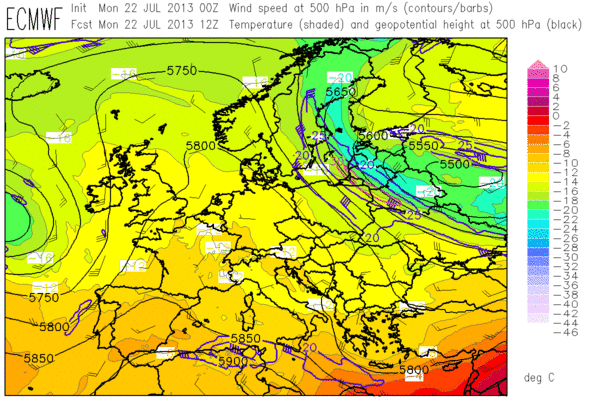
Fig. 1a: ECMWF forecast of 500 hPa geopotential (black contour lines), temperature (color shades) and wind (barbs) for 12 UTC Mon 22 July 2013.
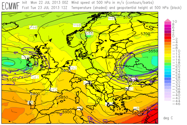
Fig. 1b: As in Fig. 1a, but for 12 UTC Tue 23 July 2013.
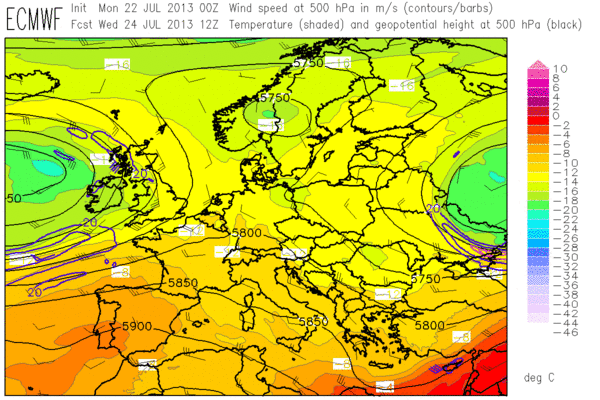
Fig. 1c: As in Fig. 1a, but for 12 UTC Wed 24 July 2013.
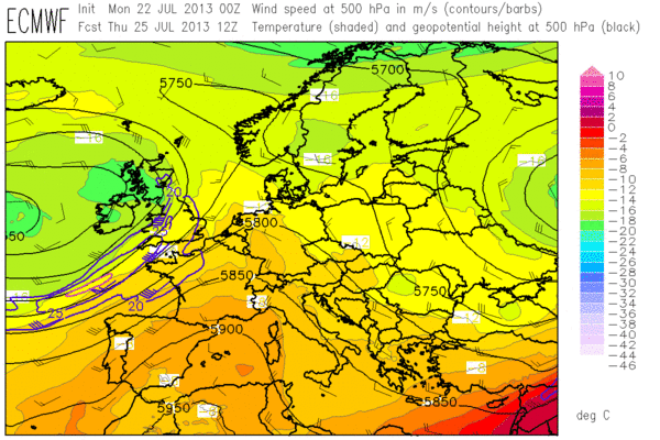
Fig. 1d: As in Fig. 1a, but for 12 UTC Thu 25 July 2013.
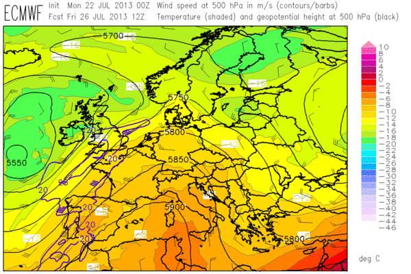
Fig. 1e: As in Fig. 1a, but for 12 UTC Fri 26 July 2013.
The main feature this week is a broad upper-level ridge, which will very slowly move eastward and push an old cut-off low further into Russia. From the Atlantic, a new pronounced upper-level low will gradually come closer to Western Europe. Ahead of it, the Southwesterly flow is forecast to steadily increase during the week and advect hot air from Morocco and Iberia deeply into Central Europe, where temperatures within reach of record-breaking values can be expected by next weekend. Closer to the frontal zone, an extraordinary overlap of CAPE and shear may evolve from Spain via France to the BeNeLux countries and possibly into parts of Germany. This already smells like an outbreak of severe weather!
Until then we have to still lower our sights a little bit, but the week is already starting more exciting than the previous ones. Today’s thunderstorm activity was expected to be centered over two areas, the first one over the Western Alps and the second one in a belt from Western France into England. In the absence of synoptic-scale forcing (apart from the British Isles, which see some support from a first Atlantic trough overnight), the main trigger mechanism is provided on local scales by upvalley/upslope winds and by sea breeze fronts, respectively. The 12 UTC soundings from Payerne (CH), Milano (IT) and Bordeaux (FR) in Fig. 2 exemplarily outline today’s environment in the Western half of Europe: rich low-level moisture and fairly steep lapse rates create locally quite high CAPE with an conquerably small cap, but vertical wind shear is weak to non-existent.
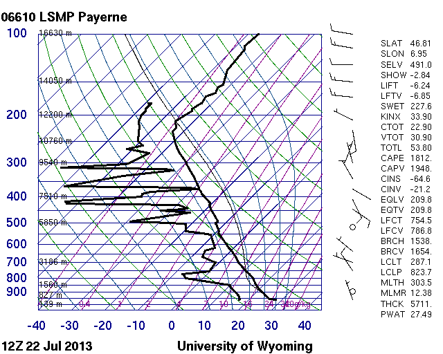
Fig. 2a.
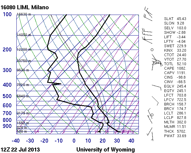
Fig. 2b.
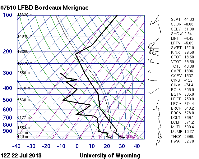
Fig. 2c.
The afternoon turned quite interesting, when a lot of pulse storms formed across France, Belgium, Luxemburg and the Western Alps – in fact more than expected also over hilly or even flat terrain. The rapid scan satellite images revealed that some of the convection was obviously triggered secondarily by outflow boundaries or fast-moving gravity waves, which made it particularly difficult to predict the next instances of convective initiation.

Fig. 3a: Meteosat E-View satellite image at 1330 UTC Mon 22 July 2013.
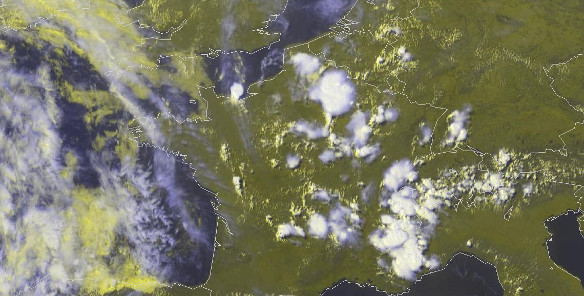
Fig. 3b: Meteosat E-View satellite image at 1430 UTC Mon 22 July 2013.
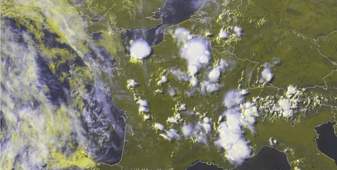
Fig. 3c: Meteosat E-View satellite image at 1530 UTC Mon 22 July 2013.
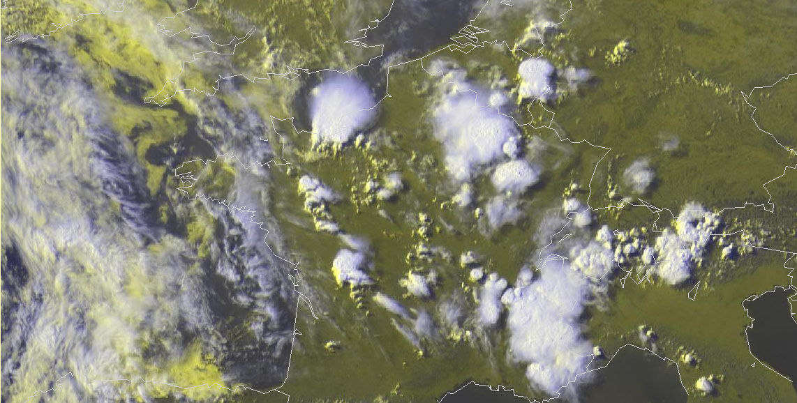
Fig. 3d: Meteosat E-View satellite image at 1630 UTC Mon 22 July 2013.
Since we don’t have anything to verify yet on the first day of a new Testbed week, this posting finally has to turn into some more or less random “image-dropping” again. Fig. 3 shows an hourly sequence of satellite images of the French storms at 1330, 1430, 1530 and 1630 UTC. Enjoy the particularly beautiful initiation of still indecisive storms along the sea breeze front over Western France and an isolated, powerful storm over the French North coast. The latter dumped a cloudburst over Caen, which resulted in a severe flash flood and a few broken trees. This was today’s first severe weather event we learned about, but certainly not the last one. Stay tuned for tomorrow’s verification!
