
Today even two day 1 teams worked parallel on forecasts for the Toulouse domain, where another round of pulse storms over Southern France and the Western Alps and better organized storms over Northern Spain are expected, and for the Helsinki domain, where the beginning southward shift of the main frontal zone finally starts to create a more dynamic situation (Fig. 1). These two day 1 forecast are presented below. Enjoy!
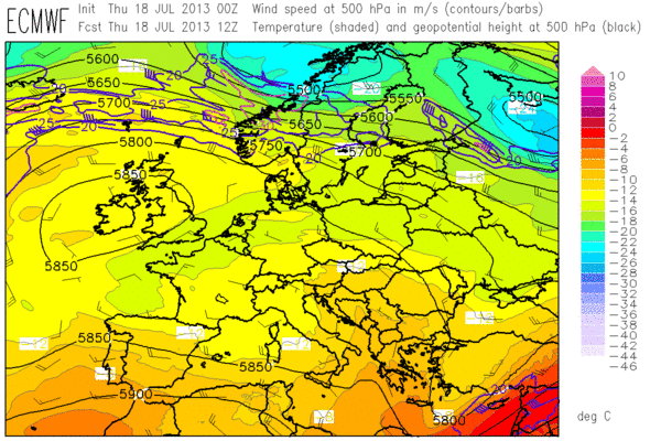
Fig. 1: ECMWF forecast of 500 hPa geopotential (black contour lines), temperature (color shading) and wind (barbs) for 12 UTC Thu 18 July 2013.

Fig. 2: Day 1 forecast valid for Thu 18 July 2013 for the Toulouse domain.
—–
Day 1 Forecast
Valid: Thu 18 Jul 2013 08:00 to Fri 19 Jul 2013 06:00 UTC
Issued: Thu 18 Jul 2013 09:31
Forecaster: ESSL TESTBED
A level 2 was issued for northeastern Spain mainly for large hail and severe wind gusts.
A level 1 was issued for southeastern France mainly for local excessive convective precipitation.
…other comments…
15 m/s 0-3 km shear is presented by most models over the northeastern edge of the Spanish Plateau. High dewpoints are returning into the Ebro Valley. Together with weak capping and deep convergence storms will be triggered and likely transform into supercell storms with a chance of large hail. High LCL heights > 1700m enhance both hail and severe wind gust threat. The coastal region will remain capped, tough.
France is under very weak shear conditions, limiting the organization and severe weather potential, but slow storm motion can lead to locally high precipitation accumulations.
Western France has high dewpoints and convergence and may trigger early storms.
The IPV feature moving into SW France at night seems not capable of triggering storms, no model produces precip there at night as CAPE has disappeared, possibly by advection of lower theta-e air from N Spain.
—–
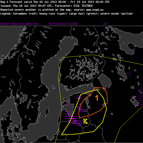
Fig. 3: Day 1 forecast valid for Thu 18 July 2013 for the Helsinki domain.
—–
Day 1 Forecast
Valid: Thu 18 Jul 2013 08:00 to Fri 19 Jul 2013 06:00 UTC
Issued: Thu 18 Jul 2013 09:07
Forecaster: ESSL TESTBED
A level 1 was issued for NE Latvia, E Estonia and parts of NW Russia mainly for severe wind gusts, large hail, as well as a slight risk for tornados.
Embedded into a NW upper level flow is a short wave trough that is expected to lead to some severe weather in the regions indicated above.
Low level moisture is advected from the Baltic Sea leading to considerable CAPE levels around 1000J/kg. In the northern parts of the Level 1 area this overlaps with considerable low level shear and a low LCL which indicates a slight risk for tornados in this area. The strongest activity is expected already in the afternoon hours.
—–
In due time for the afternoon nowcasting, plenty of storms formed up over the Toulouse domain. The “Team A” was excelling itself in issuing large watch areas mainly for hail and wind in Spain and mainly for heavy rain in France and the Western Alps. A parallel “Team B” covered the isolated convection over Latvia and Lithuania. As the last action of the day, even a tornado watch was issued for the Estonian storm visible in Fig. 4, as it moved into a region of Easterly surface wind and hence even stronger low-level shear than the models predicted.
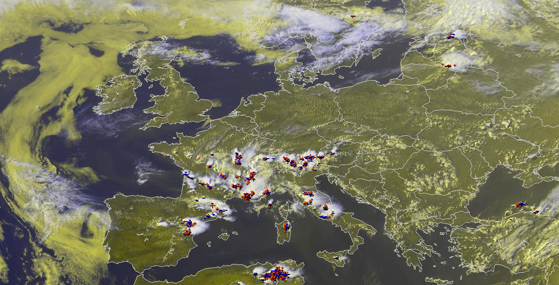
Fig. 4: Nowcast display at 1545 UTC Thu 18 July 2013: Meteosat E-View satellite image and lightning detections within the last 15 minutes.
Tomorrow (Fri 19 July 2013) will be even more interesting for Northeastern Europe: an even stronger cold front and a pronounced short-wave trough will cross the Baltics, Poland and Belarus. The day 2 team issued the so far largest level 2 area centered over Belarus for tomorrow.
