
Hooray for the third Testbed week! 10 new participants from Poland, Hungary, Austria, Germany, Spain and the United States arrived, but did not bring any new weather yet.
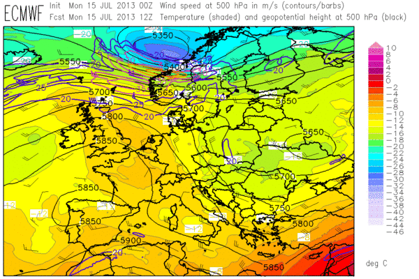
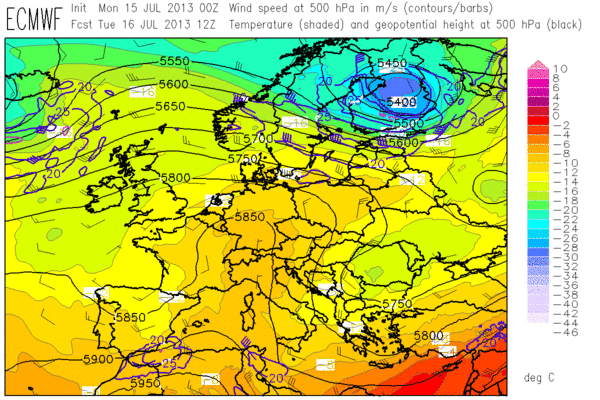

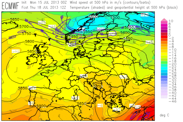
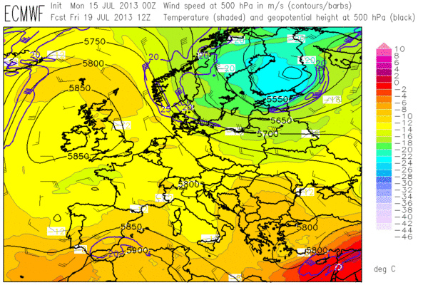
Fig 1: ECMWF forecasts of 500 hPa geopotential (black contours), temperature (colour shades) and wind (barbs) for the week from Mon 15 July 2013 to Fri 19 July 2013 (12 UTC each day).
Fig. 1 presents the daily sequence of the 500 hPa ECMWF forecasts. The primary interest of this week will still be on Spain and (hold on tight!) even Northern Algeria, where the subtropical branch of the jet stream along with opposed Easterly low-level flow will boost vertical wind shear to values in excess of 20 m/s. Up to moderate CAPE may form where rich low-level moisture gets advected inland. It is anticipated that a series of short-wave troughs will discriminate between days with only isolated storms that struggle against the strong cap, and other days with rather widespread activity over Spain.
Otherwise, weakly organized thunderstorms are expected in the range of slowly decaying upper-level lows over Eastern Europe and the Balkans, and – especially after midweek – over the orography of Southern France and the Western Alps despite weak upper-level ridging. Towards the end of the week, it looks like the active frontal zone over the far North will run another attempt to erupt towards Eastern Europe, but by then discrepancies between GFS (not shown) and ECMWF become quite high and a concurrence with unstably stratified air is still doubtful.
The day 1 forecast for the Toulouse domain which opened this week is inserted below in Fig.2.
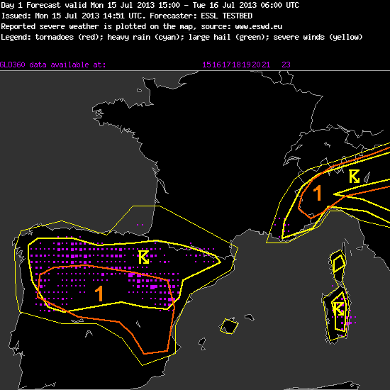
Fig. 2: Day 1 forecast issued on Mon 15 July 2013.
—–
Day 1 Forecast
Valid: Mon 15 Jul 2013 15:00 to Tue 16 Jul 2013 06:00 UTC
Issued: Mon 15 Jul 2013 14:51
Forecaster: ESSL TESTBED
A level 1 was issued for central Iberian Peninsula mainly for large hail.
A level 1 was issued for northern Italy mainly for large hail.
There is a high chance of storms over parts of Spain and northern Italy as result of weakly capped CAPE and convergence resulting from orography. In combination with around 10 m/s deep layer shear multicell storms should be the mode. Over northeastern Italy and eastern Spain the 0-6 km shear reaches over 15 m/s which supports weak supercells with large hail as primary threat.
Isolated severe wind gusts are not as likely due to weak flow and rather moist mid levels with mediocre lapse rates over most of Spain and northern Italy with the exception of northwestern Italy where Milan 12Z sounding shows a very dry layer at 600 hPa.
The probability of supercellular tornadoes is very low because of absence of significant low level shear (0-1 km shear less than 7 m/s in most of the area)
Storms may remain active overnight over Spain and northern Italy.
—–
While we were still working on our day 1 and day 2 forecast, respectively, the sky darkened outside our windows and some passing thundery showers reminded us that we should not completely omit today’s weak cold front, which was leisurely moving Southeastward into Eastern Europe and across the Alps. In the Southern Alpine region deep-layer shear up to 20 m/s overlapped with non-zero CAPE in the forecast maps, the low-level flow was still Southerly, and last week’s experiences had taught us utmost care in such situations.The situation had a striking similarity with last Thursday (extensively covered in the last two blog entries), despite a lower degree of moisture, lapse rates, wind shear and everything else you can imagine or not. We awaited some better organized storms to form over the Southern Alpine region again.
However, due to active discussions and the far from trivial situation, the day 1 to 5 forecasts took longer than expected and no time was left for nowcasting any more. This was no serious matter, because not too many interesting storms had formed yet. The Spanish storms were only slowly gearing up, and in the Southern Alpine region a little bit happened over Slovenia and Croatia but Northern Italy was left out this time (at least till the time of writing). Midnight isn’t exactly the right time to find out why.
