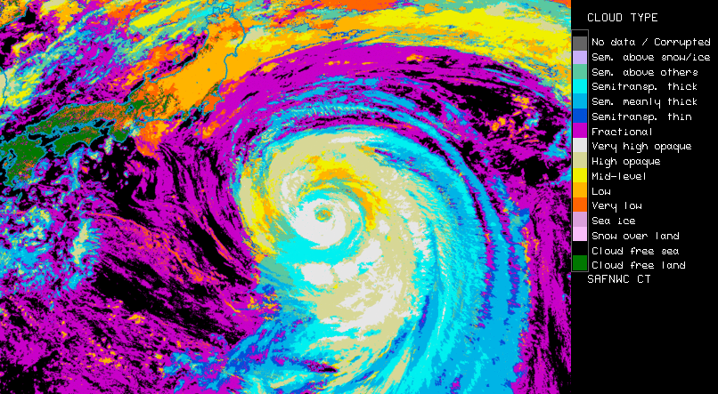
Cloud Type
Operationally produced by NWC SAF.
Application:
Identification of cloudy and cloud free areas.
Detection of the presence of snowy grounds.
Identification of major cloud classes (low broken (fractional), high semi-transparent, high, mid-level and low thick clouds).
Advantages:
✓ Available from meteorological geostationary satellites (GOES, Himawari, MSG).
✓ Available during day and night.
✓ Available at the temporal frequency of the satellites.
Limitations:
X Low clouds may not be detected at low sun elevation or even at night-time (infrequent).
X Snow is not identified at night-time and may be confused as low clouds.
X Low clouds surmounted by thin cirrus may be classified as mid-level clouds.
X Very low clouds may be classified as mid-level clouds in case strong thermal inversion.
X Very thin cirrus may be classified as low broken clouds.
Accessibility and Dissemination:
- Local installation: Product is accessible after registration (signed contract) at NWCSAF and installation of NWCSAF GEO V2016 in the local environment. It can be run every 15 minutes or with the different settings every 5 minutes RSS. Output format is NetCdf.
- Images for the last 24h, updated every 15 minutes at NWCSAF web site: http://www.nwcsaf.org/ct
Additional Information:
Web site
Training Module
Practical info and documentation
Overview modified after NWC SAF Practical Guide by V. Nietosvaara, EUMETSAT, 2018.