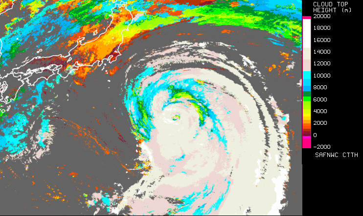
Cloud Top Temperature and Height
Operationally produced by NWC SAF.
Application:
Estimation of the cloud top height (altitude in km or pressure in hPa) and the cloud top temperature.
Advantages:
✓ Available from meteorological geostationary satellites (GOES, Himawari, MSG).
✓ Available during day and night.
✓ Available at the temporal frequency of the satellites.
✓ Useful in estimation of the height of convective clouds .
Limitations:
X CTTH is not retrieved for low broken clouds.
X CTTH may be not retrieved for thin cirrus clouds.
X Retrieved low cloud top height may be overestimated.
Accessibility and Dissemination:
- Local installation: Product is accessible after registration (signed contract) at NWCSAF and installation of NWCSAF GEO V2016 in the local environment. It can be run every 15 minutes or with the different settings every 5 minutes RSS. Output format is NetCdf.
- Images for the last 24h, updated every 15 minutes at NWCSAF web site: http://www.nwcsaf.org/ctth
Additional Information:
Web site
Training Module
Practical info and documentation
Overview modified after NWC SAF Practical Guide by V. Nietosvaara, EUMETSAT, 2018.