Rapidly Developing Thunderstorm (RDT)
Operationally produced by NWC SAF.
Application:
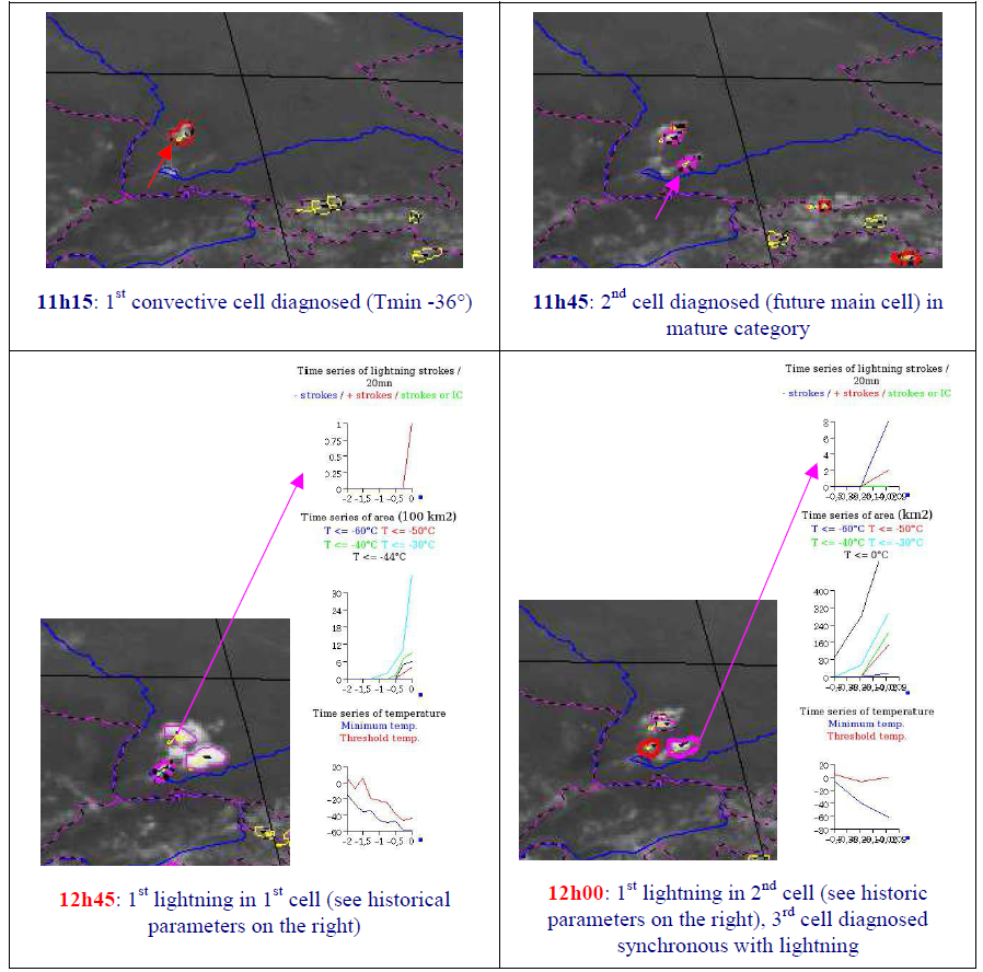
RDT detects, tracks, characterizes and forecasts convective cells.
It requires at least satellite input data refreshed every 30′, forecasts are up to 1h. The product is intended or several end-users, including aeronautical users, forecasters or warning systems for ground-based end-users.
Advantages:
✓ Available over the geostationary satellite coverage.
Limitations:
X Warm system detection and convection diagnosis for these systems.
X Forecast: no creation or dissipation of cells, no change in trajectory.
X Performs better in summer or during intermediate season compared to winter.
Accessibility and Dissemination:
- Local installation: Product is accessible after registration (signed contract) at NWCSAF and installation of NWCSAF GEO V2016 in the local environment. It can be run every 15 minutes or with the different settings every 5 minutes RSS. Output format is NetCdf.
- Images for the last 24h, updated every 15 minutes at NWCSAF web site: http://www.nwcsaf.org/rdt
Additional Information:
Web site
Training Module
Practical info and documentation
Overview modified after NWC SAF Practical Guide by V. Nietosvaara, EUMETSAT, 2018.