Lightning Density
Experimentally /operationally produced by National Meteorological Services.
Application:
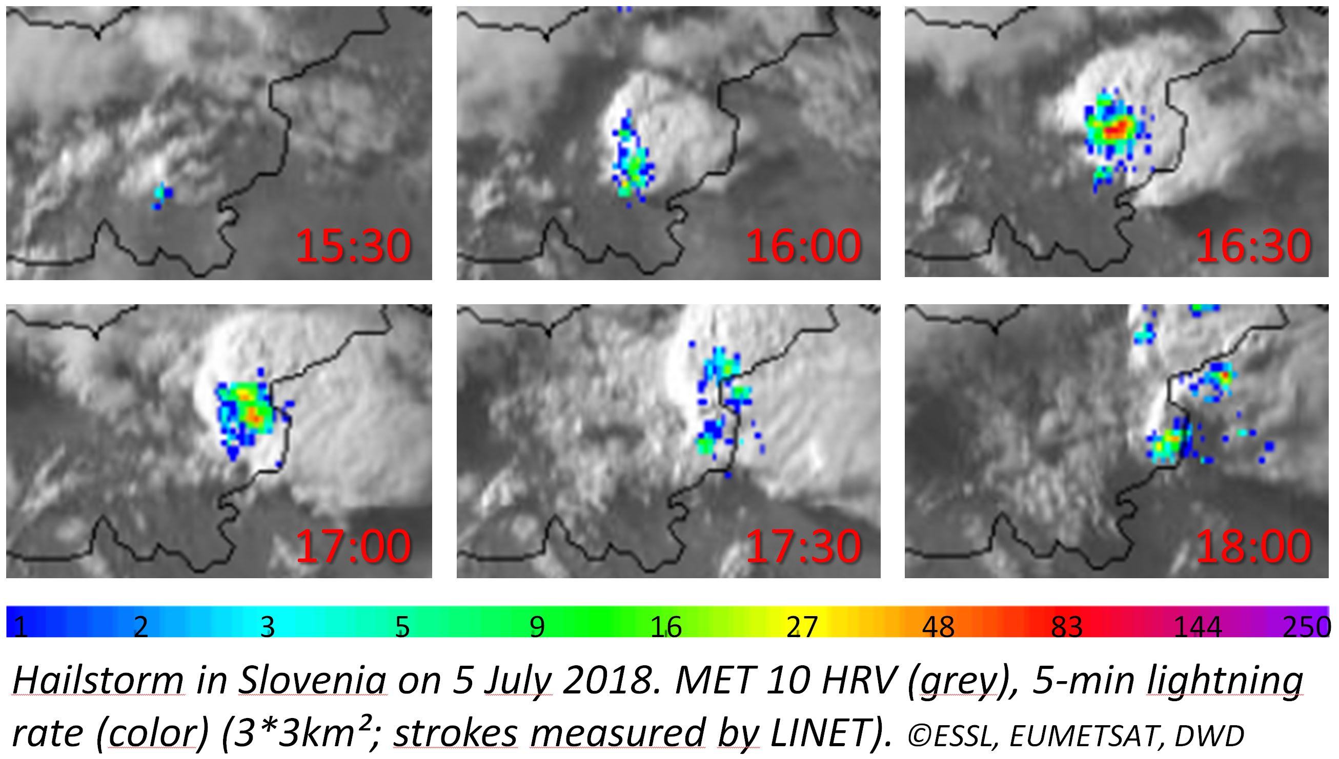
The lightning density is the number of lightning strokes or flashes per chosen spatial area (e.g. km²) and time interval (e.g. min). It can be derived using measurements from ground-based lightning location networks or lightning imagers/mappers onboard meteoro-logical satellites.
Typically total lightning (intra-cloud and cloud-to-ground lightning) is considered.
The lightning activity of a convective storm is linked to the updraft strength. Thus monitoring lightning characteristics of convective storms help to assess storm intensity and potential severity. Lightning jumps, i.e. a rapid increase in lightning rate, have shown to be a precursor of reported severe weather in many cases.
Advantages:
✓ Useful for monitoring of storm severity
✓ Available during night and day
✓ Applicable to any lightning location network or lightning mapper / imager.
✓ Easy to configure spatial and temporal resolution dependent on application
Limitations:
X Depends on detection efficiency of used lightning location network or lightning mapper / imager.
Accessibility and Dissemination:
Mostly on national level, typically for their internal use only.
Lightning density products will come available for the new Lightning Imager on board MTG via NWCSAF.
Additional Information:
Prepared by K. Wapler, DWD, 2018.
< MSG Sandwich Image Products Home MSG Global Instability Index >